geo.wikisort.org - Reservoir
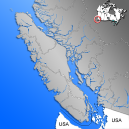
Kennedy Lake is the largest lake on Vancouver Island, British Columbia, Canada.[1] Located north of Ucluelet on the island's central west coast, the lake is formed chiefly by the confluence of the Clayoquot and Kennedy Rivers. Outflow is via a short stretch of the Kennedy River into Tofino Inlet. The lake includes an extensive northern arm called Clayoquot Arm.
| Kennedy Lake | |
|---|---|
 | |
 Kennedy Lake | |
| Location | Vancouver Island, British Columbia |
| Coordinates | 49°3′N 125°33′W |
| Primary inflows | Clayoquot River, Kennedy River, Sand River |
| Basin countries | Canada |
| Surface area | 6,475 ha (16,000 acres) |
| Average depth | 38 m (125 ft) |
| Max. depth | 145 m (476 ft) |
| Residence time | 1.1 year |
| Shore length1 | 111.9 km (69.5 mi) |
| Surface elevation | 12 m (39 ft) |
| References | [1] |
| 1 Shore length is not a well-defined measure. | |
The lake and surrounding region's natural beauty has led to portions of it being protected from the logging industry. Parks adjacent to the lake include Clayoquot Plateau Provincial Park, Pacific Rim National Park, Clayoquot Arm Provincial Park, Kennedy Lake Provincial Park, Kennedy River Bog Provincial Park and the Clayoquot Arm Beach recreation site.[2] The lake is a popular recreation destination for camping, boating and fishing. It is an important spawning habitat for sockeye and various species of salmon and trout, and lies within the Coastal Western Hemlock Biogeoclimatic Zone.
The lake is part of the ancestral lands of the Tla-o-qui-aht First Nations, and is named for the last governor of the Colony of Vancouver Island, Sir Arthur Kennedy.[3]: 134
Geography
Kennedy Lake has a surface area of 6,475 hectares (16,000 acres), making it the largest lake on Vancouver Island. It has an irregular shape made up of two basins, referred to as the Main Arm and the Clayoquot Arm, connected by a narrow sill. While the mean depth of the lake is 38 metres (125 ft), the sill dividing the two arms is less than 10 metres (33 ft) depth, while the deepest part of the lake reaches 145 metres (476 ft).[1] The lake is situated at 12 metres (39 ft) above sea level.
British Columbia Highway 4 winds along the south-east and southern side of the lake, the only highway accessing the communities of Ucluelet and Tofino.
See also
- Clayoquot Sound
References
- "Vancouver Island Large Lakes Management Plan" (PDF). Fish and Wildlife Branch, Ministry of Forests, Lands and Natural Resource Operations.
- "Clayoquot Arm Beach (Tofino)". Recreation Sites and Trails BC.
- Akrigg, G.P.V.; Akrigg, Helen B. (1986), British Columbia Place Names (3rd, 1997 ed.), Vancouver: UBC Press, ISBN 0-7748-0636-2
External links
- Kennedy Lake Provincial Park.
- Kennedy River Bog Provincial Park.
- Clayoquot Arm Provincial Park.
- Clayoquot Plateau Provincial Park.
- "Kennedy Lake". BC Geographical Names.
На других языках
[de] Kennedy Lake (Vancouver Island)
Kennedy Lake ist der größte See auf Vancouver Island, British Columbia, Kanada. Er befindet sich nördlich der Stadt Ucluelet an der zentralen Westküste der Insel. Der See entsteht hauptsächlich durch den Zusammenfluss des Clayoquot- und des Kennedy Rivers. Der Abfluss erfolgt über einen kurzen Lauf des Kennedy Rivers in den Tofino Inlet. Der See hat auch einen ausgedehnten Nord-Arm, der Clayoquot Arm genannt wird. Die Naturattraktionen der Region haben dazu geführt, dass Teile davon staatlicherseits vor Holzeinschlag geschützt werden. Zu den Nationalparks, die sich am See befinden, gehören der Clayoquot Plateau Provincial Park, Clayoquot Arm Provincial Park, Kennedy Lake Provincial Park, und der Kennedy River Bog Provincial Park. Der See ist ein beliebtes Naherholungsgebiet für Bootsfahrer und Angler. Das Gewässer ist ein wichtiges Laichgebiet für den Rotlachs und verschiedene andere Arten von Lachsen und Forellen.- [en] Kennedy Lake (Vancouver Island)
Другой контент может иметь иную лицензию. Перед использованием материалов сайта WikiSort.org внимательно изучите правила лицензирования конкретных элементов наполнения сайта.
WikiSort.org - проект по пересортировке и дополнению контента Википедии