geo.wikisort.org - Reservoir
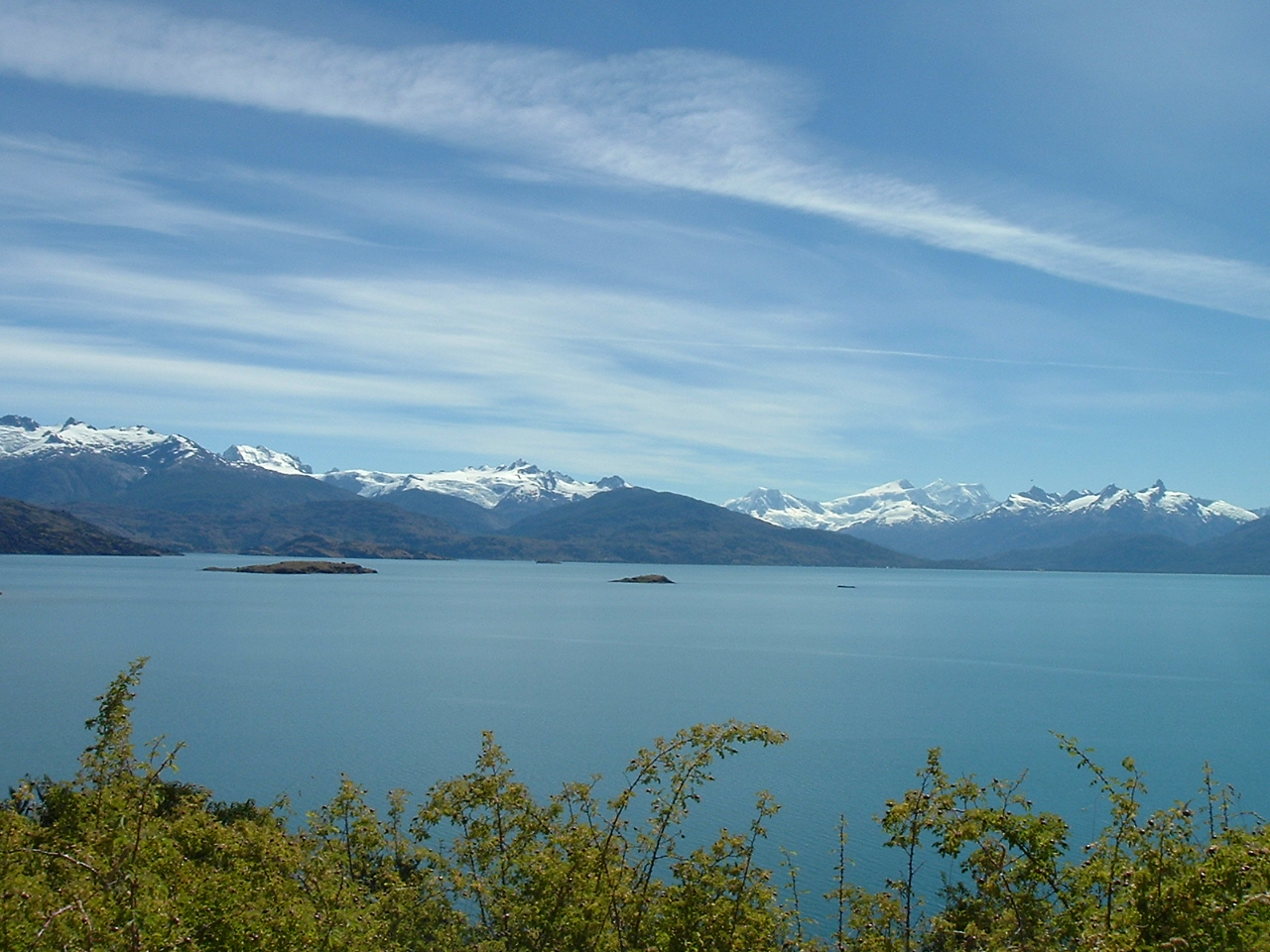
General Carrera Lake (Chilean part, officially renamed in 1959)[2] or Lake Buenos Aires (Argentine part) is a lake located in Patagonia and shared by Argentina and Chile. Both names are internationally accepted, while the autochthonous name of the lake is Chelenko, which means "stormy waters" in Aonikenk.[3]
| General Carrera Lake | |
|---|---|
| Buenos Aires Lake Lake Buenos Aires | |
 | |
General Carrera Lake in the Aysén Region | |
 General Carrera Lake | |
| Location | Lago Buenos Aires Department, Santa Cruz Province, Argentina / General Carrera Province, Aysén del General Carlos Ibáñez del Campo Region, Chile, in Patagonia |
| Coordinates | 46°26′15″S 71°42′54″W[1] |
| Type | Moraine dammed |
| Primary inflows | Soler, Los Antiguos, Jeinemeni, Ibáñez, San Martín, Delta |
| Primary outflows | Bertrand Lake and then Baker River (Pacific Ocean) Deseado River (Atlantic Ocean) |
| Basin countries | Argentina, Chile |
| Surface area | 1,850 km2 (710 sq mi) |
| Max. depth | 586 m (1,923 ft) |
| Surface elevation | 217 m (712 ft) |
| Settlements | Chile Chico, Puerto Ingeniero Ibáñez, Puerto Guadal, Los Antiguos |
| References | [1] |
 | |

The lake is of glacial origin and is surrounded by the Andes mountain range. The lake drains to the Pacific Ocean on the west through the Baker River.
The weather in this area of Chile and Argentina is generally cold and humid. But the lake itself has a sunny microclimate, a weather pattern enjoyed by the few settlements along the lake, such as Puerto Guadal, Fachinal, Mallín Grande, Puerto Murta, Puerto Río Tranquilo, Puerto Sánchez, Puerto Ingeniero Ibáñez and Chile Chico in Chile, and Los Antiguos and Perito Moreno in Argentina.
The area near the coast of the lake was first inhabited by criollos and European immigrants between 1900 and 1925. In 1971 and 1991, eruptions of the Hudson Volcano severely affected the local economy, especially that of sheep farming. A car ferry operates between Puerto Ingeniero Ibáñez and Chile Chico in the Chilean sector of the lake. The lake is known as a trout and salmon fishing destination.
Area
The lake has a surface of 1,850 km2 (710 sq mi) of which 970 square kilometres (370 sq mi) are in the Chilean Aysén del General Carlos Ibáñez del Campo Region, and 880 square kilometres (340 sq mi) in the Argentine Santa Cruz Province, making it the biggest lake in Chile, and the fourth largest in Argentina. In its western basin, Lake Gen. Carrera has 586 m (1,923 ft) maximum depth.[4]
Geology
The lake occupies a continental-scale graben formed by SWS-ENE normal faults that have resulted in down dropping the bottom of the lake to 350 meters (1,150 ft) below mean sea level.[5] Preservation of younger lithostratigraphic units within the graben form reverse stratigraphy with older units exposed at higher topographic elevations to the south. The graben channeled mountain glaciers which formed terminal moraine helping to modify the present-day shape of the lake. The tectonic activity that formed the depression can be inferred to subduction of the triple joint that has occurred over the past 20 million years, as indicated by ripple marks in volcaniclastic sediments observed along the southern shoreline. There is some speculation on whether the tectonics and crustal heat flow in the lake area are influenced by the asthenospheric window that exists beneath the crust in this region of Patagonia.[6]
The Marble Caves, Marble Chapel, and Marble Cathedral are unusual geological formations located on the shoreline midway along the lake's length. They represent a group of caverns, columns, and tunnels formed in monoliths of marble. The Marble Caves have been formed by wave action over the last 6,200 years.[7]
Gallery
 SRTM-Topography of the Chilean zone
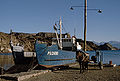 Boat near Chile Chico in Chile
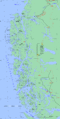 Map of the Chilean zone
 Folded and weathered marble at General Carrera Lake


References
- Earth Info, earth-info.nga.mil webpage: "GNS: Country Files". Archived from the original on 2012-05-04. Retrieved 2010-06-27.
- "Ley N.º 13.375: Crea y fija los limites de los departamentos de Palena, Aysén, Coyhaique y Chile Chico y las de sus respectivas comunas-subdelegaciones". Ministerio del Interior de Chile. 1959-09-09.
- Prudencio Vergara, Guillermo (2019-05-06). "Una "fiebre del oro" junto al mayor lago de la Patagonia" [A "gold fever" along the major lake in Patagonia]. El País (in Spanish). Chile Chico. Retrieved 2021-12-29.
- Murdie et al. 1999, Geo-Marine Letters 18:315-320.
- B. Scalabrino, et al., A morphotectonic analysis of central Patagonian Cordillera: Negative inversion of the Andean belt over a buried spreading center?, TECTONICS, VOL. 29, TC2010, doi:10.1029/2009TC002453, 2010
- Lagabrielle, Yves; Suárez, Manuel; Rossello, Eduardo A.; Hérail, Gérard; Martinod, Joseph; Régnier, Marc; de la Cruz, Rita (2004). "Neogene to Quaternary tectonic evolution of the Patagonian Andes at the latitude of the Chile Triple Junction". Tectonophysics. 385 (1–4): 211–241. Bibcode:2004Tectp.385..211L. doi:10.1016/j.tecto.2004.04.023.
- "The Marble Caves (Cavernas de Mármol)". Wondermondo. 2012-01-10.
Hydrography of Aysén Region | ||
|---|---|---|
| Rivers |  | |
| Lakes |
| |
| Glaciers |
| |
Authority control | |
|---|---|
| General | |
| National libraries | |
| Other |
|
На других языках
[de] Lago Buenos Aires/General Carrera
Lago Buenos Aires (Argentinien) oder Lago General Carrera (Chile) ist ein See in Argentinien und Chile. Er liegt in der Región de Aisén und in der Provinz Santa Cruz an der argentinisch-chilenischen Grenze.- [en] General Carrera Lake
[es] Lago Buenos Aires/General Carrera
El lago Buenos Aires, General Carrera o Chelenko es un lago de América del Sur, localizado en la Patagonia y compartido por Chile y Argentina. A cada lado de la frontera tiene nombres diferentes, ambos reconocidos a nivel internacional: En Argentina se le denomina lago Buenos Aires, mientras que en Chile es conocido como lago General Carrera (oficialmente desde 1959).[1] También es conocido con el nombre autóctono de Chelenko, que en aonikenk significaría "aguas tormentosas".[2][fr] Lac Buenos Aires/General Carrera
Le lac Buenos Aires/General Carrera se trouve en Patagonie, à la frontière entre l'Argentine et le Chili. En Argentine, il porte le nom de lago Buenos Aires, tandis qu'au Chili il se nomme lago General Carrera. Les deux noms sont acceptés au niveau international[réf. nécessaire].[it] Lago Buenos Aires/General Carrera
Il lago Buenos Aires/General Carrera si trova in Patagonia ed è suddiviso tra Cile ed Argentina. In Argentina è noto con il nome di lago Buenos Aires, mentre in Cile si chiama lago General Carrera; entrambi i nomi sono riconosciuti a livello internazionale.[ru] Буэнос-Айрес (озеро)
Буэ́нос-А́йрес или Хенера́ль-Карре́ра — озеро ледникового происхождения в Патагонских Андах, на границе Чили и Аргентины. Площадь озера в настоящее время — 1850 км²[1]. Находится на высоте 208 м над уровнем моря, наибольшая глубина — 590 м[источник не указан 2994 дня]. Западная часть озера — фьордообразная, обрамлена крутыми лесистыми склонами; восточная часть лежит на плато и окаймлена моренами. Сток из озера осуществляется через озеро Бертран в реку Бейкер, которая относится к бассейну Тихого океана.Другой контент может иметь иную лицензию. Перед использованием материалов сайта WikiSort.org внимательно изучите правила лицензирования конкретных элементов наполнения сайта.
WikiSort.org - проект по пересортировке и дополнению контента Википедии