geo.wikisort.org - Reservoir
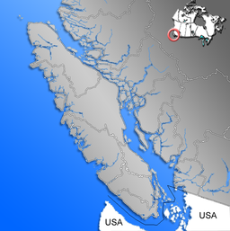
Cowichan Lake is a large freshwater lake located on southern Vancouver Island, British Columbia, Canada. It is located along the Cowichan Valley in the Cowichan Valley Regional District, with its eastern shore about 28 km (17 mi) west of Duncan, British Columbia. Cowichan Lake is about 30 km (19 mi) in length, running mostly from west to east, and is about 4 km (2.5 mi) wide at its widest point. The lake is also the source of the Cowichan River.
| Cowichan Lake | |
|---|---|
 | |
 Cowichan Lake | |
| Location | British Columbia |
| Coordinates | 48°49′N 124°02′W |
| Primary inflows | Robertson River, Nixon Creek |
| Primary outflows | Cowichan River |
| Basin countries | Canada |
| Max. length | 30 km (19 mi) |
| Max. depth | 160 m (520 ft) |
| Surface elevation | 164 m (538 ft) |
| Settlements | Lake Cowichan |
Cowichan Lake has several communities along its shores. The town of Lake Cowichan is located at the east end of the lake, at the start of the Cowichan River, and is the largest community. Along the south side of the lake are the communities of Mesachie Lake and Honeymoon Bay, and also Gordon Bay Provincial Park. On the north shore is the community of Youbou.
The Cowichan Valley was once a thriving lumber centre in British Columbia. In the past, two major railroads had spur lines to and around parts of the lake. With the change in the logging industry, these rail lines have now been abandoned by the railroads and are now part of a major public trail system which leads eastward toward the lower end of the Cowichan Valley. The lake area is largely undeveloped because of the extensive logging by timber companies holding the land surrounding the lake. Currently there are several development projects at new locations around the lake.
External links
- Town of Lake Cowichan
- Cowichan Lake District Chamber of Commerce
- Imagine the Cowichan, part of Simon Fraser University's Imagine BC series
Authority control | |
|---|---|
| General |
|
| National libraries | |
На других языках
[de] Cowichan Lake
Cowichan Lake ist ein großer Süßwasser-See, der sich im Süden von Vancouver Island, British Columbia, Kanada befindet. Er verläuft am Cowichan Valley entlang, befindet sich westlich von Duncan, British Columbia, und gehört zum Cowichan Valley Regional District. Das östliche Ufer hat eine Länge von ungefähr 28 km (17 mi). Die Gesamtlänge des Cowichan Lakes beträgt ungefähr 30 km (19 mi), wobei er meistens in west-östliche Richtung verläuft und mit ungefähr 4 km (2 mi) die breiteste Ausdehnung besitzt. Der See ist auch die Quelle für den Cowichan River.- [en] Cowichan Lake
[fr] Lac Cowichan
Le lac Cowichan est situé dans le sud de l'île de Vancouver en Colombie-Britannique au Canada. Il se trouve à environ 30 km au sud de Nanaimo et à environ 65 km au nord-ouest de Victoria à vol d'oiseau.[it] Cowichan Lake
Cowichan Lake è un grande lago d'acqua dolce situato nella parte meridionale dell'Isola di Vancouver, Columbia Britannica, Canada. Si trova lungo la Cowichan Valley nel Distretto regionale di Cowichan Valley, con la sua sponda orientale a circa 28 km (17 mi) ad Ovest di Duncan. Cowichan Lake ha una lunghezza di circa 30 km (19 mi), corre principalmente da Ovest a Est ed ha una larghezza di circa 4 km (2,5 mi) nel suo punto più largo. Il lago è anche la sorgente del Cowichan River.[ru] Ковичан (озеро)
Ковичан (англ. Cowichan Lake) — озеро, расположенное в южной части острова Ванкувер в провинции Британская Колумбия, Канада.Другой контент может иметь иную лицензию. Перед использованием материалов сайта WikiSort.org внимательно изучите правила лицензирования конкретных элементов наполнения сайта.
WikiSort.org - проект по пересортировке и дополнению контента Википедии