geo.wikisort.org - Reservoir
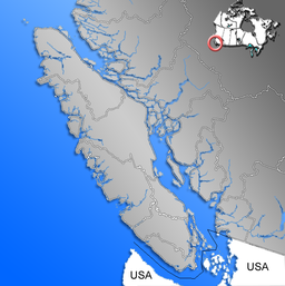
Buttle Lake is a lake on Vancouver Island in Strathcona Regional District, British Columbia, Canada. It is about 23 kilometres (14 mi) long and 1.5 kilometres (0.9 mi) wide, has an area of 28 square kilometres (11 sq mi), is up to 120 metres (394 ft) deep, and lies at an elevation of 221 metres (725 ft). The lake is located between Campbell River and Gold River in Strathcona Provincial Park. The lake is the headwaters of the Campbell River.
| Buttle Lake | |
|---|---|
 Buttle Lake from below the Lupin Falls trail | |
 Buttle Lake | |
| Location | Vancouver Island, British Columbia |
| Coordinates | 49°40′59″N 125°32′59″W |
| Lake type | Reservoir |
| Primary inflows | Ralph River, Thelwood Creek, Wolf River |
| Primary outflows | Campbell River |
| Basin countries | Canada |
| First flooded | 1958 |
| Max. length | 23 km (14 mi) |
| Max. width | 1.5 km (0.93 mi) |
| Surface area | 28 km2 (11 sq mi) |
| Max. depth | 120 m (390 ft) |
| Surface elevation | 221 m (725 ft) |
History

The lake was named after John Buttle, geologist and botanist from Kew Gardens, London, who came to the area with the Royal Engineers. They mapped the area around the lake in 1865.[1] Buttle explored Vancouver Island as naturalist under Dr Robert Brown as part of the Vancouver Island Exploring Expedition in 1864.[2] He discovered and mapped the lake the next year.[3]: 34
During 1955–1958, the Strathcona Dam was built on Upper Campbell Lake, raising the water level by 30 metres (98 ft).[4] The raised water level coalesced Upper Campbell and Buttle Lake, raising the level of Buttle by 5 meters. Prior to the increase 600 hectares (1,500 acres) of forest at low-lying areas along the shore was harvested, and in many areas not fully cleared.[5] At times of low water, there exist mudflats with stumps remaining from the forests that formerly stood there.[6]
Travel and Activities

The lake is accessed via Strathcona Provincial Park which is located almost in the center of Vancouver Island. The main access to the park is via Highway 28, which connects with Gold River on the west coast of Vancouver Island. Highway 28 passes through the northern section of the park and provides access to Buttle Lake.[7]
There are multiple campgrounds along Buttle Lake. Hiking, swimming, boating, fishing and bicycling are common activities in and nearby.
References
- "Toporama - Topographic Map Sheets 92F12, 92F13". Atlas of Canada. Natural Resources Canada. Archived from the original on 2010-08-31. Retrieved 2010-02-01.
- Walbran, Captain John T. (1971). British Columbia Place Names, Their Origin and History (Facsimile reprint of 1909 ed.). Vancouver: Douglas & McIntyre. p. 75. ISBN 978-0-88894-143-5. OCLC 34583503. Archived from the original on 2016-03-03. Retrieved 2009-03-25.
- "Buttle Lake". BC Geographical Names.
- Akrigg, G.P.V.; Akrigg, Helen B. (1986), British Columbia Place Names (3rd, 1997 ed.), Vancouver: UBC Press, ISBN 0-7748-0636-2
- "Strathcona Dam". BC Hydro.
- Keeling, Arn; Wynn, Graeme (Summer 2011). "The Park...is a mess: Development and Degradation in British Columbia's First Provincial Park". BC Studies. 170. Retrieved 2020-06-01.
- http://ojs.library.ubc.ca/index.php/bcstudies/article/viewFile/2004/2219 [bare URL PDF]
- Environment, Ministry of. "Strathcona Provincial Park - BC Parks". www.env.gov.bc.ca. Retrieved 2018-04-22.
External links
- Details at B.C. Adventure
 Media related to Buttle Lake at Wikimedia Commons
This article about a location on the Coast of British Columbia, Canada is a stub. You can help Wikipedia by expanding it. |
На других языках
[de] Buttle Lake
Der Buttle Lake ist ein 28 km² großer See auf Vancouver Island in der Provinz British Columbia in Kanada.- [en] Buttle Lake
[fr] Lac Buttle
Le lac Buttle est un lac de l'île de Vancouver, en Colombie-Britannique, au Canada.[ru] Батл (озеро, Британская Колумбия)
Батл[1] (англ. Buttle Lake) — озеро, расположенное на острове Ванкувер в провинции Британская Колумбия, Канада. Находится на территории провинциального парка Страткона между реками Кэмпбелл и Голд Ривер.Другой контент может иметь иную лицензию. Перед использованием материалов сайта WikiSort.org внимательно изучите правила лицензирования конкретных элементов наполнения сайта.
WikiSort.org - проект по пересортировке и дополнению контента Википедии