geo.wikisort.org - Montagne
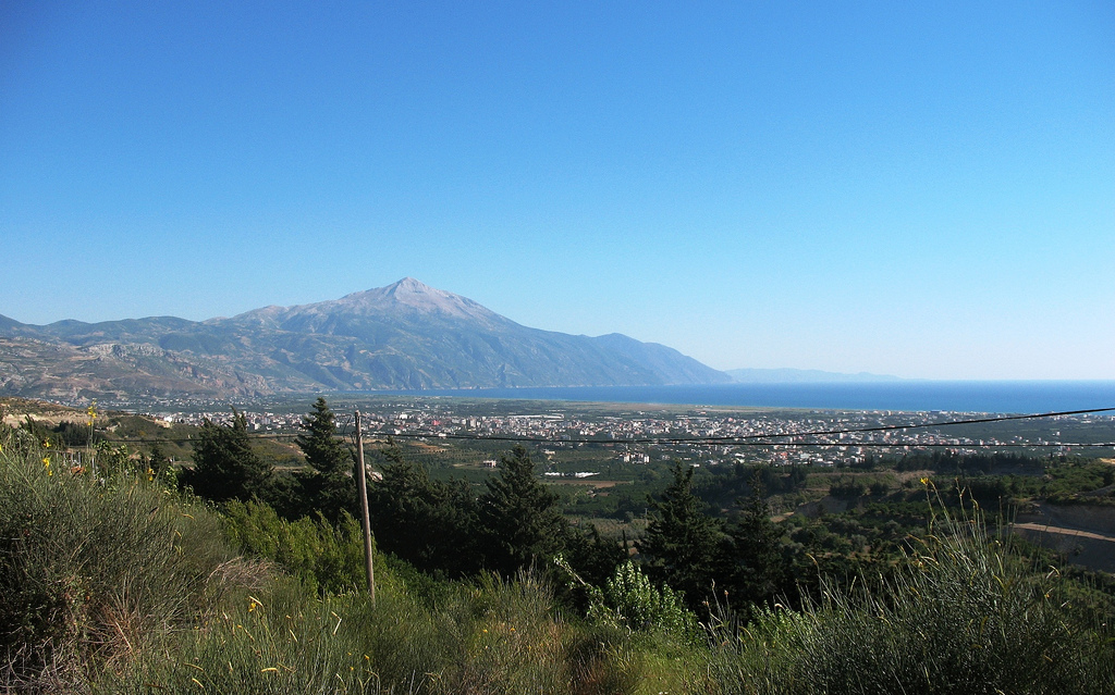
Il Jebel Aqra (arabo: جبل الأقرع;Turco: Cebel-i Akra), noto anche come Monte Casius[1], è una montagna alta 1.717 m (5.633 piedi) calcarea situata sul confine tra la Siria e la Turchia in territorio turco vicino alla foce del fiume Oronte sul Mar Mediterraneo. Il suo lato turco è anche conosciuto come Monte Calvo (Kel Dağı). La montagna era un luogo di culto nell'antica religione cananea.[2]
| Jebel Aqra | |
|---|---|
| Stato | |
| Altezza | 1 736 m s.l.m. e 1 717 m s.l.m. |
| Coordinate | 35°57′09″N 35°58′09.5″E |
| Altri nomi e significati | Monte Calvo (Kel Dağı) |
| Mappa di localizzazione | |
 Jebel Aqra | |
Storia

Gli Hurriani lo chiamavano Monte Hazzi e lo consideravano la dimora del loro dio della tempesta Teshub. Gli Ittiti continuarono il suo culto, celebrando la vittoria di Teshub sul mare nel Cantico di Kumarbi ritrovato nella loro capitale Hattusa. Su questo monte il dio Baal-Zephon era ampiamente adorato: il suo tempio di Ugarit conteneva un rilievo in arenaria a lui dedicato da uno scriba reale in Egitto e il re di Tiro lo chiamò come testimone divino in un trattato con l'imperatore d'Assiria nel 677 a. C.[3]
Sotto varie forme, il culto continuò per tutta l'antichità, quando fu chiamato Monte Casius (greco: Κασιος , Kasios; latino: Casius Mons).
ll culto del dio della montagna fu trasferito, per interpretatio graeca, a Zeus Kasios, o "Zeus del monte Kasios", simile a Ras Kouroun nel Sinai. Le tegole del santuario greco-romano del sito, con impresso il nome del dio, furono riutilizzate nel monastero cristiano che andò ad occupare le pendici orientali e verso terra di Kazios.[4]
Bibliografia
- Rutherford, Ian (2001), "The Song of the Sea", Studien zu den Boghaz-Köy-Texten, No. 45, pp. 598–609.
Note
- (EN) William Burckhardt Barker, Lares and Penates, Or, Cilicia and Its Governors: Being a Short Historical Account of that Province from the Earliest Times to the Present Day : Together with a Description of Some Household Gods of the Ancient Cilicians, Broken Up by Them on Their Conversion to Christianity, First Discovered and Brought to this Country by the Author, Ingram, Cooke, and Company, 1853. URL consultato il 25 giugno 2022.
- Zaphon, su Dictionary of Deities and Demons in the Bible Online. URL consultato il 25 giugno 2022.
- Gregory Nagy, (R.) Lane Fox Travelling Heroes: Greeks and their Myths in the Epic Age of Homer. London and New York: Allen Lane, 2008. Pp. 517. £25. 9780713999808., in The Journal of Hellenic Studies, vol. 131, 2011-11, pp. 166–169, DOI:10.1017/s0075426911000127. URL consultato il 25 giugno 2022.
- John Rosser, Archeological Investigations in the Region West of Antioch-on-the-Orontes. Wachtang Djobadze , M. Hendy , N. Lowick , C. Mango , D. M. Metcalf , H. Seyrig, in Speculum, vol. 64, n. 4, 1989-10, pp. 934–936, DOI:10.2307/2852882. URL consultato il 25 giugno 2022.
На других языках
[de] Keldağ
Der Keldağ, Kel Dağı, (deutsch: ‚Kahler Berg‘) auch Kılıç Dağı (deutsch: ‚Schwertberg‘), arabisch Dschabal al-Aqra (arabisch جبل الأقرع, DMG Ǧabal al-Aqraʿ ‚Kahler Berg‘; auch Jabal al-Aqra oder Jebel al-Akra transkribiert; auch Cebeli akra) oder Kasios-Berg (armenisch Կասիոս լեռը .mw-parser-output .Latn{font-family:"Akzidenz Grotesk","Arial","Avant Garde Gothic","Calibri","Futura","Geneva","Gill Sans","Helvetica","Lucida Grande","Lucida Sans Unicode","Lucida Grande","Stone Sans","Tahoma","Trebuchet","Univers","Verdana"}Kasios ler'y'; altgriechisch Κάσιον ὂρος Kásion óros, lateinisch Casius Mons) ist ein Berg an der Grenze zwischen Syrien und der Türkei, nahe der Mündung des Orontes ins Mittelmeer und etwa 40 Kilometer nördlich der bronzezeitlichen Stadt Ugarit und 65 km südwestlich des modernen Antakya. Der 1736 Meter[1] hohe Berg liegt nahe an der Küste und dient der Seefahrt als Orientierungspunkt. Administrativ gesehen liegt der syrische Teil des Berges auf dem Gebiet der armenisch geprägten Kleinstadt Kessab im Gouvernement Latakia, der türkische Teil im Landkreis Yayladağı der Provinz Hatay.[en] Jebel Aqra
Jebel Aqra, properly Jebel al-ʾAqraʿ (Arabic: جبل الأقرع, [ˈd͡ʒæbæl al ˈʔaqraʕ]; Turkish: Cebel-i Akra), also known as Mount Casius, is a limestone mountain located on the Syrian–Turkish border near the mouth of the Orontes River on the Mediterranean Sea. Its Turkish side is also known as Mount Bald (Kel Dağı). Rising from a narrow coastal plain, Jebel Aqra is a mariners' landmark which gathers thunderstorms.[fr] Djebel Akra
Le djebel Akra, en arabe جبل الأقرع, en turc Cebel-i Akra ou Kel Dağı, est un sommet situé en Turquie près de la frontière avec la Syrie.- [it] Jebel Aqra
[ru] Джебели-Акра
Джебели-Акра[1] (араб. الجبل الأقرع, тур. Kel Dağı) — гора, расположенная на сирийско-турецкой границе недалеко от устья реки Аси (Оронт) в иле Хатай в районе Яйладагы (Турция) и Латакии (Сирия).Другой контент может иметь иную лицензию. Перед использованием материалов сайта WikiSort.org внимательно изучите правила лицензирования конкретных элементов наполнения сайта.
WikiSort.org - проект по пересортировке и дополнению контента Википедии