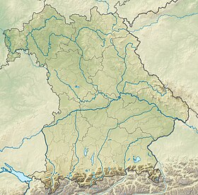
geo.wikisort.org - Montagne
Avec 2 744 mètres d'altitude, le Hochwanner est le second sommet le plus élevé d'Allemagne après la Zugspitze, si on considère que le Schneefernerkopf, qui est plus élevé, n'est qu'un sommet annexe de la Zugspitze. Il est situé sur la frontière avec l'Autriche (Land du Tyrol).
| Hochwanner | |
 Le Hochwanner vu du sud | |
| Géographie | |
|---|---|
| Altitude | 2 744 m[1],[2] |
| Massif | Wetterstein (Alpes) |
| Coordonnées | 47° 23′ 46″ nord, 11° 03′ 19″ est[1],[2] |
| Administration | |
| Pays | |
| Land allemand Land autrichien |
Bavière Tyrol |
| District allemand District autrichien |
Haute-Bavière Innsbruck-Land |
| Ascension | |
| Première | 1870, par Hermann von Barth |
| Géologie | |
| Roches | Roches sédimentaires |
| modifier |
|
C'est le plus haut sommet du chaînon principal du Wetterstein, qui s'étend du Gatterl à l'Oberen Wettersteinspitze en passant par Mittenwald.
Le Hochwanner est resté une montagne relativement méconnue, malgré son altitude et sa spectaculaire paroi nord, haute de 1 400 mètres (une des plus hautes parois rocheuses des Préalpes orientales septentrionales).
C'est par erreur que le Watzmann, en réalité moins élevé, était désigné comme la seconde montagne la plus haute d'Allemagne.
Notes et références
- Hochwanner sur Bayerische Vermessungsverwaltung.
- Visualisation sur BEV.
- Portail de la montagne
- Portail des Alpes
- Portail de la Bavière
- Portail de l'Autriche
На других языках
[de] Hochwanner
Der Hochwanner (veraltet: Kothbachspitze) ist ein Berg im Wettersteingebirge. Er ist mit 2744 m ü. NHN der nach der Zugspitze zweithöchste Berg Deutschlands[4] (sofern man den noch höheren Schneefernerkopf und die ebenfalls geringfügig höheren Wetterspitzen nur als Nebengipfel der Zugspitze betrachtet).[en] Hochwanner
At 2,744 metres (9,003 ft),[1][2] the Hochwanner (formerly: Kothbachspitze) is the second highest mountain in Germany[3] after the Zugspitze (if the somewhat higher Schneefernerkopf is only considered as a sub-peak of the Zugspitze). In addition the Hochwanner is the highest peak on the main ridge of the Wetterstein (Wettersteinhauptkamm) running from Gatterl to the Upper Wettersteinspitze (Oberen Wettersteinspitze) above Mittenwald in an east–west direction.[4] From the Hochwanner massif there is an all-round view of the Rein valley (Reintal), the Leutasch valley in Austria, the Gais valley, the Zugspitze, the Mieming Chain, the Jubiläumsgrat, the Karwendel mountains and far into the central Alps.[4]- [fr] Hochwanner
[it] Hochwanner
Hochwanner è la seconda montagna più elevata (2.744 m s.l.m.) della Germania.[ru] Хохваннер
Хохваннер (нем. Hochwanner) — гора в хребте Веттерштайн на границе федеральных земель Бавария и Тироль.Другой контент может иметь иную лицензию. Перед использованием материалов сайта WikiSort.org внимательно изучите правила лицензирования конкретных элементов наполнения сайта.
WikiSort.org - проект по пересортировке и дополнению контента Википедии


