geo.wikisort.org - Mountains
At 2,744 metres (9,003 ft),[1][2] the Hochwanner (formerly: Kothbachspitze) is the second highest mountain in Germany[3] after the Zugspitze (if the somewhat higher Schneefernerkopf is only considered as a sub-peak of the Zugspitze). In addition the Hochwanner is the highest peak on the main ridge of the Wetterstein (Wettersteinhauptkamm) running from Gatterl to the Upper Wettersteinspitze (Oberen Wettersteinspitze) above Mittenwald in an east–west direction.[4] From the Hochwanner massif there is an all-round view of the Rein valley (Reintal), the Leutasch valley in Austria, the Gais valley, the Zugspitze, the Mieming Chain, the Jubiläumsgrat, the Karwendel mountains and far into the central Alps.[4]
| Hochwanner | |
|---|---|
 | |
| Highest point | |
| Elevation | 2,744 m (9,003 ft) |
| Coordinates | 47°23′45″N 11°3′15″E |
| Geography | |
 Hochwanner Location in the Alps | |
| Location | Bavarian / Tyrolian border |
| Parent range | Wettersteinhauptkamm |
| Climbing | |
| First ascent | 1870 by Hermann von Barth |
| Easiest route | Mountain tour (from the south, partially trackless, Grade I climb in places) |
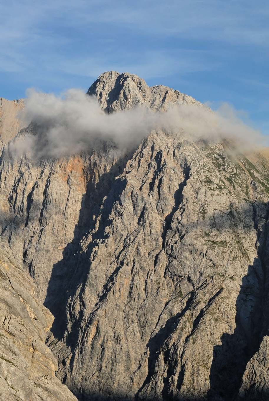
Despite being the second highest peak in Germany and having a north face which drops about 1500 m[2] (one of the highest rock faces in the whole of the Northern Limestone Alps) the Hochwanner has remained a relatively unknown mountain. This is due to its relatively inaccessible location, behind the Alpspitze and hidden by the Höllentalspitze. The more widely known, but lower Watzmann is often wrongly cited as the second highest mountain in Germany.
The easiest route to the summit is from the south from the Rotmoosalm (3 hours) or from Gatterl. Pathless in places or only recognisable by a faint trail it initially runs up steep grass meadows, later over a short rock climb (grade I on the UIAA scale) and then mainly over steep, laborious scree slopes to the summit. The route is sparingly marked with cairns. The north face is a very long climb.
Hochwanner was first climbed by Hermann von Barth in 1870.[2]
Image gallery
 View from the summit of the Hochwanner towards the west
 The north face of the Hochwanner
 The Hochwanner around 1900


See also
- List of highest mountains of Germany
- Great north faces of the Alps
References
| Wikimedia Commons has media related to Hochwanner. |
- Hochwanner 2744 m at www.bergeberge.de. Accessed on 10 Feb 2010.
- "Hochwanner". SummitPost.org. Retrieved 10 Feb 2010.
- Hochwanner - holiday Germany at en.tixik.com. Accessed on 10 Feb 2010.
- Wettersteingebirge: Südseite Archived 2007-10-09 at the Wayback Machine at www.steinmandl.de. Accessed on 10 Feb 2010.
External links
- the Hochwanner (in German)
На других языках
[de] Hochwanner
Der Hochwanner (veraltet: Kothbachspitze) ist ein Berg im Wettersteingebirge. Er ist mit 2744 m ü. NHN der nach der Zugspitze zweithöchste Berg Deutschlands[4] (sofern man den noch höheren Schneefernerkopf und die ebenfalls geringfügig höheren Wetterspitzen nur als Nebengipfel der Zugspitze betrachtet).- [en] Hochwanner
[fr] Hochwanner
Avec 2 744 mètres d'altitude, le Hochwanner est le second sommet le plus élevé d'Allemagne après la Zugspitze, si on considère que le Schneefernerkopf, qui est plus élevé, n'est qu'un sommet annexe de la Zugspitze. Il est situé sur la frontière avec l'Autriche (Land du Tyrol).[it] Hochwanner
Hochwanner è la seconda montagna più elevata (2.744 m s.l.m.) della Germania.[ru] Хохваннер
Хохваннер (нем. Hochwanner) — гора в хребте Веттерштайн на границе федеральных земель Бавария и Тироль.Другой контент может иметь иную лицензию. Перед использованием материалов сайта WikiSort.org внимательно изучите правила лицензирования конкретных элементов наполнения сайта.
WikiSort.org - проект по пересортировке и дополнению контента Википедии