geo.wikisort.org - Mountains
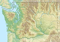
Yakima Ridge is a long anticline mountain ridge in Yakima County and Benton County in the U.S. state of Washington. From its western end just north of the city of Yakima, the ridge runs east-southeast through the Yakima Training Center to its eastern end at Hanford Reach National Monument and the Hanford Site. Yakima Ridge is paralleled on the north by Umtanum Ridge and on the south by the Rattlesnake Hills. Moxee Valley and Black Rock Valley lie south of Yakima Ridge.
| Yakima Ridge | |
|---|---|
| Highest point | |
| Elevation | 4,195 ft (1,279 m) NAVD 88[1] |
| Prominence | 1,224 ft (373 m)[2] |
| Coordinates | 46°35′25″N 120°04′39″W[1] |
| Geography | |
| Location | Yakima and Benton, counties, Washington |
| Topo map | USGS Black Rock Spring |
Yakima Ridge is part of the Yakima Fold Belt of east-tending long ridges formed by the folding of Miocene Columbia River basalt flows.[3]
The Yakima River cut a water gap through Yakima Ridge at Selah Gap. The river cut through other ridges at locations including Umtanum Ridge Water Gap and Union Gap at Ahtanum Ridge.
References
- "Coffin". NGS Data Sheet. National Geodetic Survey, National Oceanic and Atmospheric Administration, United States Department of Commerce. Retrieved 2011-06-08.
- "Yakima Ridge High Point, Washington". Peakbagger.com. Retrieved 2011-06-08.
- "Complete Report for Saddle Mountains structures, Saddle Mountains fault" (database search). USGS Earthquake Hazards Program. Retrieved 2011-06-08.
External links
- "Yakima Ridge". Geographic Names Information System. United States Geological Survey, United States Department of the Interior. Retrieved 2011-06-08.
- "Rattlesnake Hills". Yakima Valley Wines. Retrieved 2011-06-08. Geography of the Yakima Valley
На других языках
[de] Yakima Ridge
Die Yakima Ridge ist ein langer antiklinaler Gebirgsgrat in den Countys Yakima und Benton im US-Bundesstaat Washington. Von seinem Westende nördlich der Stadt Yakima verläuft er ostsüdostwärts durch die Yakima Research Station bis zu seinem Westende am Hanford Reach National Monument und der Hanford Site. Die Yakima Ridge verläuft parallel zur nördlich gelegenen Umtanum Ridge und den südlich gelegenen Rattlesnake Hills. Das Moxee Valley und das Black Rock Valley liegen südlich der Yakima Ridge.- [en] Yakima Ridge
Другой контент может иметь иную лицензию. Перед использованием материалов сайта WikiSort.org внимательно изучите правила лицензирования конкретных элементов наполнения сайта.
WikiSort.org - проект по пересортировке и дополнению контента Википедии
