geo.wikisort.org - Mountains
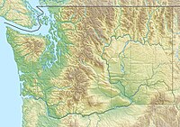
Boistfort Peak, also called Baw Faw Peak, is a peak in the Willapa Hills in Washington state. The summit was once the site of a fire lookout and is the highest point in the Willapa Hills.[3] Today it has communication antennae including the WA7UHD 2-meter ham repeater. It also is the site of station BOW in the Pacific Northwest Seismic Network.[4]
| Boistfort Peak | |
|---|---|
| Highest point | |
| Elevation | 3,113 ft (949 m) NAVD 88[1] |
| Prominence | 2,680 ft (820 m)[2] |
| Coordinates | 46°29′17″N 123°12′55″W[1] |
| Geography | |
| Location | Lewis County, Washington, U.S. |
| Parent range | Willapa Hills, Pacific Coast Ranges |
| Topo map | USGS Boistfort Peak |
References
- "Baw Faw". NGS data sheet. U.S. National Geodetic Survey. Retrieved 2008-12-03.
- "Boistfort Peak, Washington". Peakbagger.com. Retrieved 2008-12-03.
- "Baw Faw (Boistfort) Lookout". Rex's Forest Fire Lookout Page. Retrieved 2008-12-03.
- "Webicorder Maps". The Pacific Northwest Seismic Network. Archived from the original on 2008-12-16. Retrieved 2008-12-03.
External links
- "Boistfort Peak". Geographic Names Information System. United States Geological Survey. Retrieved 2008-12-03.
- "Baw Faw Repeater Group". Archived from the original on 2008-08-20. Retrieved 2008-12-03.
Текст в блоке "Читать" взят с сайта "Википедия" и доступен по лицензии Creative Commons Attribution-ShareAlike; в отдельных случаях могут действовать дополнительные условия.
Другой контент может иметь иную лицензию. Перед использованием материалов сайта WikiSort.org внимательно изучите правила лицензирования конкретных элементов наполнения сайта.
Другой контент может иметь иную лицензию. Перед использованием материалов сайта WikiSort.org внимательно изучите правила лицензирования конкретных элементов наполнения сайта.
2019-2025
WikiSort.org - проект по пересортировке и дополнению контента Википедии
WikiSort.org - проект по пересортировке и дополнению контента Википедии
