geo.wikisort.org - Mountains
Treskavica is a mountain range in Bosnia and Herzegovina, situated in Trnovo municipality just south of city of Sarajevo. Mala Ćaba (Đokin Toranj) peak at 2088 m (6850 ft.), which makes Treskavica the tallest of all the mountains circling Sarajevo, and only some 300 m shorter than the tallest mountain in the country. On clear days with good weather, climbers can see far into the distance, up to Montenegro and the Adriatic Sea.
| Treskavica | |
|---|---|
 Veliko Jezero and Treskavica main ridge | |
| Highest point | |
| Elevation | 2,088 m (6,850 ft) |
| Coordinates | 43.5960573°N 18.3469105°E |
| Geography | |
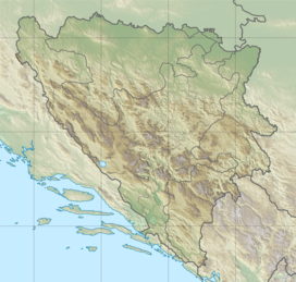 Treskavica Location in Bosnia | |
| Location | |
| Topo map | yes |
| Climbing | |
| Easiest route | from Trnovo via Turovi and Sustavac P.D. proceeding to Veliko Jezero. From there strictly following the markings towards Đokin Toranj (mine hazard!). |
Topography
Geologically, the Treskavica range is part of the Dinaric Alps and formed largely of secondary and tertiary sedimentary rock, mostly limestone and dolomite.[1] A number of beautiful mountain lakes are scattered throughout the group, of which Veliko Jezero is the largest. A number of streams source from these mountains: the Bistrica tributary of the Drina river, the Željeznica tributary of the Bosna river, Ljuta and Rakitnica tributaries of the Neretva. Notable peaks are Mala Ćaba (2088 m.), Pašina Planina (2070 m.), Mali Treskač (1950 m.) and Lupoč (1773 m.).[citation needed]
History
During the Bosnian War, the Treskavica mountains were part of the frontline between both ARBiH and VRS, which saw intense combat. Numerous battles were fought within these mountains over the possession of the small town of Trnovo, which would allow access to the Goražde enclave and the staging point for the Siege of Sarajevo.
Nowadays, the borderline between the two entities of Bosnia and Herzegovina runs parallel to the former lines diagonally through Treskavica, dividing the south-eastern part of the mountain range towards the territory of the Republika Srpska whereas the north-western part belongs to the Federation of Bosnia and Herzegovina.
Although contamination with land mines and unexploded ordnance still pose a serious threat throughout the area,[2] hiking and tourism have picked up during the last couple of years, and some mountain huts have re-opened (Sustavac, and Turnovi Stan).
The main peak of Mala Ćaba is generally known as Đokin Toranj because of a view tower that used to stand on its summit, but has been destroyed and removed during the war. A marked itinerary, leading from Veliko Jezero to the top was re-established in 2010.[citation needed]
References
- Matias Gomez: ‘Forgotten Beauty – A hikers guide to BiH’s 2000 metre peaks’ (page 13) Buybook, 2005 ISBN 978-9958-630-59-0
- BiH Mine Action Centre, (Annual) Mine Maps
| Authority control: National libraries |
|---|
This Sarajevo Canton geography article is a stub. You can help Wikipedia by expanding it. |
На других языках
[de] Treskavica
Die Treskavica (serbisch-kyrillisch Трескавица) ist ein zu den Dinariden gehörendes Gebirgsmassiv im Zentrum von Bosnien und Herzegowina, etwa 25 Kilometer südlich von Sarajevo. Ihr höchster Gipfel – der 2086 m hohe Dokin Toranj – ist die höchste Erhebung in der Hauptstadtregion und der siebthöchste Punkt des ganzen Landes.- [en] Treskavica
[es] Treskavica
Treskavica es una montaña en Bosnia y Herzegovina, ubicada en el municipio de Trnovo justo al sur de la ciudad de Sarajevo. Con 2088 msnm, Treskavica es la más alta de las montañas que circunda Sarajevo, y sólo 300 metros más baja que la más alta montaña del país. En los días claros con buen tiempo, los escaladores pueden ver muy lejos en la distancia, hasta Montenegro y el mar Adriático.[fr] Treskavica
Treskavica est une montagne du centre de la Bosnie-Herzégovine au sud de la ville de Sarajevo. Elle culmine à 2 088 mètres ce qui en fait la plus haute montagne de la région de Sarajevo. Par temps clair, on peut apercevoir de son sommet la mer Adriatique et le Monténégro.[it] Treskavica
Il Treskavica (in cirillico Трескавица) è un gruppo montuoso della Bosnia ed Erzegovina appartenente alla catena delle alpi Dinariche; il picco di Mala Ćaba (Đokin Toranj), alto 2 088 m s.l.m., è la più alta delle montagne che circondano Sarajevo.[ru] Трескавица
Трескавица — гора в Республике Сербской, часть её западного склона располагается уже на территории Федерации Боснии и Герцеговина. Высота Трескавицы составляет 2 086 метров над уровнем моря. Является частью Динарского нагорья, формировалась из вторичных и третичных осадочных пород, из известняков и доломитов. На горе находятся несколько красивых горных озер, крупнейшее из которых — Велико-Йезеро. В свою очередь, из них вытекают несколько горных рек, такие как Бистрица (приток Дрины), Жельеница (приток Босны), Люта и Ракитиница (притоки Неретвы). В солчнечную погоду с горы можно видеть территорию Черногории и Адриатическое море.Другой контент может иметь иную лицензию. Перед использованием материалов сайта WikiSort.org внимательно изучите правила лицензирования конкретных элементов наполнения сайта.
WikiSort.org - проект по пересортировке и дополнению контента Википедии