geo.wikisort.org - Mountains
Seoraksan is the highest mountain in the Taebaek mountain range in the Gangwon Province in eastern South Korea.[1] It is located in a national park near the city of Sokcho. After the Hallasan volcano on Jeju Island and Jirisan in the south, Seoraksan is the third highest mountain in South Korea. The Daechongbong Peak (대청봉) of Seoraksan reaches 1,708 meters (5,603 feet). The mountain is sometimes considered the backbone of South Korea.[2]

This article needs additional citations for verification. (February 2017) |
| Seoraksan | |
|---|---|
 The Dinosaur Ridge of Seoraksan | |
| Highest point | |
| Elevation | 1,708 m (5,604 ft) |
| Coordinates | 38°7′10″N 128°27′56″E |
| Geography | |
 Seoraksan Seoraksan is located in Gangwon Province in eastern South Korea | |
| Location | South Korea |
| Parent range | Taebaek Mountains |
| Climbing | |
| Easiest route | Hike, scramble |
Geography
Seoraksan is divided into Naeseorak (Inner Seorak), Oaeseorak (Outer Seorak), and Namseorak (South Seorak).
Naeseorak (Inner Seorak)
The area belonging to Inje-gun in the northwest and Daecheongbong Peak is called Naeseolak,
Naeseorak features various valley views including Baekdam Valley, Gaya-dong Valley, Gugokdam Valley, Gugokdam Valley, 12 Seonnyeondang, Daeseung Falls and Yongajangseong Fortress. In addition to Cheonbul-dong Valley, it is easy to access Ulsan Rock, Gwongeumseong Fortress, Geumgang Cave, Biryong Falls, and Toseong Falls.[3]
Oaeseorak (Outer Seorak)
Oaeseorak is the area belonging to Sokcho City towards the east. It features easier hiking courses and is one of the most accessed areas of the park.[3]

Mountain geography, fauna and flora
It was designated as Natural Monument No.171 in 1965, and as a national park on Mount Seorak on March 24, 1970.[4] In August 1982, UNESCO designated the area as a biosphere reserve.[5][6][7]
Depending on the climate and characteristics, the mountain's biologic features have different ecosystems. While the inland climate is composed of gentle slopes and thick layers of soil, the forest is abundant and animal form is abundant, the outcropping is a marine climate, which causes the ground to steep and frequent visitors, which is less formal. Rare plants and animals live in the wild, including natural monuments such as mountain goats and semi-moon chest bears.
The biosphere of the Mt. Seolak is composed of different ecosystems according to climate and characteristics. It is an inland climate with gentle slopes and thick soil layers that are rich in forests and rich in animal habitats, while oyster shells have a marine climate with steep slopes and few visitors. It is home to rare animals and plants, including natural monuments such as goats and bears.
Hiking Paths
Outer Seorak District
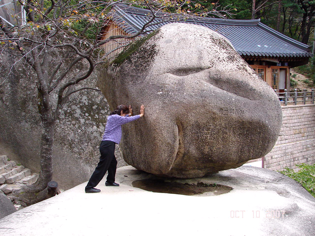
The Yukdam waterfall and the Biryeong waterfall (비룡폭포) are located on the left side of the valley, about a forty-minute walk from the main car park. Ulsanbawi (울산바위) is a rock formation in the Seoraksan national park.[8] The shape of Ulsanbawi is unique in the area. To reach the rocks you need to follow a hiking path and climb over 800 steps (it is actually 888 steps according to locals). On the way there, there are two temples and a spherical rock (Heundeulbawi, 흔들바위) which is located on top of a larger rock.[9] This rock is about 5 meters (16 feet) high and can be moved with some effort. Thousands of people have already tried to push down Heundeulbawi, but nobody gets further than waggling the rock.
Legend of Ulsanbawi
According to the legend Ulsanbawi comes from the city of Ulsan in the south east of Korea. As Kumgangsan (금강산) was built, Ulsanbawi walked to the north as the representative of the city. Unfortunately Ulsanbawi arrived too late and there was no more room. Ulsanbawi was ashamed and slowly trudged back to the south. One evening the rock went to sleep in the Seorak area. Ulsanbawi felt it was so beautiful around there that it decided to stay for good.[10]
At the end of the main valley is Biseondae, a rock platform in a stream. Above the stream is a difficult to reach cave, which offers clear views of the surrounding rock formations.
A bit farther from the entrance is the Valley of a Thousand Buddhas (천불동계곡), the primary valley of Seorak Mountain, also sometimes referred to as Seorak Valley. The valley was so named because the rock formations that line its sides resemble a line-up of Buddha statues.
Dinosaur Ridge
The Dinosaur Ridge (공룡능선) is the ridge in Seoraksan that extends from Mardeungyeong to Sinseonam.[11] It is one of Korea's cultural scenic treasures, being designated as the 103rd treasure in 2013.[12] It earns it name due to the mountain peaks in the ridge looking like the back of a spiked dinosaur.[13] The course is very strenuous, with steep peaks that require a 16+ hour hike to go through the course.[14] It is listed among the most difficult mountain courses to climb in Korea.[15] Due to this, accidents due to exhaustion are very common, especially in winter.[16] One incident in December 1993 left 2 university students dead due to them losing their way at night and experiencing hypothermia.[17]
Gallery
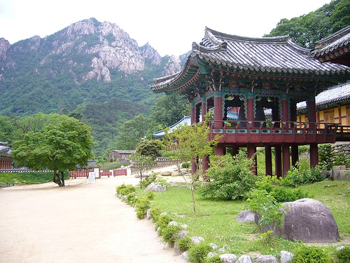
 Mount Gwonggeumseong in Seoraksan National Park
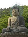 Bronze Buddha of Sinheungsa (Buddhist Temple) near the main entrance to Seoraksan National Park.
 Sinheungsa (Buddhist Temple) in Seoraksan National Park
 Ulsanbawi (peak) in Seoraksan National Park
 Biryong (Flying Dragon) Waterfalls in Seoraksan National Park.
 Seoraksan National Park
 Trying to shake Heundeulbawi (Rocking Rock) at Kyejo-am in Seoraksan National Park
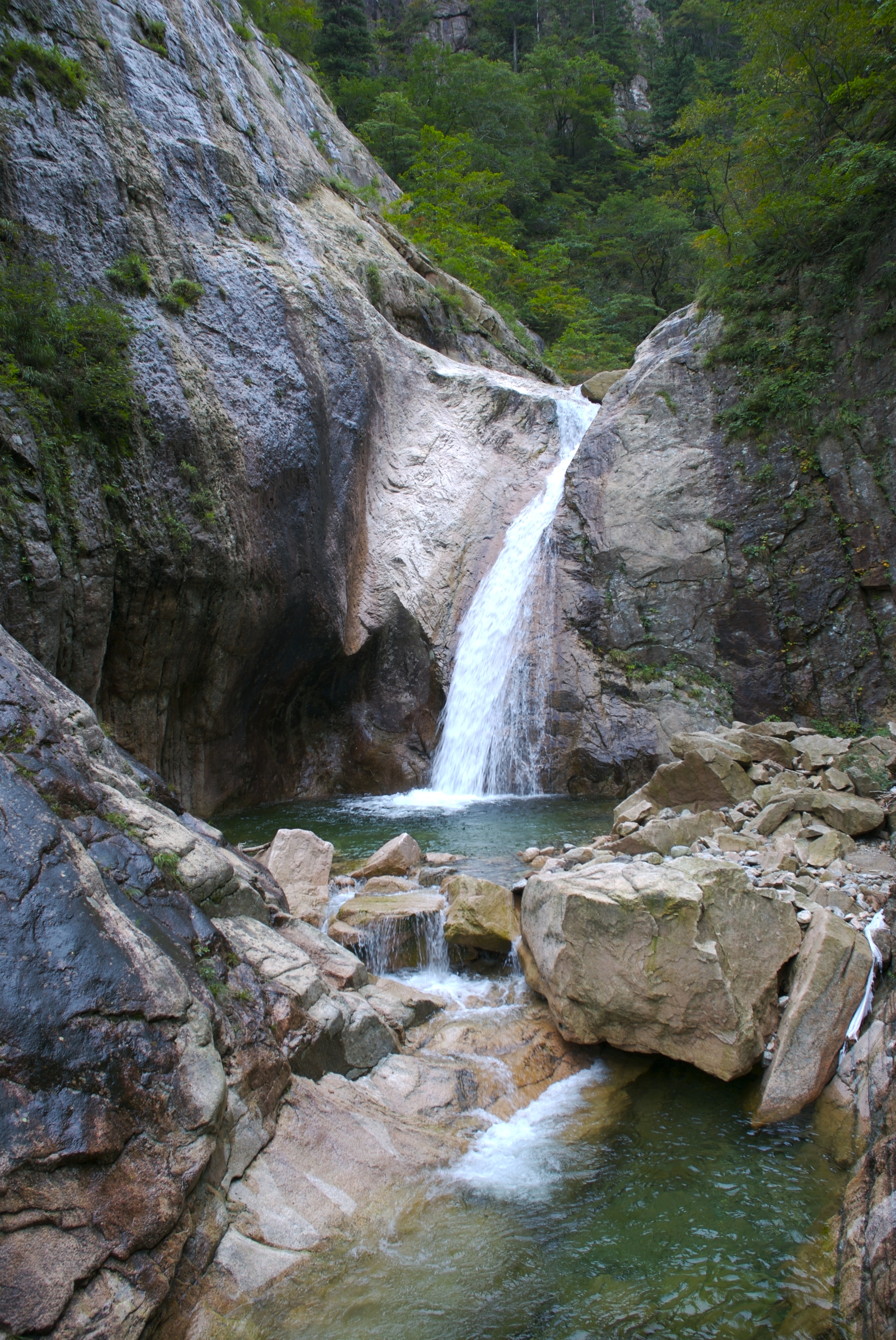
 Cheondang Waterfall


See also
- List of mountains in Korea
- Geography of South Korea
References
- "대한민국 구석구석 행복여행 - 설악산국립공원". korean.visitkorea.or.kr. Retrieved 2017-02-21.[permanent dead link]
- "설악산" (in Korean). Retrieved 2018-06-14.
- "설악산".
- "국가기록원 기록물뷰어". theme.archives.go.kr (in Korean). Retrieved 2019-06-07.
- "국가기록원 기록물뷰어". theme.archives.go.kr (in Korean). Retrieved 2019-06-07.
- "국가기록원 기록물뷰어". theme.archives.go.kr (in Korean). Retrieved 2018-03-24.
- "문화재청고시제2011-87호 (국가지정문화재<천연기념물> 관리단체 변경)" [National Cultural Property Administration Notification No. 2011-87 (Change of management organization of national cultural property <Natural Monument>)]. Gazette No. 17498. 2011-04-29. p. 122. Retrieved 2016-10-14.[dead link]
- "설악산 울산바위" (in Korean). Retrieved 2018-06-14.
- "설악산 흔들바위" (in Korean). Retrieved 2018-06-14.
- "The legend of Ulsanbawi (in Korean)".
- "설악산 공룡능선(雪嶽山恐龍稜線) - 한국민족문화대백과사전". encykorea.aks.ac.kr. Retrieved 2019-08-09.
- "명승 제103호 설악산 공룡능선 (Scenic Location no.103, the dinosaur ridge in Seoroksan)". www.heritage.go.kr. Retrieved 2019-08-09.
- "설악산 공룡능선 (the dinosaur ridge at Seoroksan)". kormt.co.kr.
- "사방이 장관인 설악 중의 진짜 설악…설악산 공룡능선". mk.co.kr (in Korean). Retrieved 2019-08-09.
- "설악산 공룡 능선을 넘다". 오마이뉴스. 2005-06-29. Retrieved 2019-08-09.
- "[산의 무서움] 93년 설악산 공룡능선 조난사고 (+당시 기사 추가)". www.fmkorea.com. Retrieved 2019-08-09.
- 김정수 (December 19, 1993). "설악산등반 대학생 1명 사망 1명 실종". The Hankyoreh.
External links
 Seoraksan National Park travel guide from Wikivoyage
- Seoraksan National park
На других языках
[de] Seoraksan
Der Seoraksan (Seorak-Berg) ist einer der Hauptgipfel des auf der Koreanischen Halbinsel liegenden Taebaek-Gebirges. Er ist mit 1708 Metern Höhe der dritthöchste Berg Südkoreas und für seine außerordentlich zerklüftete Felslandschaft bekannt.- [en] Seoraksan
[fr] Seoraksan
Le Seoraksan (설악산 en coréen, 雪嶽山 en chinois) est le plus haut massif des monts Taebaek, qui s'étend dans la province de Gangwon, à l'est de la Corée du Sud. Il se trouve dans un parc national et domine la ville portuaire de Sokcho sur la mer du Japon. Les Coréens sont fiers de ce massif dont ils admirent l'aspect sauvage.[it] Monte Seorak
Il Monte Seorak o Seoraksan è la più alta cima dei Monti Taebaek nella Penisola coreana.[ru] Сораксан
Сораксан — самые высокие горы хребта Тхэбэксан в провинции Канвондо на востоке Южной Кореи. Расположены в национальном парке рядом с городом Сокчхо. Сораксан — третьи по высоте горы в Южной Корее после вулкана Халласан на острове Чеджудо и горы Чирисан на юге страны[1]. Пик Тэчхонбон достигает 1 708 метров в высоту.Другой контент может иметь иную лицензию. Перед использованием материалов сайта WikiSort.org внимательно изучите правила лицензирования конкретных элементов наполнения сайта.
WikiSort.org - проект по пересортировке и дополнению контента Википедии