geo.wikisort.org - Mountains
Jirisan is a mountain located in the southern region of South Korea. It is the second-tallest mountain in South Korea after Jeju Island's Hallasan, and the tallest mountain in mainland South Korea.[1]
This article may be expanded with text translated from the corresponding article in Korean. (March 2022) Click [show] for important translation instructions.
|
| Jirisan | |
|---|---|
 | |
| Highest point | |
| Elevation | 1,915 m (6,283 ft) |
| Prominence | 1,696 m (5,564 ft) |
| Listing | Ultra |
| Coordinates | 35°20′13″N 127°43′50″E |
| Geography | |
 Jirisan South Korea | |
| Parent range | Sobaek Mountains |
| Climbing | |
| Easiest route | Hike |
| Korean name | |
| Hangul | |
|---|---|
| Hanja | |
| Revised Romanization | Jirisan |
| McCune–Reischauer | Chirisan |
The 1915m-high mountain is located in Jirisan National Park. The park spans three provinces (North, South Jeolla and South Gyeongsang) and is the largest in South Korea. The largest proportion of the national park is in the province of South Gyeongsang. The highest peak of the mountain, Cheonwangbong is also located in this province. Another well-known peak is Samshin-bong (Three Spirits Peak).
Jirisan is at the southern end of the Sobaek and Baekdudaegan mountain ranges, the "spine" of the Korean Peninsula incorporating the Sobaek mountain range and most of the Taebaek mountain range.
There are seven major Buddhist temples on Jirisan. Hwaeomsa is the largest and best-known temple among these. It contains several national treasures, mostly stone artworks from about 600–900 CE. The mountain is also home to the Cheonghak-dong (Azure Crane Village) alpine valley, which includes the Samseonggung (Three Sages Palace), which is a site celebrating one of Korea's foundation myths.[2]
Every year more than 280,000 people visit Jirisan. Summer and autumn are the most popular visiting seasons. The mountain is advertised as having ten scenic views. These are ‘Sunrise from Cheonwang-bong peak’, ‘Nogodan Sea of Clouds’, ‘Banyabong’s Nakjo’, ‘Full moon at Byukso-ryung’, ‘Piagol Autumn Leaves’, ‘Royal Azalea Blossoming’, ‘Chilseon Valley’, ‘Seomjincheongryu’, ‘Buril water fall’, ‘Yeonha-Sunkyung’. Jirisan National Park has several hiking routes.
Legends
At the entrance to Baemsagol Valley, some 1,300 years ago, there used to be Songnimsa Temple. This temple practiced an annual rite on the Chilwolbaekjung holiday (full moon day of July by the lunar calendar) wherein they selected the most pious monk and prayed earnestly for his safe passage to paradise as a deity. In a certain year, the then highest monk Seosandaesa visited the temple, heard about this Buddhist rite, and guessed that there must be a secret behind it. Seosandesa allowed that year's chosen monk to pray wearing a silk robe anointed with poison, linked by a silk thread to Sinseodae Terrace. Seosandaesa then hid himself behind a rock to watch. At around 1 am, an imugi anaconda, which was sorry not to have turned into a dragon, slithered up from the valley below Sinseondae Terrace to the sound of roaring water. The imugi jumped upon the praying monk, bit him in the mouth, and disappeared into the water. Seosandaesa returned to the temple, and waited until dawn. Early in the morning, he, together with the villagers, went to Sinseondae Terrace to find that the imugi had died , having failed to swallow the whole body of the monk. Seosandaesa discovered Songnimsa Temple's secret of sacrificing a monk to an imugi every year. Thereafter, the valley was named Baemsagol, which means the valley where an imugi, which failed to become a dragon, died. The village at the entrance to Baemsagol Valley was named Banseon (meaning a "half deity") in memory of the dead monk because he was sacrificed without becoming a deity.[3]

Peaks
This section is written like a travel guide rather than an encyclopedic description of the subject. (March 2022) |
Samshinbong (bong means "peak") is 1,284 m (4,213 ft) high and a popular, but strenuous, day-hike from the Ssanggye Temple entry point (it is the closest major peak from this trailhead). From Ssanggyesa, a trail winds up 2.3 km to Bul-il Falls. From the left turn in the path just before the waterfall, the track continues 6.9 km to the peak (for a grand round-trip total of 18.4 km). Starting from Ssanggyesa (the sa suffix indicates a Buddhist temple), the peak can be reached in four hours at a steady pace. There is a helipad near the summit for emergency services. It takes about three hours to get down; it is an extremely steep hike. Climbers are advised to bring plenty of water as it is only available from streams beyond the temple grounds. This peak can also be climbed from the back of Cheonghak-dong Village.
History
During the Korean War, North Korean troops occupied the region in 1950. After the United Nations forces took the area in 1951, a considerable number of North Koreans remained in the mountains, where they continued a guerrilla war, until they were finally beaten in 1955, two years after the Korean Armistice Agreement was signed by the belligerents. The Republic of Korea issued an "Anti-Guerrilla Warfare Service Medal" for its troops who fought in the area [4] and a movie about the fighting was later produced.[5] An earlier film, Piagol, about a group of North Korean soldiers in the area, was released the year the fighting ended.
Ecosystem
Jirisan is known to grow about 1,500 kinds of plants, many of which are endemic. This is the largest growth of plants in South Korea except for Mt. Halla.
Some plants were first found in Mt. Jiri and have 'Jirisan' or 'Jirisan'. However, some plants do not have 'geori' or 'geori' attached to them even though they were first found on Mt. Jiri.[6]
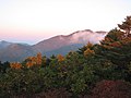
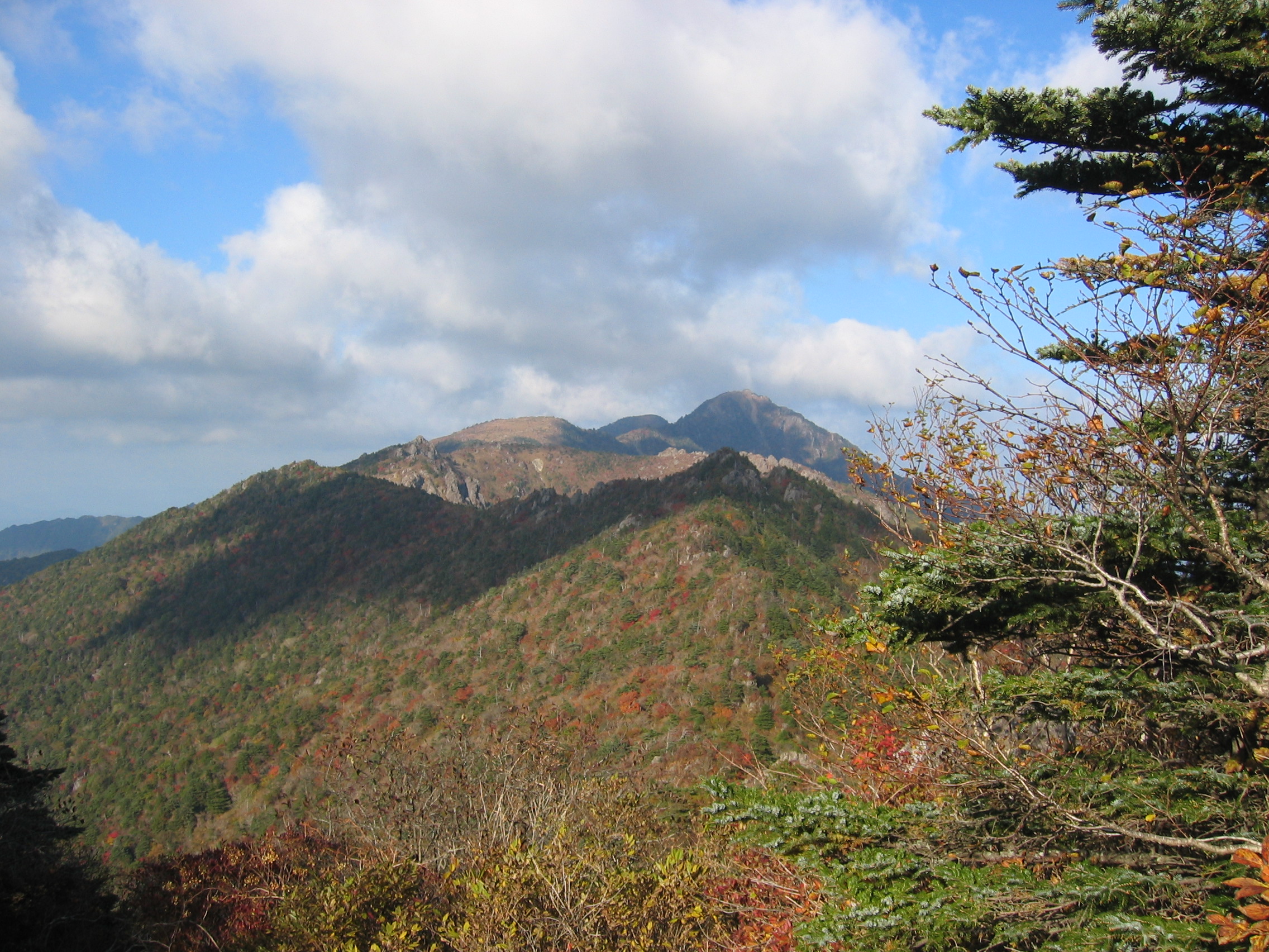
Gallery
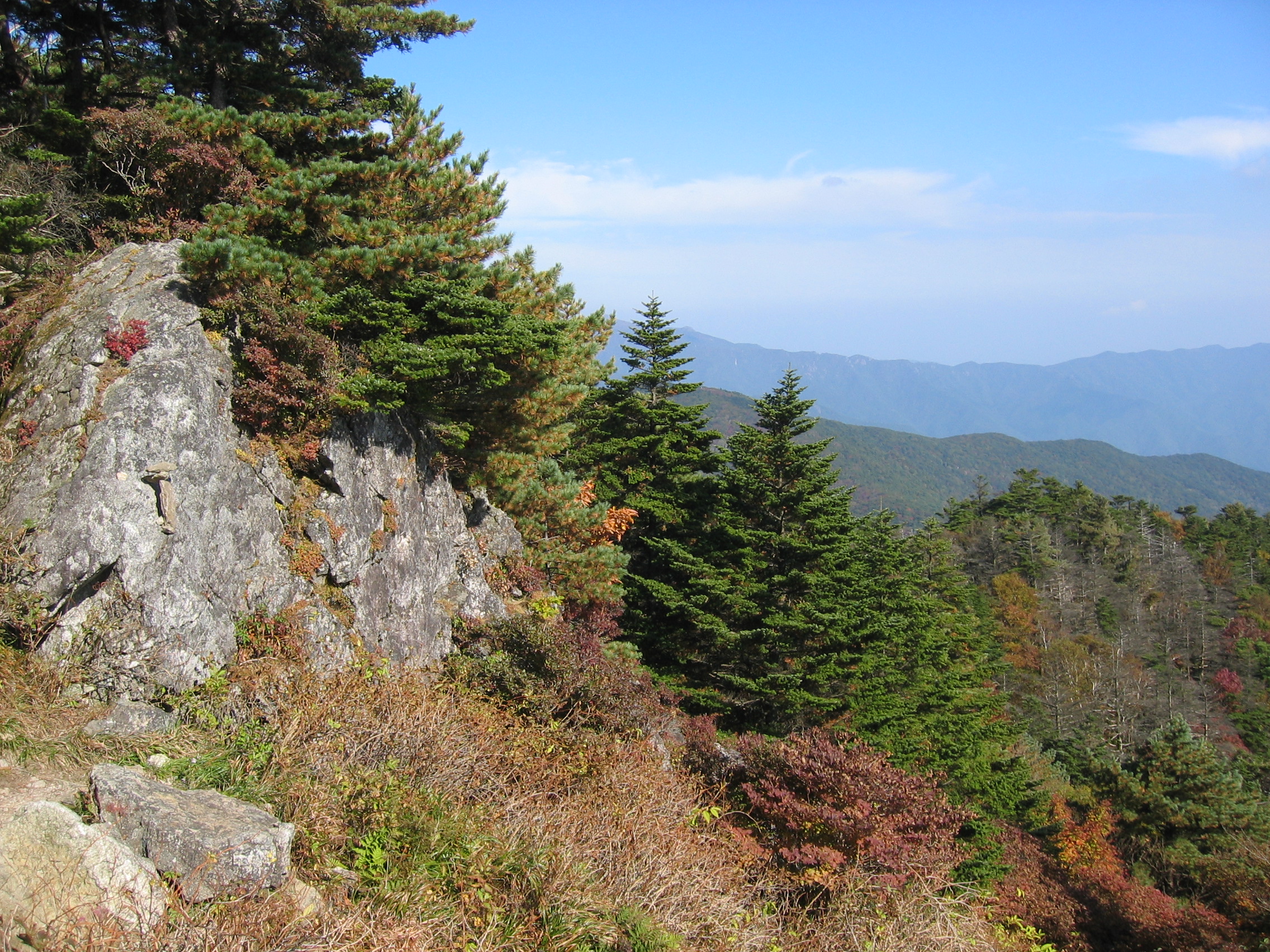
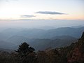 Jirisan National Park

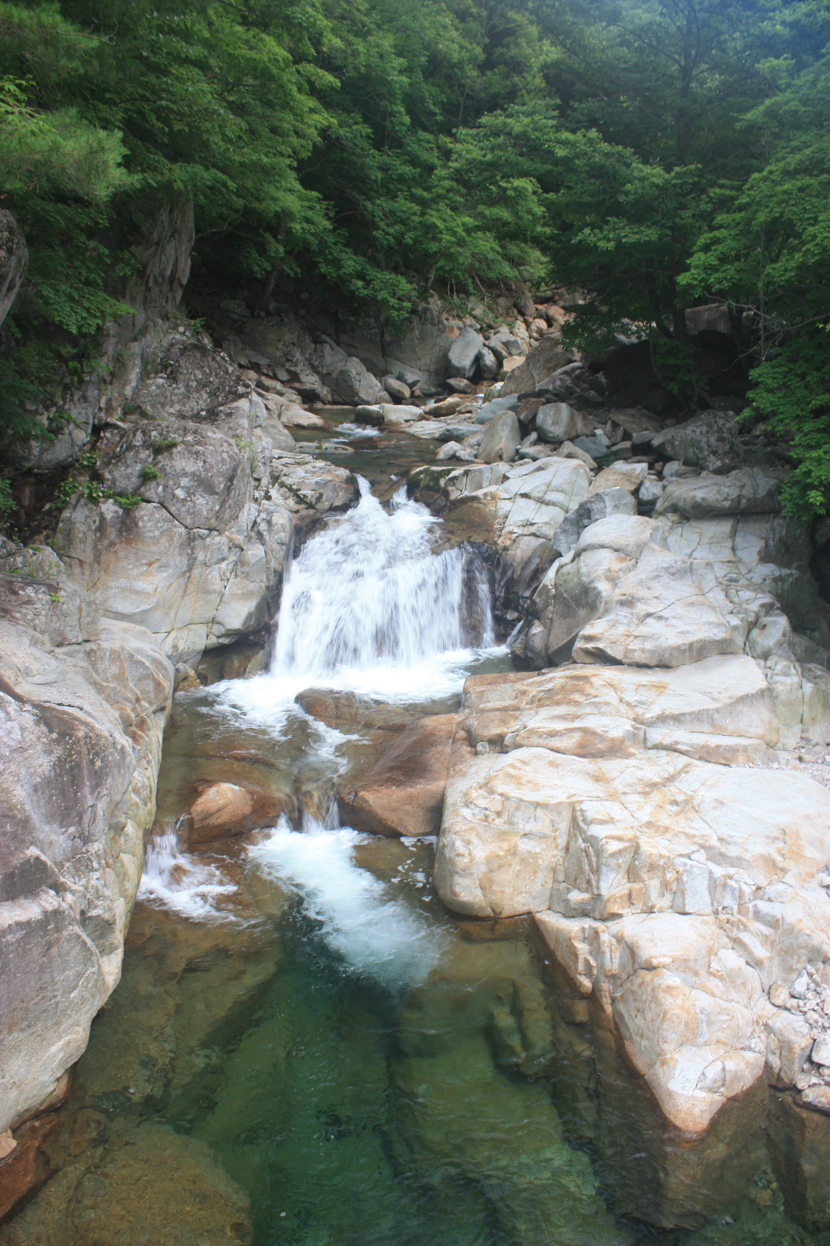
 Baemsagol valley


See also
- National parks of South Korea
- List of mountains in Korea
- Geography of South Korea
- Mayago
- Korea Forest Service
- Jirisan (TV series)
References
- "Highest Mountains South Korea". www.geonames.org.
- "지리산" (in Korean). Retrieved 2018-06-14.
- "뱀사골" (in Korean). Retrieved 2018-06-14.
- "Republic of Korea: Anti-Guerrilla Warfare Service Medal". Medals of the World. Retrieved 2013-04-07.
- "North Korean Partisan in South Korea". Korean Film Archive. Archived from the original on 2012-05-28. Retrieved 2013-04-07.
- "[서울신문] [현진오의 꽃따라 산따라]지리산". archive.fo. 2013-05-01. Archived from the original on 2013-05-01. Retrieved 2019-06-07.
External links
- Jirisan National Park-Official KNPS Homepage
- Online mashup/interactive map of Jirisan hiking trails (in Korean)
- Korea in the Clouds: A Detailed Guide to Hiking Korea's Mountains
- Jiri-san as a Sacred Mountain, Mason's pages on the religious character and sites of this remarkable set of peaks, slopes and gorges.
На других языках
[de] Jirisan
Der Jirisan (지리산, Jiri-Berg) ist mit 1915 m Höhe nach dem Hallasan der zweithöchste Berg in Südkorea und der höchste auf dem Festland. Er ist Teil der Gebirgskette Baekdu-daegan (백두대간), deren südlicher Teil im Jirisan-Nationalpark liegt. Der Berg wird vom Fluss Seomjingang umflossen.- [en] Jirisan
[es] Jirisan
Jirisan o Chirisan es la montaña más alta del territorio continental de Corea del Sur y la segunda más alta de todo el país, superada solo por Hallasan en la isla de Jeju.[1] Está en el extremo sur de las cordilleras Sobaek y Baekdudaegan, en el Jirisan Parque Nacional, y su cumbre más alta, Cheonhwangbong,[2] está localizada en Gyeongsang del Sur.[fr] Jirisan
Le Jirisan est le second plus haut sommet de la Corée du Sud, après le volcan Hallasan, et l'une des trois montagnes majeures du pays, avec le Seoraksan. Il se dresse dans le parc national du même nom, qui se partage entre les provinces de Gyeongsang du Sud, Jeolla du Nord, et Jeolla du Sud.[it] Jirisan
Jirisan (지리산?, 1915 m s.l.m.) è una montagna ubicata nella provincia del Gyeongsang Meridionale, in Corea del Sud. Parte della catena dei monti Sobaek, è la seconda cima del paese dopo il monte Halla. La sua area è protetta dall'omonimo parco nazionale. Sulle sue pendici si trovano sette importanti templi buddisti.[ru] Чирисан (гора)
Чириса́н (кор. 지리산, 智異山, Jirisan, Chirisan) — самая высокая гора в южной (материковой) части Республики Корея (1915 м над уровнем моря), высшая точка Восточно-Корейских гор.Другой контент может иметь иную лицензию. Перед использованием материалов сайта WikiSort.org внимательно изучите правила лицензирования конкретных элементов наполнения сайта.
WikiSort.org - проект по пересортировке и дополнению контента Википедии