geo.wikisort.org - Mountains
The Taebaek Mountains are a mountain range that stretches across North Korea and South Korea. They form the main ridge of the Korean peninsula.
This article needs additional citations for verification. (April 2012) |
| Taebaek Mountains | |
 Location of the Taebaek Mountains | |
| Korean name | |
|---|---|
| Hangul | |
| Hanja | |
| Revised Romanization | Taebaek Sanmaek |
| McCune–Reischauer | T'aebaek Sanmaek |
Geography
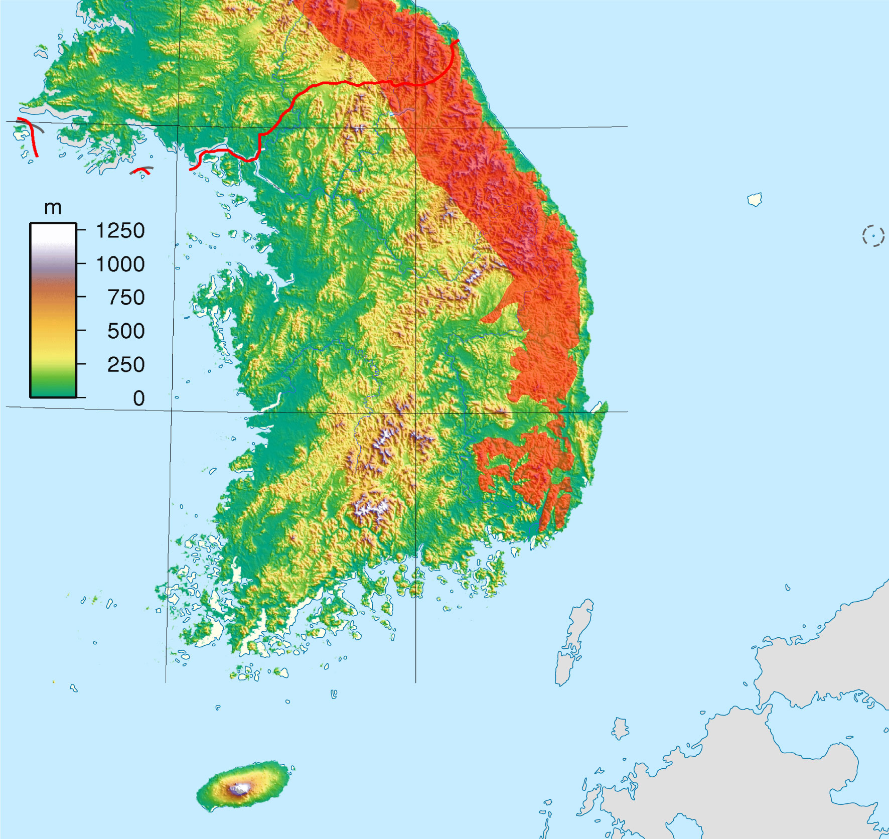
The Taebaek mountains are located along the eastern edge of the peninsula and run along the eastern coast of the Korean Peninsula. The Hwangnyong Mountain in North Korea (1268 meters) forms the northern end of the range. Busan lies at the southern end of this mountain range, thus making the mountain range a total length of over 500 kilometers, averaging about 1000 meters in height.[1]
Prominent peaks of the range include Mount Seoraksan (1,708 m), Mount Kumgangsan (1,638 m), Mount Taebaeksan (1,566.7 m) and Mount Odaesan (1,563 m). To the east, the mountain range falls steeply into the sea, but to the west, there are more gentle slopes. Many spurs stretch southwest. The most important rivers of South Korea, the Han River and the Nakdong River, both originate in the Taebaek Mountains.
Ecology
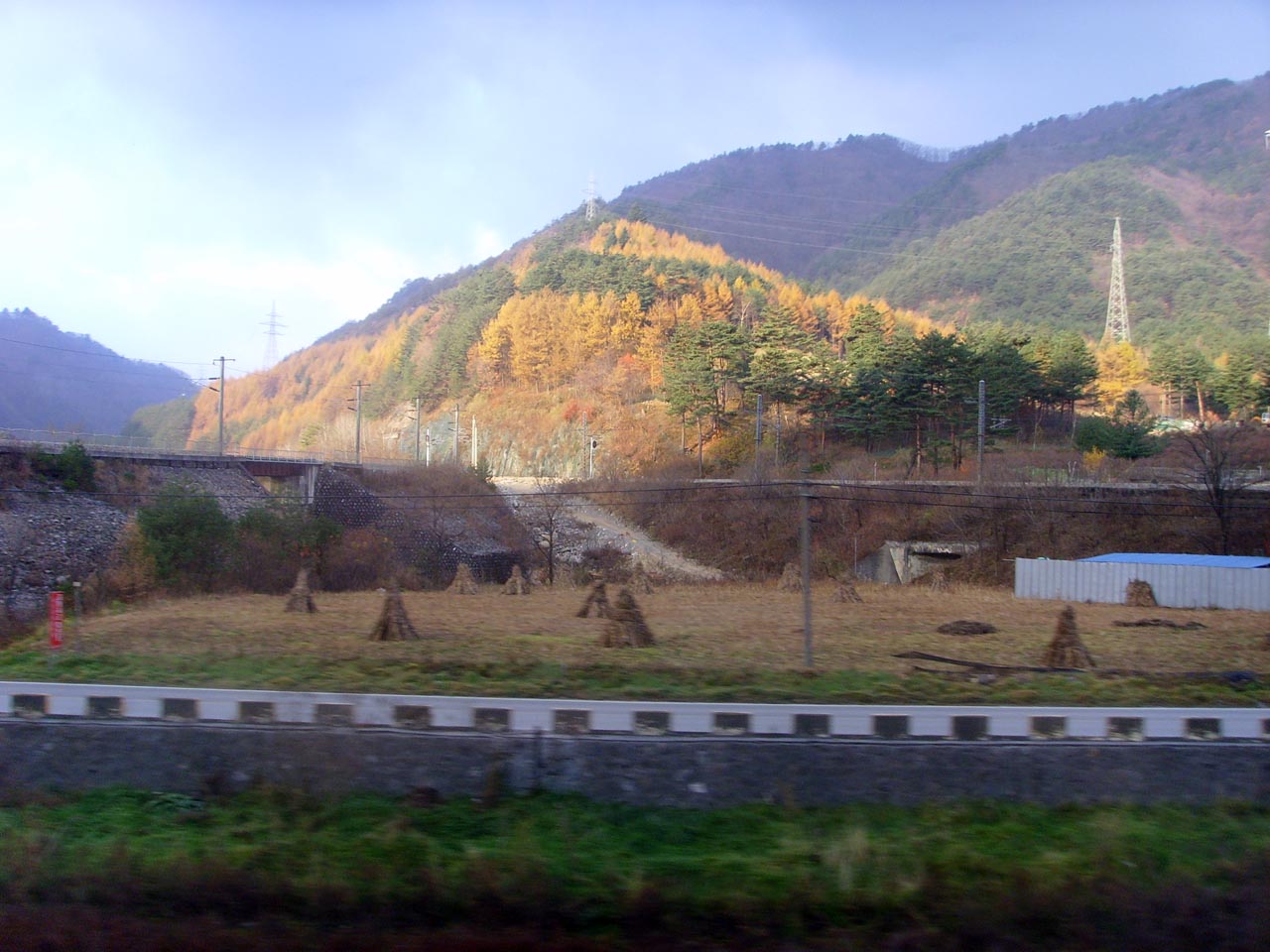
Many of the slopes are extensively covered in forests.[1]
Industry
Economically the Taebaek mountains are important for the mining of iron, coal, tungsten, fluorite, and limestone.[1]
Attractions
Manggyeongsa Temple in Hyeol-dong Taebaek, Gangwon-do Province at an altitude of 1,460 meters on Mount Taebaeksan, is a temple built to enshrine the statue of the Bodhisattva of wisdom. It was built by Jajang, a Silla Dynasty monk. The "Dragon Spring" at the entrance of the temple is known as the highest spring in Korea.[2]
The 2018 Winter Olympics took place in Pyeongchang, Gangwon-do, located in the mountains.
Taebaek is also a name of a poomsae that is performed by the 3rd Dan black belts in Tae Kwon Do. Taebaek is mostly practised in Southern South Korea.
See also
- Baekdudaegan
- List of mountains in Korea
- Geography of South Korea
References
- "T'aebaek Mountains". Encyclopædia Britannica. Retrieved 17 November 2013.
- Cin Woo Lee "Simply stunning: 33 incredible Korean temples" CNN Go. 10 February 2012. Retrieved 2012-04-12
Authority control | |
|---|---|
| General |
|
| National libraries | |
На других языках
[de] Taebaek-Gebirge
Das Taebaek-Gebirge (kor. 태백 산맥, Hanja .mw-parser-output .Hani{font-size:110%}太白山脈, rev. Taebaek Sanmaek) ist der Hauptgebirgszug der Koreanischen Halbinsel.- [en] Taebaek Mountains
[fr] Monts Taebaek
Les monts Taebak, ou monts T’aebaek, sont une chaîne de montagne de la péninsule coréenne, qui court du nord au sud de la péninsule, sur son flanc oriental. Les monts Kumgang constituent sa partie septentrionale en Corée du Nord.[it] Monti Taebaek
I Monti Taebaek (태백산맥?, 太白山脈?, Taebaek SanmaekLR) sono una catena montuosa che attraversa sia la Corea del Nord che la Corea del Sud e sono di fatto il principale crinale della Penisola coreana.[ru] Восточно-Корейские горы
Восточно-Корейские горы (Тхэбэксан; кор. 태백산맥?, 太白山脈?, Taebaek Sanmaek) — горная система на востоке Корейского полуострова. Протяжённость составляет более 600 км, наибольшая высота — 1915 м (гора Чирисан).Другой контент может иметь иную лицензию. Перед использованием материалов сайта WikiSort.org внимательно изучите правила лицензирования конкретных элементов наполнения сайта.
WikiSort.org - проект по пересортировке и дополнению контента Википедии