geo.wikisort.org - Mountains
The Sella group (German: Sellagruppe, Ladin: Mëisules or L Sela) is a plateau-shaped massif in the Dolomites mountains of northern Italy. The Sella lies north of the Marmolada and to the east of the Langkofel. The highest peak is Piz Boè at 3,151 m (10,338 ft) above sea level.

The Sella lies between the four Ladin valleys of Badia, Gherdëina, Fascia, and Fodom and is divided between the provinces of South Tyrol, Trentino and Belluno. It can be driven around by car crossing the Campolongo Pass, Pordoi Pass, Sella Pass, and Gardena Pass. In winter it is possible to ski around the entire massif by using the Sella Ronda ski lift carousel. Also each winter the alpine touring ski Sellaronda Skimarathon race is held, which leads around the entire Sella and covers 42 km of mountain trails. The same trails can be mastered by Mountain bike during the summer.
Other peaks in the massif are the Piz Pisciadù 2,985 m (9,793 ft), the Boèseekofel 2,910 m (9,550 ft), the four Sellatürme 2,696 m (8,845 ft), Sass Pordoi 2,952 m (9,685 ft), whose summit can be reached by funicular from Pordoi Pass, and Brunecker Turm 2,495 m (8,186 ft). During winter the summit is the starting point for many alpine ski tours, of which the most famous are the descent through the Val Mesdì and the descent from the Pordoischarte.
Climate
The plateau of the Sella Group is characterized by a Tundra climate with average temperatures above 0 °C only during the summer months. Average data at the weather station on Piz Pisciadù at 2,985 m (9,793 ft) measured between 2004 and 2020 shows that the average temperature in summer lies around +3 °C and +5 °C, while in winter it ranges between -8 and -10 °C.
| Climate data for Piz Pisciadù (period: 2004–2020; altitude: 2,985 m) | |||||||||||||
|---|---|---|---|---|---|---|---|---|---|---|---|---|---|
| Month | Jan | Feb | Mar | Apr | May | Jun | Jul | Aug | Sep | Oct | Nov | Dec | Year |
| Record high °C (°F) | 4.6 (40.3) |
5.8 (42.4) |
5.6 (42.1) |
9.5 (49.1) |
13.2 (55.8) |
16.1 (61.0) |
16.0 (60.8) |
16.8 (62.2) |
12.4 (54.3) |
11.9 (53.4) |
7.4 (45.3) |
6.5 (43.7) |
16.8 (62.2) |
| Average high °C (°F) | −7.1 (19.2) |
−7.3 (18.9) |
−5.1 (22.8) |
−1.5 (29.3) |
1.4 (34.5) |
5.9 (42.6) |
8.3 (46.9) |
8.1 (46.6) |
4.4 (39.9) |
1.2 (34.2) |
−2.7 (27.1) |
−5.9 (21.4) |
0.0 (32.0) |
| Daily mean °C (°F) | −9.8 (14.4) |
−10.2 (13.6) |
−8.2 (17.2) |
−4.6 (23.7) |
−1.5 (29.3) |
2.9 (37.2) |
5.1 (41.2) |
5.2 (41.4) |
1.8 (35.2) |
−1.2 (29.8) |
−5.0 (23.0) |
−8.4 (16.9) |
−2.8 (27.0) |
| Average low °C (°F) | −12.4 (9.7) |
−12.8 (9.0) |
−10.9 (12.4) |
−7.2 (19.0) |
−4.1 (24.6) |
0.3 (32.5) |
2.4 (36.3) |
2.6 (36.7) |
−0.6 (30.9) |
−3.5 (25.7) |
−7.3 (18.9) |
−10.9 (12.4) |
−5.4 (22.3) |
| Record low °C (°F) | −25.1 (−13.2) |
−28.0 (−18.4) |
−24.5 (−12.1) |
−19.1 (−2.4) |
−13.8 (7.2) |
−11.8 (10.8) |
−6.4 (20.5) |
−7.1 (19.2) |
−11.3 (11.7) |
−17.1 (1.2) |
−22.5 (−8.5) |
−26.2 (−15.2) |
−28.0 (−18.4) |
| Source: Landeswetterdienst Südtirol[1] | |||||||||||||
Gallery
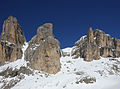 Sella group from the Lasties Valley
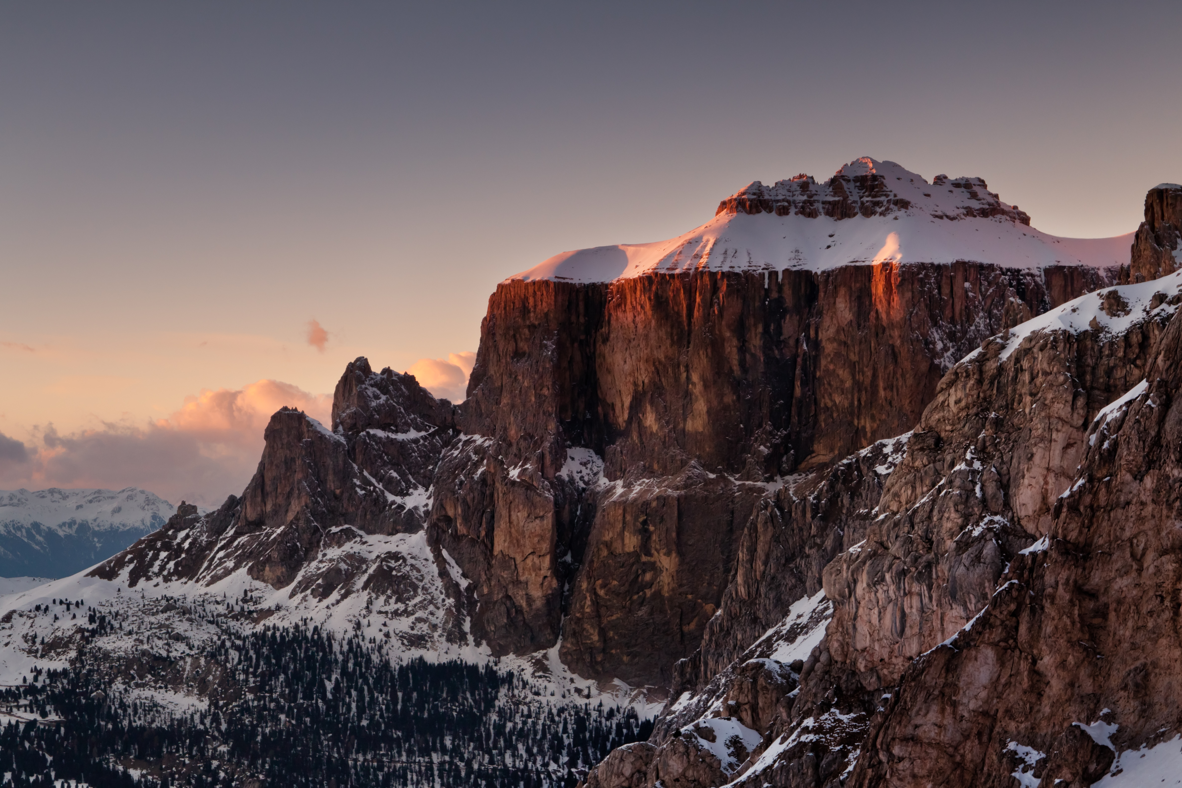
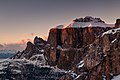 Sella group in the evening
 The Sella group seen from Sella Pass
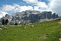 The Sella group seen from Val Gardena
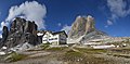 Pisciadùhütte (2587 m)


Maratona dles Dolomites
Each year the course of the annual single-day seven mountain passes crossing Maratona dles Dolomites Bicycle Race goes around the Sella group.
References
- "Wetterstation Piz Pisciadù". Monatswerte Temperaturen. Landeswetterdienst Südtirol. Retrieved 14 December 2020.
External links
| Wikimedia Commons has media related to Sella group. |
- 360-degree panorama of the Sella Group, Marmolada and Fedaia lake
- 360-degree panorama of the Sella Group from Cima Rocca
Authority control | |
|---|---|
| General |
|
| National libraries | |
This Trentino-Alto Adige/Südtirol location article is a stub. You can help Wikipedia by expanding it. |
This article on a location in Veneto is a stub. You can help Wikipedia by expanding it. |
На других языках
[de] Sellagruppe
Die Sellagruppe oder einfach Sella (ladinisch l Sela, italienisch il Sella) ist ein plateauförmiger Bergstock in den Dolomiten in Italien. Sie befindet sich zu Teilen in Südtirol, im Trentino und in Venetien. Höchster Gipfel der Gruppe ist der Piz Boè mit 3152 m s.l.m.- [en] Sella group
[fr] Groupe du Sella
Le groupe du Sella est un chaînon montagneux des Dolomites, situé entre les vallées Gardena et Badia (province autonome de Bolzano), Fassa (province autonome de Trente) et Livinallongo (province de Belluno), et caractérisé par un plateau situé à son sommet, d'où émerge son point culminant, le piz Boè (3 152 m)[1].[it] Gruppo del Sella
Il Gruppo del Sella (in tedesco Sellagruppe) è un gruppo montuoso[1] delle Dolomiti, posizionato tra le valli di Gardena e Badia (Provincia autonoma di Bolzano), Fassa (Provincia autonoma di Trento) e Livinallongo (Provincia di Belluno), e caratterizzato da un altopiano che si trova sulla sua sommità, dal quale emerge il suo punto più alto (Piz Boè, 3.152 m s.l.m.)[ru] Селла (горы)
Селла — горный массив в Доломитовых Альпах в северной Италии.Другой контент может иметь иную лицензию. Перед использованием материалов сайта WikiSort.org внимательно изучите правила лицензирования конкретных элементов наполнения сайта.
WikiSort.org - проект по пересортировке и дополнению контента Википедии