geo.wikisort.org - Mountains
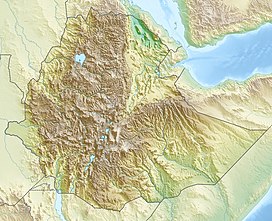
Ras Dashen (Amharic: ራስ ዳሸን rās dāshn), also known as Ras Dejen, is the highest mountain in Ethiopia and fourteenth highest peak in Africa. Located in the Simien Mountains National Park in the North Gondar Zone of the Amhara Region, it reaches an elevation of 4,550 metres (14,930 ft).[1]
| Ras Dashen | |
|---|---|
| ራስ ዳሸን | |
 The summit area viewed from the west summit | |
| Highest point | |
| Elevation | 4,620 m (15,160 ft)[1] |
| Prominence | 3,997 m (13,114 ft)[2] Ranked 23rd |
| Isolation | 1,483 km (921 mi) |
| Listing | Country high point Ultra |
| Coordinates | 13°14′09″N 38°22′15″E[2] |
| Geography | |
| Parent range | Simien Mountains |
The English form, "Ras Dashen" is a corruption of its Amharic name, "Ras Dejen", the term used by the Ethiopian Mapping Authority (EMA) which alludes to the traditional head or general who fights in front of the Emperor.[dubious ][3]
Overview
According to Erik Nilsson, Ras Dashen is the eastern peak of the rim of "an enormous volcano, the northern half of which is cut down about [a] thousand metres by numerous ravines, draining into the Takkazzi River." Its western counterpart is Mount Biuat (4,437 meters), separated by the valley of the Meshaha river.[3] The mountain often sees violent snowfalls during the night, but given that day and night temperatures vary greatly, the snow is almost completely melted in a few hours (during the hottest period of the year), for the temperature may be over 5 degrees Celsius by midday. In winter snow falls rarely, since the majority of Ethiopia's yearly rainfall is in the summer, but if it does it usually lasts for weeks or months.
The first recorded ascent by a European was in 1841, by French officers Ferret and Galinier. There is no verifiable evidence of earlier ascents by locals, but the summit climate and conditions are relatively hospitable, and there are nearby high altitude pastoral settlements. A small fort is still partially standing at around 4,300 metre SRTM data.[1]
References
- "Africa Ultra-Prominences" According to Peaklist.org: "There is a high-divergence of published elevations for Ras Dejen (also spelled Ras Deshen or Ras Dashen). An Italian military survey measured it at 4620m mi, a height that is still often quoted."Ras Dashen". Peakware.com. Archived from the original on 2016-03-04. A new elevation of 4,533m emerged from a 1970s triangulation survey.example: Peakbagger.comand Summitpost.org A subsequent Franco-Italian survey established a height of 4,550m."Peaklist footnote #2. See also Elevation misquotes. Retrieved 2012-09-02.
- "Africa Ultra-Prominences" Peaklist.org. Retrieved 2012-09-02.
- Erik Nilsson, "Traces of Ancient Changes of Climate in East Africa: Preliminary Report", Geografiska Annaler, 17 (1935), p. 13
External links
- Detailed trip report
- "Africa Ultra-Prominences" on Peaklist
- "Ras Dashen Terara, Ethiopia" on Peakbagger
- "Ras Dashen" on Summitpost
- "Ras Dashen". Peakware.com. Archived from the original on 2016-03-04.
- Elevation misquotes
- Simien Mountains National Park
На других языках
[de] Ras Daschän
Der Ras Daschän (amharisch ራስ ዳሸን Ras Dašän, englisch Ras Dashan, Ras Dejen) ist mit 4533 m[1] der höchste Berg von Äthiopien.- [en] Ras Dashen
[es] Monte Ras Dejen
El Ras Dejen, conocido también como Ras Dashen o Ras Dashan (en ge'ez ራስ ደጀን rās dejen), es una montaña ubicada en el sistema montañoso de las Simen en Etiopía. Con sus 4.553 msnm, constituye la cumbre más alta del país y la décima más alta de África. Forma parte del Parque nacional de Simen, desde su creación en 1969.[fr] Ras Dashan
Le Ras Dashan (ge'ez : ራስ ዳሸን (Ras Dashän)) est, avec 4 550 mètres d'altitude, le point culminant de l'Éthiopie et des monts Simien[2]. Il fait partie du parc national du Simien. Il est gravi pour la première fois par un Occidental en 1841 et son ascension ne présente aucune difficulté.[it] Ras Dascian
Il Ras Dascian (in amarico ራስ ደጀን, "Capo delle Guardie") è una montagna dell'Africa orientale e con i suoi 4549 metri di altezza [1] è la massima elevazione dell'Etiopia e la quarta in Africa, dopo il Kilimanjaro, il Monte Kenya e il Monte Stanley. Costituisce la ventitreesima cima più prominente del pianeta.[ru] Рас-Дашэн
Рас-Дашэ́н[2] (амх. ራስ ደጀን) — наивысшая гора Эфиопии и всего Эфиопского нагорья, расположенная на севере Эфиопского нагорья, недалеко от города Гондэр. Высота — 4533 м. Является частью национального парка Сымен.Другой контент может иметь иную лицензию. Перед использованием материалов сайта WikiSort.org внимательно изучите правила лицензирования конкретных элементов наполнения сайта.
WikiSort.org - проект по пересортировке и дополнению контента Википедии
