geo.wikisort.org - Mountains
Rakhiot Peak is a peak in the Himalayas range of the Gilgit-Baltistan, Pakistan. It is one of the many subsidiary summits of the Nanga Parbat massif.
| Rakhiot Peak | |
|---|---|
 Rakhiot Peak, slightly right of centre, seen from the north | |
| Highest point | |
| Elevation | 7,070 m (23,200 ft) |
| Prominence | 213 m (699 ft)[1] |
| Parent peak | Nanga Parbat I |
| Listing | List of mountains in Pakistan |
| Coordinates | 35°15′32″N 74°38′15″E[1] |
| Geography | |
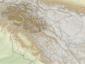 Rakhiot Peak Gilgit-Baltistan, Pakistan  Rakhiot Peak Rakhiot Peak (Pakistan) | |
| Parent range | Himalayas |
| Climbing | |
| First ascent | July 16, 1932 by Peter Aschenbrenner (Austria) and Herbert Kunigk (Germany)[2] |
Location
It lies just south of the Indus River in the Diamer District. Not far to the north is the western end of the Karakoram range.
Layout of the mountain
From the article: Nanga Parbat The core of Nanga Parbat is a long ridge trending southwest–northeast. The southwestern portion of this main ridge is known as the Mazeno Ridge, and has a number of subsidiary peaks. In the other direction from the summit, the main ridge starts as the East Ridge before turning more northeast at Rakhiot Peak (7,070 m), about 4 km northeast of the Nanga Parbat summit. The Silver Saddle (Silbersackel) is about halfway in-between Rakhiot Peak and Nanga Parbat summit. The south/southeast side of the mountain is dominated by the Rupal Face, often referred to as the highest mountain face in the world: it rises an incredible 4,600 m (15,100 feet) above its base. The north/northwest side of the mountain, leading to the Indus, is more complex. It is split into the Diamir (west) face and the Rakhiot (north) face by a long ridge. There are a number of subsidiary summits, including the North Peak (7,816 m) some 3 km north of the main summit.
See also
- Nanga Parbat
- Eight-thousander
- List of highest mountains on Earth
References
- "Rakhiot Peak-Nanga Parbat". Peakbagger.com. Retrieved 2020-04-30.
-
Kunigk, Herbert (1932). "The German-American Himalayan Expedition, 1932" (PDF). Alpine Journal. 5: 192–200. Retrieved 2020-04-30.
{{cite journal}}: CS1 maint: url-status (link)
External links
- "Rakhiot Peak". Peakware.com. Archived from the original on 2016-03-04.
- Nanga Parbat on summitpost.org
- BBC Story on Rescue of Tomaz Humar
- A mountain list ranked by local relief and steepness showing Nanga Parbat as the World #1
- Northern Pakistan detailed placemarks in Google Earth
This Pakistan location article is a stub. You can help Wikipedia by expanding it. |
На других языках
[de] Rakhiot Peak
Der Rakhiot Peak, als einer der Vorgipfel des Nanga Parbat, ist ein Berg im Himalaya in Pakistan mit einer Höhe von 7070 m. Er befindet sich am Ende des westlichen Himalayakammes im nördlichen, pakistanisch kontrollierten Teil von Kaschmir. Der Berg ist Teil des langen Ostgrat des Nanga Parbats und befindet sich etwa vier Kilometer südöstlich des Hauptgipfels. Der Höhenunterschied zum 25 km entfernten Industal (und Karakorum Highway) beträgt etwa 6000 m. Die gegen Süden abfallende Wand (Rupal-Flanke) des Berges ist 3500 m hoch. Der Berg besteht hauptsächlich aus Graniten und Gneisen. Klimatisch ist er in eine thermische Doppelzone eingebettet.- [en] Rakhiot Peak
[ru] Ракиот-Пик
Ракиот-Пик[уточнить] (англ. Rakhiot Peak) — вершина высотой 7070 метров над уровнем моря в Гималаях. Ракиот-Пик является одной из второстепенных вершин девятого по высоте восьмитысячника мира Нанга-Парбат.Другой контент может иметь иную лицензию. Перед использованием материалов сайта WikiSort.org внимательно изучите правила лицензирования конкретных элементов наполнения сайта.
WikiSort.org - проект по пересортировке и дополнению контента Википедии