geo.wikisort.org - Mountains
Ports de Tortosa-Beseit (Catalan pronunciation: [ˈpɔɾdz ðə tuɾˈtozə βəˈzejt]), also known as Ports de Beseit, or simply as Els Ports [əls ˈpɔɾts] or Lo Port [lu ˈpɔɾt] by locals, is a limestone mountain massif located at the north-eastern end of the Sistema Ibérico, a complex system of mountain ranges and massifs in the centre of the Iberian Peninsula. Its highest point is Mont Caro, 1,441 m.[1] Rivers such as the Matarranya and the Sénia have their source in these mountains.
| Ports de Tortosa-Beseit | |
|---|---|
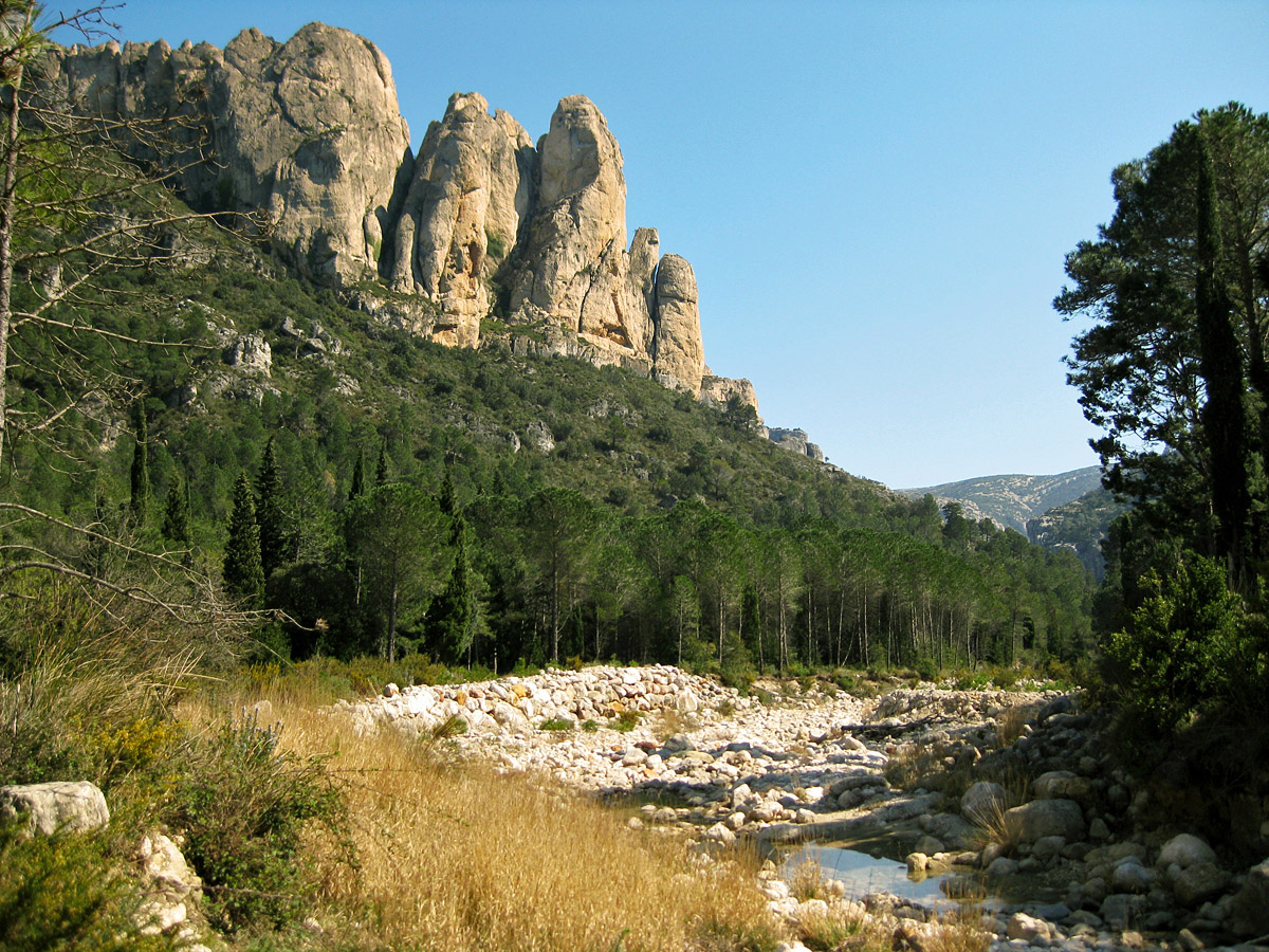
 Rocky outcrops at els Ports | |
| Highest point | |
| Peak | Mont Caro |
| Elevation | 1,441 m (4,728 ft) |
| Listing | List of mountains in Aragon |
| Coordinates | 40°48′28″N 0°19′07″E |
| Geography | |
 Ports de Tortosa-Beseit Location in Spain | |
| Country | Spain |
| Communities | Aragon, Catalonia and Valencia |
| Comarca | Matarranya, Baix Ebre, Montsià and Baix Maestrat |
| Parent range | Iberian System, eastern zone |
| Geology | |
| Orogeny | Alpine orogeny |
| Age of rock | Cretaceous |
| Type of rock | Karstic |
| Climbing | |
| Easiest route | Drive from Roquetes on the western side or from Beseit on the eastern |

Description
At the 1350 m high Tossal dels Tres Reis (Peak of the Three Kings), where the borders of the ancient Kingdoms of Valencia, Catalonia and Aragon meet, there is a cairn marking the meeting point of the ancient three kingdoms of the Crown of Aragon.
It is mostly a limestone massif, with many steep cliffs, jagged peaks, deep valleys, shafts and caves. The area is mostly uninhabited except for small villages. These mountains were one of the last redoubts of the Spanish Maquis in the 1940s and 50s.[2]
Ecology
One of the largest colonies of griffon vultures in Europe, as well as Spanish Ibex, Roe Deer, Wild Boar, European badgers, common genets, grey wagtails, among others, have their habitat in these lonely mountains.[3] Among the aquatic animals there are trout in some of the rivers and amphibians such as the Marbled newt in many of the ponds of the range.[4]
The vegetation of the Ports is rich and varied. Besides the Mediterranean species, there are also species belonging to Alpine flora and colder temperate regions at high altitudes and in protected valleys.[5]
Mountain ranges
The Ports Massif comprises several mountain ranges, like the Muntanyes de Benifassà, Serra de les Falconeres, Serra del Àguila, Serra de Rastell, Los Curullons, Moles de Raudorar, Serra de la Fortalesa, Serra de Caro, Serra de la Puca, Serra de Rafalgari, Serra de Paüls, Serra de les Deveres, Serra de l'Escaleta, Serra d'Encanader, Serra del Pedregal, Serra del Coc and Serra de l'Espina.[6] The latter, located at its northern end, connects with the Catalan Pre-Coastal Range.
Peaks
Some of the main peaks of the massif are: Mont Caro (1441 m), the highest point, Castell de l'Airosa, Tossal d'en Cervera, Mola del Boix, Mola del Boixet, el Castellar, la Portella del Pinell, Curullons, el Negrell, Punta de l'Àliga, Farrubio, Penyaflor, Mola de Catí, Tossal dels Tres Reis, Tossa Blanca, Roques de Benet, Penyagalera, Mola de Lli, Tossal de Tall Nou, Tossal de l'Espada, la Ballestera, Mola de la Paridera, Muntanyola, La Tossa, Mola Castellona, Tossal de Joan Gran, Tossal de la Forca, Tossal d'en Grillo, Muntanya de Santa Bàrbara, L'Espina and La Moleta d'Alfara.
Protected areas
There are two natural parks in the massif; there is no protected area on the Aragonese side:
- Parc Natural dels Ports on the Catalan side
- Parc Natural de la Tinença de Benifassà on the Valencian side.
See also
- Beseit
- Matarraña/Matarranya
- Tinença de Benifassà
- List of mountains in Aragon
- List of mountains in the Valencian Community
- List of mountains in Catalonia
Features
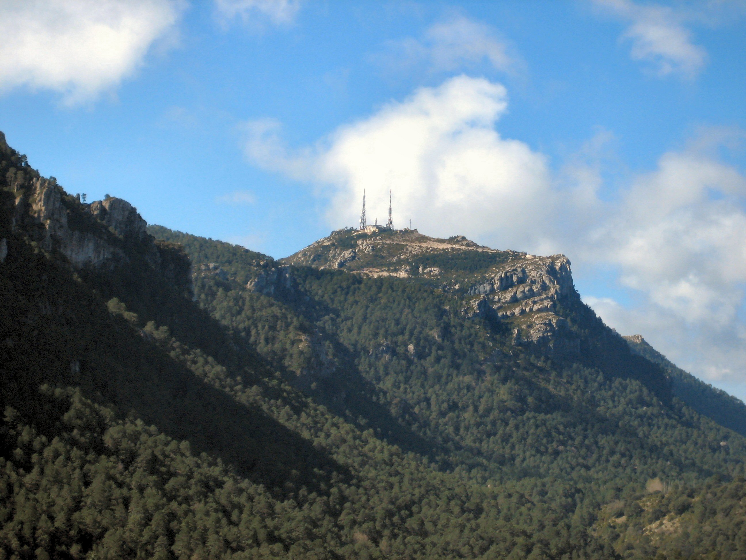
 Mont Caro, the Ports' highest point
 Beech forest in the National Park area
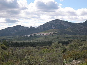 Mas de Barberans, a town located at the feet of the eastern edge of the Ports
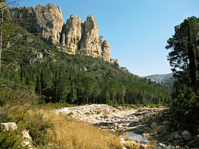 A mountain river at La Vall in the Mas de Barberans administrative area
 Ulldemó River close to Beseit on the western edge of the Ports
 Spanish Ibex at Ports de Tortosa Beseit
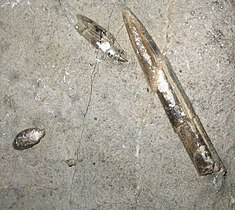 Belemnites fossils from Les Foies, in the Serra de l'Espina close to Alfara de Carles
 Ulldecona Reservoir in the Tinença de Benifassà


References
- "Mapa Topogràfic de Catalunya". Institut Cartogràfic de Catalunya. Retrieved 9 September 2010..
- Jose Calvo Segarra, La pastora. Del monte al mito, ed. by Odette Calvo
- Walking In Spain
- Comarca del Matarraña - Biblioteca Virtual de Aragón
- Plantes del Port, Grup de Recerca Científica 'Terres de l'Ebre', Tortosa 2009
- Ports de Beseit
External links
- Turisme a les Terres de l'Ebre
- Parc Natural dels Ports
- Lo Port
- Walking trails through the natural park of Tinença de Benifassa
На других языках
[de] Ports de Tortosa-Beseit
Die Ports de Tortosa-Beseit (Katalanisch auch Ports de Tortosa, Ports de Beseit oder einfach Els Ports; Aragonesisch Puertos de Bezeit; Spanisch Puertos de Tortosa-Beceite) sind ein Bergmassiv im äußersten Osten des Iberischen Gebirges in den Provinzen Castellón, Tarragona und Teruel und bilden den Übergang zur Serralada Prelitoral Catalana, den Katalanischen Küstenbergen.- [en] Ports de Tortosa-Beseit
[es] Puertos de Tortosa-Beceite
Los puertos de Tortosa-Beceite (en catalán: Ports de Tortosa, Ports de Beseit, o simplemente Els Ports) es un macizo montañoso situado a caballo entre las provincias de Tarragona (Cataluña), Teruel (Aragón), y Castellón (Comunidad Valenciana), que constituye el punto de encuentro de la Cordillera Prelitoral catalana con el Sistema Ibérico.[fr] Ports de Tortosa-Beseit
Les Ports de Tortosa-Beseit, connus aussi comme Els Ports, sont un massif montagneux situé à l'extrémité orientale du Système ibérique qui constitue une zone de transition avec la cordillère prélittorale catalane.[ru] Портс-де-Тортоза-Безейт
Портс-де-Тортоза-Безейт (каталонское произношение: [ˈpɔɾdz ðə tuɾˈtozə βəˈzejt]), также известна как Порта-Де-Бесеит (Ports de Beseit), или просто как Элс Портс (Els Ports) или Ло Порт (местное название) — известняковый горный массив, расположенный на северо-восточной оконечности Иберийской горной системы, сложная система горных хребтов и массивов в центральной части Пиренейского полуострова. Самая высокая точка гора Монт-Кару[en] высотой 1447 м[2]. В горах массива находится исток рек Матаррания[en] и Сения[en].Другой контент может иметь иную лицензию. Перед использованием материалов сайта WikiSort.org внимательно изучите правила лицензирования конкретных элементов наполнения сайта.
WikiSort.org - проект по пересортировке и дополнению контента Википедии