geo.wikisort.org - Mountains
Pleasant Peak is a location on the Falkland Islands, East Falkland, two miles (3.2 km) north of RAF Mount Pleasant.[1]
| Pleasant Peak | |
|---|---|
 The memorial on Pleasant Peak | |
| Highest point | |
| Elevation | 230 m (750 ft) |
| Coordinates | 51°46′55.85″S 58°28′22.13″W |
| Geography | |
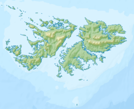 Pleasant Peak East Falkland, Falkland Islands, south Atlantic Ocean | |
History

The mountain was the site of the 1982 British Army Gazelle friendly fire incident when HMS Cardiff shot down a British Army Gazelle helicopter, killing its four occupants.[2]
When the adjacent Mount Pleasant Complex was being constructed in the aftermath of the Falkland conflict, a quarry was opened up on the lower slopes of Pleasant Peak to supply hard rock (quartzite) for the construction of the foundations and a base for the runway.[3]
References
- "View from Pleasant Peak - Falkland Islands". www.british-towns.net. Retrieved 3 May 2008.
- Ranter, Harro. "Westland Gazelle AH1 XX377 accident, 6 Jun 1982". aviation-safety.net. Retrieved 24 September 2017.
- Aldis, E. T.; Edwards, D. J. (1999). "The Geology of the Falkland Islands" (PDF). nerc.ac.uk. British Geological Survey. p. 208. Retrieved 24 September 2017.
Capital: Port Stanley | |||||||
| History |
| ||||||
| Geography |
| ||||||
| Military |
| ||||||
| Politics |
| ||||||
| Economy |
| ||||||
| Society |
| ||||||
(*) Sixth-formers attend Peter Symonds College in England and national diploma/NVQ students attend Chichester College in England | |||||||
This Falkland Islands location article is a stub. You can help Wikipedia by expanding it. |
На других языках
- [en] Pleasant Peak
[fr] Pleasant Peak
Pleasant Peak est un pic rocheux situé sur l'île de la Malouine orientale, la deuxième plus grande île des îles Malouines. La base militaire RAF Mount Pleasant est située à 3 km au sud.Текст в блоке "Читать" взят с сайта "Википедия" и доступен по лицензии Creative Commons Attribution-ShareAlike; в отдельных случаях могут действовать дополнительные условия.
Другой контент может иметь иную лицензию. Перед использованием материалов сайта WikiSort.org внимательно изучите правила лицензирования конкретных элементов наполнения сайта.
Другой контент может иметь иную лицензию. Перед использованием материалов сайта WikiSort.org внимательно изучите правила лицензирования конкретных элементов наполнения сайта.
2019-2026
WikiSort.org - проект по пересортировке и дополнению контента Википедии
WikiSort.org - проект по пересортировке и дополнению контента Википедии