geo.wikisort.org - Mountains
Owen Stanley Range is the south-eastern part of the central mountain-chain in Papua New Guinea. Its highest point is Mount Victoria at 4,038 metres (13,248 ft), while its most prominent peak is Mount Suckling.
| Owen Stanley Range | |
|---|---|
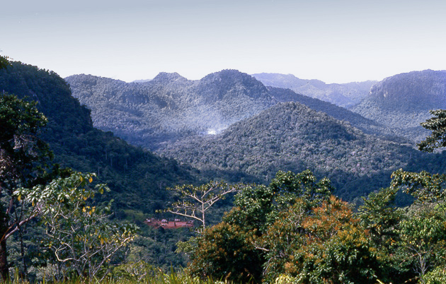 View from Owers Corner. The Kokoda Track crosses here. | |
| Highest point | |
| Peak | Mount Victoria |
| Elevation | 4,038 m (13,248 ft) |
| Coordinates | 8°50′S 147°30′E |
| Geography | |
 | |
| Country | Papua New Guinea |
| Provinces | Central and Northern |
| Range coordinates | 9°20′S 148°00′E |
History
Owen Stanley Range was seen in 1849 by Captain Owen Stanley while surveying the south coast of Papua and named after him. The eastern extremity of the range is Mount Victoria, which was climbed by Sir William MacGregor in 1888, and it extends as far west as Mount Thynne and Lilley. But the name is generally used to denote the whole of the chain of the Papuan Peninsula, from Mount Chapman 3,376 metres (11,076 ft) to the south-eastern end of the island, and to include Mount Albert Edward 3,990 m (13,091 ft) which is really separated from it by the Wharton Chain.
Geography
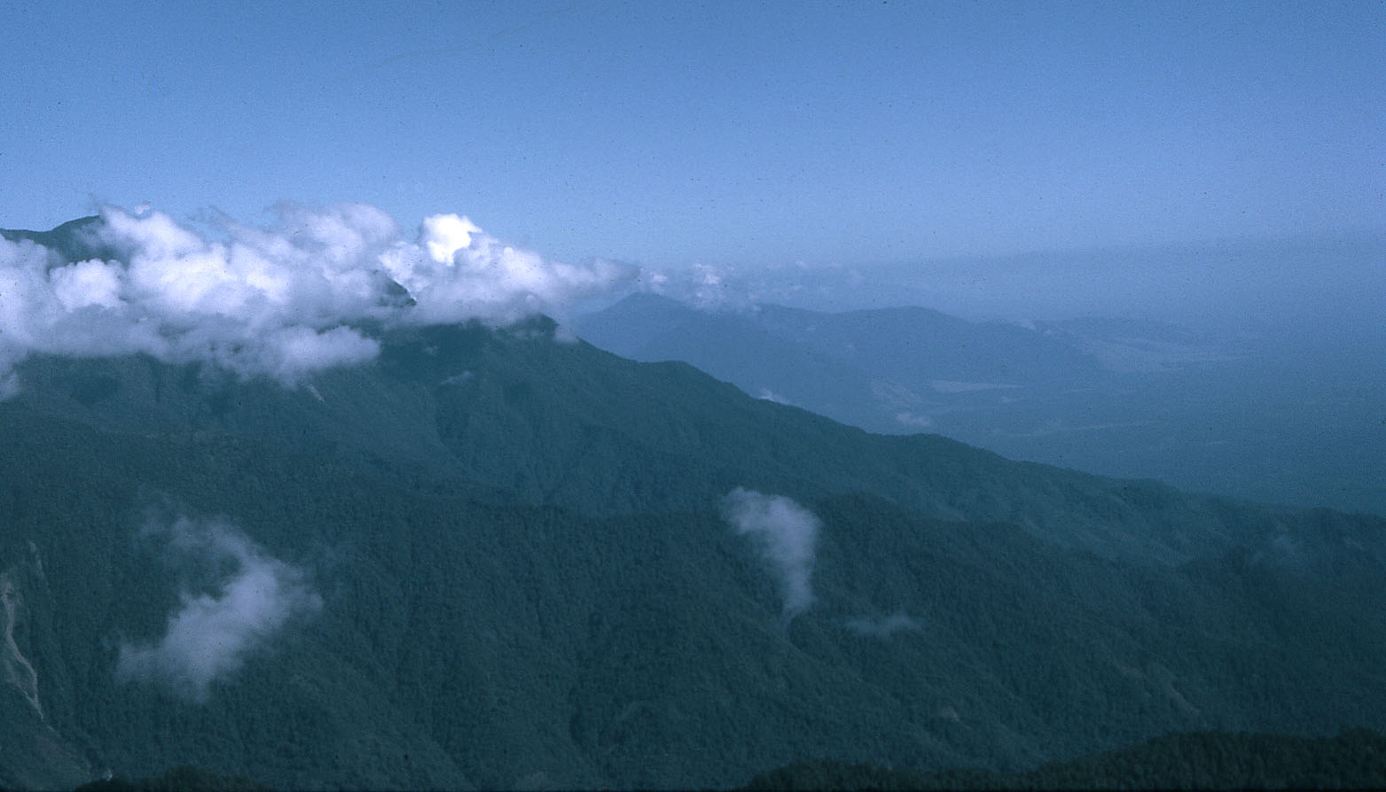
The range is flanked by broken and difficult country, particularly on the south-western side. There are few practicable passes, the easiest being the famous Kokoda Track which crosses the range between Port Moresby and Buna and was in use for more than 50 years as a regular overland mail-route. Another route used by the 900 men of the US 2nd Battalion, 126th Infantry Regiment, 32nd Division, was the Kapa Kapa Trail, parallel to but 30 miles (48 km) to the southeast of the Kokoda Track. They took nearly five weeks to cover the 130 miles (210 km) track over extraordinarily difficult jungle terrain, from 14 October to 20 November 1942.
Immense ridges, or "razorbacks," followed each other in succession like the teeth of a saw. As a rule, the only way the troops could get up these ridges, which were steeper than along the Kokoda Trail, was either on hands and knees, or by cutting steps into them with ax and machete. To rest, the men simply leaned forward, holding on to vines and roots in order to keep themselves from slipping down the mountainside.[1]
Vehicular roads, though not impossible, would be very difficult and expensive to construct. In fact one was constructed during World War II crossing from Wau in the north to Bulldog in the south and known as the Bulldog Track. It was largely due to the impossibility of transporting heavy equipment across the range that the Japanese failed to secure Port Moresby as a base early in 1942. The mountains are rough and precipitous, with occasional fertile plateaux which are occupied by native food-gardens.
Eponyms
Two species of reptiles are named after Owen Stanley Range, Papuascincus stanleyanus and Toxicocalamus stanleyanus.[2]
See also
- Australian Encyclopaedia. Vol. 6, p. 430. Grolier.
- Owen Stanley Range languages
References
- Samuel Milner (1957). Victory in Papua. United States Army in World War II, The War in the Pacific. United States Army Center of Military History. Retrieved 2008-11-15.
- Beolens, Bo; Watkins, Michael; Grayson, Michael (2011). The Eponym Dictionary of Reptiles. Baltimore: Johns Hopkins University Press. xiii + 296 pp. ISBN 978-1-4214-0135-5. ("Stanley", p. 251).
На других языках
[de] Owen-Stanley-Gebirge
Das Owen-Stanley-Gebirge ist der südöstliche Teil des Bismarckgebirges in Papua-Neuguinea, nahe der Hauptstadt Port Moresby auf der Insel Neuguinea. Die höchste Erhebung ist der Mount Victoria mit 4038 Metern.[1]- [en] Owen Stanley Range
[fr] Chaîne Owen Stanley
La chaîne Owen Stanley est située dans la partie sud-est de la chaîne de montagne qui traverse la Papouasie-Nouvelle-Guinée. Elle a été repérée en 1849 par le capitaine Owen Stanley alors qu'il cadastrait la côte sud de la Papouasie et elle porte son nom. L'extrémité est de la chaîne est occupée par le mont Victoria (4 072 mètres) qui a été gravi pour la première fois par Sir William Macgregor en 1888, et elle s'étend à l'ouest jusqu'aux monts Thynne et Lilley. Mais le nom est généralement utilisé pour désigner l'ensemble de la chaîne depuis le mont Chapman (3 376 mètres) à l'extrémité sud-est de l'île et qui comprend le mont Albert Edward (3 990 m) qui en est séparé par la chaîne Wharton.[it] Monti Owen Stanley
La Owen Stanley, in inglese Owen Stanley Range) è una catena montuosa della Papua Nuova Guinea. Questa è la parte sudest della catena montuosa centrale del paese, scoperta nel 1849 dal capitano Owen Stanley durante la sua esplorazione della costa sud dell'isola. Il suo punto più alto è il monte Victoria, scalato nel 1888 da sir William Macgregor.[ru] Оуэн-Стэнли (хребет)
Оуэн-Стэнли (англ. Owen Stanley Range) — горный хребет, расположенный в юго-восточной части острова Новая Гвинея, на территории современного государства Папуа — Новая Гвинея. Административно находится на территории Центральной и Северной провинции страны.Другой контент может иметь иную лицензию. Перед использованием материалов сайта WikiSort.org внимательно изучите правила лицензирования конкретных элементов наполнения сайта.
WikiSort.org - проект по пересортировке и дополнению контента Википедии