geo.wikisort.org - Mountains
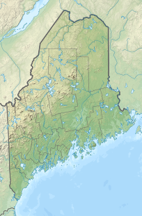
Moxie Mountain is a mountain located in Somerset County, Maine.[3]
| Moxie Mountain | |
|---|---|
 Moxie Mountain Somerset County, Maine, U.S. | |
| Highest point | |
| Elevation | 2,936 ft (895 m)[1] |
| Prominence | 1,813 ft (553 m)[2] |
| Listing | 50 New England Fifty Finest |
| Coordinates | 45°12′25″N 69°53′38″W |
| Geography | |
| Location | Somerset County, Maine, U.S. |
| Topo map | USGS Caratunk |
Moxie Mountain stands within the watershed of the Kennebec River, which drains into the Gulf of Maine. The northeast side of Moxie Mtn. drains into Big and Little Dimmick Ponds, then into Baker Pond, Moxie Pond, Moxie Stream, and into the Kennebec River. The north side of Moxie drains into Pleasant Pond, then into Pleasant Pond Stream, and into the Kennebec River. The west side of Moxie drains into Robinson Pond Outlet, then into Pleasant Pond Stream. The south side of Moxie drains into Heald Stream, then into Austin Stream and the Kennebec River.
The Appalachian Trail, a 2,170-mile (3,500-km) National Scenic Trail from Georgia to Maine, runs a few miles north of Moxie, across the summit of Pleasant Pond Mountain.
References
- U.S. Geological Survey Geographic Names Information System: Moxie Mountain
- "Moxie Mountain, Maine". Peakbagger.com. Retrieved 2012-05-06.
- "Moxie Mountain". Summitpost.org. Retrieved 2012-05-06.
See also
- List of mountains in Maine
- New England Fifty Finest
Другой контент может иметь иную лицензию. Перед использованием материалов сайта WikiSort.org внимательно изучите правила лицензирования конкретных элементов наполнения сайта.
WikiSort.org - проект по пересортировке и дополнению контента Википедии