geo.wikisort.org - Mountains
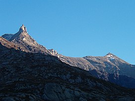
Mont d'Ambin (in French) or Rocca d'Ambin (in Italian) is a mountain on the border of Savoie, France and of the Province of Turin, Italy. It lies in the Ambin group of the Cottian Alps. On the Italian side, it commands the view of the Val di Susa. It has an elevation of 3,378 metres (11,083 ft) above sea level. The Mont d'Ambin base tunnel of the Lyon–Turin rail link is being dug at its base.
| Mont d'Ambin | |
|---|---|
| Italian: Rocca d'Ambin | |
 Mont d'Ambin (right) | |
| Highest point | |
| Elevation | 3,378 m (11,083 ft)[1] |
| Prominence | 506 m (1,660 ft)[2] |
| Parent peak | Rognosa d'Etiache |
| Isolation | 4.55 km (2.83 mi) |
| Listing | Alpine mountains above 3000 m |
| Coordinates | 45°09′25″N 06°53′03″E |
| Geography | |
 Mont d'Ambin Location in the Alps | |
| Location | Savoie, France Province of Turin, Italy |
| Parent range | Cottian Alps |
Maps
- Italian official cartography (Istituto Geografico Militare – IGM); on-line version: www.pcn.minambiente.it
- French official cartography (Institut Géographique National – IGN); on-line version: www.geoportail.fr
- Istituto Geografico Centrale – Carta dei sentieri e dei rifugi scala 1:50.000 n. 1 Valli di Susa Chisone e Germanasca e 1:25.000 n. 104 Bardonecchia Monte Thabor Sauze d'Oulx
References
- Geoportale IGM on www.pcn.minambiente.it
- key col: Colle d'Ambin(2,872 m)
На других языках
- [en] Mont d'Ambin
[fr] Mont d'Ambin
Le mont d'Ambin est une montagne de 3 378 mètres d'altitude dans les Alpes à la frontière entre la France et l'Italie.[it] Rocca d'Ambin
La Rocca d'Ambin (3378 m[1] è la seconda vetta più alta del Gruppo d'Ambin (dopo la Rognosa d'Etiache), situato sul confine tra l'Italia e la Francia appena a sud del colle del Moncenisio.Текст в блоке "Читать" взят с сайта "Википедия" и доступен по лицензии Creative Commons Attribution-ShareAlike; в отдельных случаях могут действовать дополнительные условия.
Другой контент может иметь иную лицензию. Перед использованием материалов сайта WikiSort.org внимательно изучите правила лицензирования конкретных элементов наполнения сайта.
Другой контент может иметь иную лицензию. Перед использованием материалов сайта WikiSort.org внимательно изучите правила лицензирования конкретных элементов наполнения сайта.
2019-2025
WikiSort.org - проект по пересортировке и дополнению контента Википедии
WikiSort.org - проект по пересортировке и дополнению контента Википедии