geo.wikisort.org - Mountains
The Ambin group (Groupe d'Ambin in French, Gruppo d'Ambin in Italian) is a sub-range of the Cottian Alps located on the French-Italian border.
| Ambin group | |
|---|---|
| Gruppo d'Ambin / Groupe d'Ambin | |
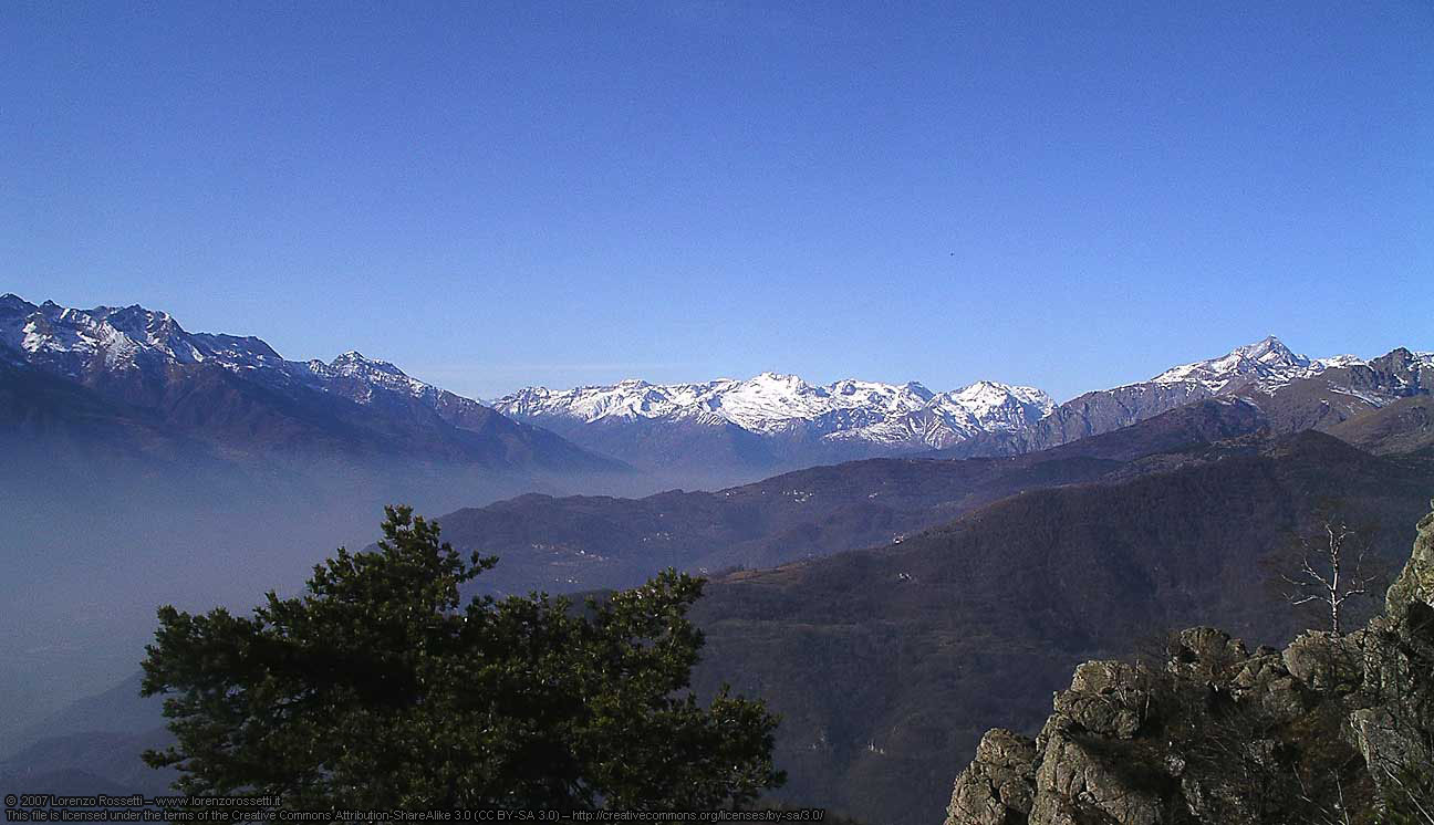 Ambin group seen from Roccasella | |
| Highest point | |
| Peak | Rognosa d'Etiache |
| Elevation | 3,382 m (11,096 ft) |
| Coordinates | 45°08′07″N 6°50′06″E |
| Geography | |
| Countries | Italy and France |
| Regione, Région | Piedmont and Rhône-Alpes |
| Provincia, Département | Turin and Savoie |
| Parent range | Cottian Alps |
Geography
Administratively the range is divided between the Italian provincia di Torino (southern slopes) and the French département de la Savoie (northern slopes).
Borders
The borders of Ambin group are (clockwise):
- Etiache pass (west, it connects Ambin group with Pierre Menue group);
- ruisseau d'Etache, ruisseau d'Ambin, Arc and ruisseau de la Fémaz (north);
- Mont Cenis pass (east, it connects Ambin group with the Graian Alps);
- torrente Rochemolles, Dora Riparia and Cenischia (south).
Notable summits

| Name | metres | Name | metres |
|---|---|---|---|
| Punta Sommeiller | 3,333 | Rognosa d'Etiache | 3,382 |
| Mont d'Ambin | 3,378 | Dents d'Ambin | 3,372 |
| Monte Niblè | 3,365 | Punta Ferrand | 3,348 |
| Mont Giusalet | 3,313 | Cima del Vallonetto | 3,217 |
| Signal du Petit Mont Cenis | 3,162 | Punta Galambra | 3,122 |
| Gros Peyron | 3,047 | Monte Seguret | 2,962 |
| Mont Malamot | 2,917 | Monte Jafferau | 2,805 |
| La Pointe du Notaire | 3,269 | Le Petit Vallon | 3,236 |
| Pointe de Bellecombe | 2,755 | Mont Froid | 2,822 |
Mountain huts

- Rifugio Levi Molinari (1,850 m - Exilles)
- Refuge de Bramanette (2,080 m - Bramans)
- Refuge du Petit Mont-Cenis (2,110 m - Bramans)
- Rifugio Scarfiotti (2,165 m - Bardonecchia)
- Refuge d'Ambin (2,270 m - Bramans)
- Rifugio Avanzà (2,578 m - Venaus)
- Rifugio Piero Vacca (2,670 m - Venaus)
- Rifugio Luigi Vaccarone (2,747 m - Giaglione)
- Bivacco Sigot (2,921 m - Exilles)
- Bivacco Walter Blais (2,925 m - Exilles)
Bibliography
- Aruga, Roberto; Pietro Losana; Alberto Re (1985). Alpi Cozie settentrionali. Guida ai monti d'Italia (in Italian). Club Alpino Italiano.
Maps
- Italian official cartography (Istituto Geografico Militare - IGM); on-line version: www.pcn.minambiente.it
- French official cartography (Institut Géographique National - IGN); on-line version: www.geoportail.fr
- I.G.C. (Istituto Geografico Centrale) - Carta dei sentieri e dei rifugi scala 1:50.000 n. 1 Valli di Susa Chisone e Germanasca e 1:25.000 n. 104 Bardonecchia Monte Thabor Sauze d'Oulx
References
На других языках
- [en] Ambin group
[it] Gruppo d'Ambin
Il Gruppo d'Ambin è un massiccio montuoso situato lungo la linea di confine tra Italia e Francia, appartenente alle Alpi del Moncenisio (Alpi Cozie).Текст в блоке "Читать" взят с сайта "Википедия" и доступен по лицензии Creative Commons Attribution-ShareAlike; в отдельных случаях могут действовать дополнительные условия.
Другой контент может иметь иную лицензию. Перед использованием материалов сайта WikiSort.org внимательно изучите правила лицензирования конкретных элементов наполнения сайта.
Другой контент может иметь иную лицензию. Перед использованием материалов сайта WikiSort.org внимательно изучите правила лицензирования конкретных элементов наполнения сайта.
2019-2026
WikiSort.org - проект по пересортировке и дополнению контента Википедии
WikiSort.org - проект по пересортировке и дополнению контента Википедии