geo.wikisort.org - Mountains
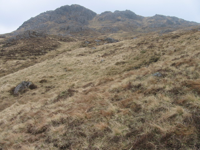
Meall an Fhudair (764 m) is a mountain in the Grampian Mountains, Scotland. It lies immediately north of the Arrochar Alps, near to the small village of Inverarnan.
| Meall an Fhudair | |
|---|---|
 Meall an Fhudair | |
| Highest point | |
| Elevation | 764 m (2,507 ft)[1] |
| Prominence | 382 m (1,253 ft) |
| Listing | Corbett, Marilyn |
| Coordinates | 56°20′02″N 4°47′56″W |
| Geography | |
| Location | Argyll and Bute, Scotland |
| Parent range | Grampian Mountains |
| OS grid | NN270192 |
| Topo map | OS Landranger 50, 56 |
A sprawling and wild mountain, it offers fine views from its summit. Walks usually start from the main A82 road just to the east.[2]
References
- "Meall an Fhudair". hill-bagging.co.uk. Retrieved 21 May 2019.
- "walkhighlands Meall an Fhudair". walkhighlands.co.uk. Retrieved 21 May 2019.
This Scottish location article is a stub. You can help Wikipedia by expanding it. |
Текст в блоке "Читать" взят с сайта "Википедия" и доступен по лицензии Creative Commons Attribution-ShareAlike; в отдельных случаях могут действовать дополнительные условия.
Другой контент может иметь иную лицензию. Перед использованием материалов сайта WikiSort.org внимательно изучите правила лицензирования конкретных элементов наполнения сайта.
Другой контент может иметь иную лицензию. Перед использованием материалов сайта WikiSort.org внимательно изучите правила лицензирования конкретных элементов наполнения сайта.
2019-2026
WikiSort.org - проект по пересортировке и дополнению контента Википедии
WikiSort.org - проект по пересортировке и дополнению контента Википедии