geo.wikisort.org - Mountains
Lewesdon Hill is a hill in west Dorset, England. With a maximum elevation of 279 m (915 ft), it is the highest point in Dorset.[1][2]
| Lewesdon Hill | |
|---|---|
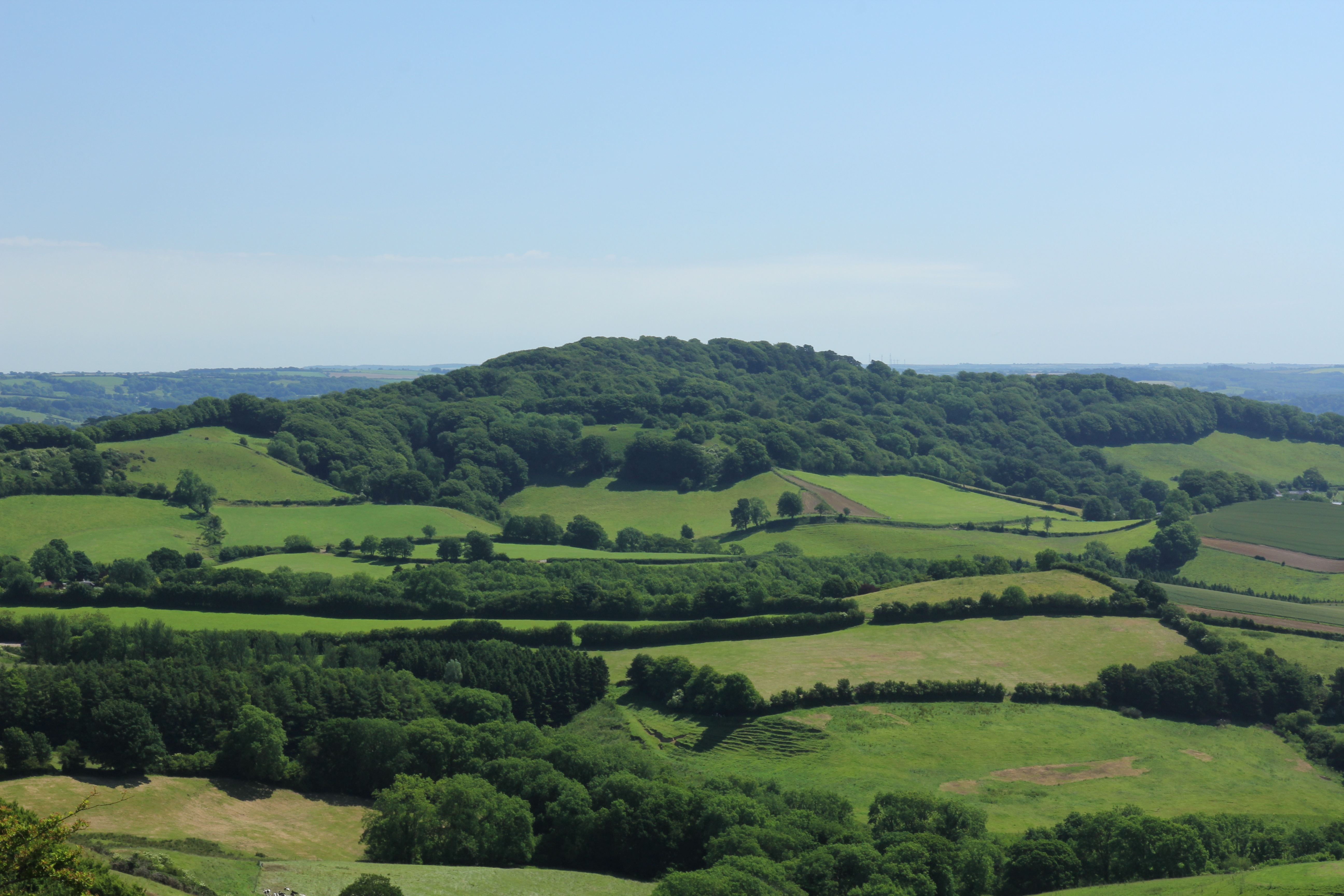 Lewesdon Hill from the west | |
| Highest point | |
| Elevation | 279 m (915 ft)[1] |
| Prominence | 185 m (607 ft) |
| Parent peak | Staple Hill |
| Listing | Marilyn, Hardy, County Top |
| Coordinates | 50°48′28″N 2°47′59″W |
| Geography | |
 Lewesdon Hill Lewesdon Hill in Dorset | |
| Location | Dorset, England |
| OS grid | ST437011 |
| Topo map | OS Landranger 193 Explorer 116 |
| Climbing | |
| Easiest route | From Beaminster on the Wessex Ridgeway |
Geography
Location
Lewesdon Hill stands about 4 km west of Beaminster, 1½ km south of Broadwindsor, 2 miles south of Mosterton, 1½ km west-northwest of Stoke Abbott and 3 km east of another hillfort-topped eminence, Pilsdon Pen. To the south of the hill is the Marshwood Vale and to the north is the valley of the River Axe.
Summit
Lewesdon is the county top of Dorset.[1] Its summit is an elongated ridge surrounded by beech woods. The actual summit is a low grassy mound at the east end of the ridge.[3] For many years, nearby Pilsdon Pen (277 m) was thought to be Dorset's highest hill, until modern survey revealed that Lewesdon Hill was 2 metres higher.[2] Dorset's third highest point is Bulbarrow Hill (274 m). Lewesdon's topographic prominence of 185 metres qualifies it as a Marilyn.[3]
Geology
The hill is formed from upper greensand which is more resistant to erosion than the surrounding clay.
History
Like many of the high hills in Dorset, including its neighbour Pilsdon Pen, it is the site of an Iron Age hillfort. Parts of the original bank and ditch are still visible although they have been disturbed by gravel quarrying and timber removal.[4] The remains of the hillfort are a scheduled monument.[5]
Lewesdon was also the site of one of the Armada Beacons in 1588 used to warn of impending attack by Spain.[4]
Access
It is a National Trust property.[6] There are two main footpaths leading up to the summit, one from the village of Broadwindsor, and one from Coombe Lane (off the B3162 between Broadwindsor and Bridport, just before the Four Ash crossroads). The Coombe Lane footpath leads to the hill via another, smaller hill, Crabb's Hill, which is privately owned. The east–west footpath is part of the Wessex Ridgeway.[7]
References
- Bathurst, David (2012). Walking the county high points of England. Chichester: Summersdale. pp. 119–125. ISBN 978-1-84-953239-6.
- Muir, Johnny, The UK's County Tops, Milnthorpe: Cicerone, 2011, p. 26. ISBN 978-1-85284-629-9
- Lewesdon Hill at www.hill-bagging.co.uk. Retrieved 18 Jun 2017.
- Lewesdon Hill[permanent dead link] at www.dorsetforyou.gov.uk. Retrieved 18 June 2017
- Historic England. "Lewesdon hillfort, 525m north east of Brimbley Coombe Farm, Broadwindsor (1017034)". National Heritage List for England. Retrieved 1 December 2021.
- "Lewesdon Hill". National Trust. Retrieved 28 February 2022.
- OS Landranger 193, 1:50,000 series.
Gallery
 Lewesdon Hill from the south
 View of Lewesdon Hill from Leweston Farm in 1963


Другой контент может иметь иную лицензию. Перед использованием материалов сайта WikiSort.org внимательно изучите правила лицензирования конкретных элементов наполнения сайта.
WikiSort.org - проект по пересортировке и дополнению контента Википедии