geo.wikisort.org - Mountains
The Kapenda Caldera (also known as the Kapenda Volcanic Centre) in New Zealands Taupō Volcanic Zone lies in a low land area immediately south of Lake Rotorua through the Hemo Gap in the Rotorua Caldera rim.
| Kapenga Caldera | |
|---|---|
| Kapenda Volcanic Centre | |
 The Kapenga Caldera is to the south of the Rotorua Caldera and to the south-east of the Ōkataina Caldera (thick white border). Relationships to other nearby volcanic and tectonic structures is also shown. | |
| Highest point | |
| Coordinates | 38°16′S 176°16′E |
| Geography | |
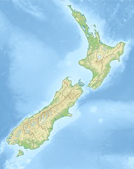
 Kapenga Caldera Kapenga Caldera (North Island) | |
| Country | New Zealand |
| Region | Waikato |
| Geology | |
| Age of rock | approximately 890,000 years |
| Mountain type | Caldera |
| Volcanic region | Taupō Volcanic Zone |
| Last eruption | 270,000 years ago |
| Climbing | |
| Access | State Highway 5 (New Zealand) |
Geography
The Kapenga Caldera has a western boundary defined by the Horohoro cliffs and an eastern boundary by volcanic domes, including those in the Ōkareka Embayment with some buried by the younger activity of the Ōkataina Volcanic Centre. Its southern boundary of volcanic activity is ill defined but does not extend to areas of continuing low residual gravity abnormality in the Paeroa Garben.
Geology
The Kapenda Caldera, just south of the Rotorua Caldera and between this and the Maroa Caldera, is believed to have been buried by subsequent eruptions including those of the Tarawera volcanic complex. Problematically to date no definite assignment of the up to seven ignimbrites attributed to it can be related to a definite caldera-forming event or documented collapse.[1] The boundary between the Kapenda Caldera and the Ōkataina Caldera is debated which particularly affects more recent Earthquake Flat activity. The Kapenda Caldera occupies the northern part of the Paeroa Garben between the uplift caused by the now fairly inactive Horohoro Fault and the uplift associated with the still very active Paeroa Fault. It contains the Ngakuru Graben. A large number of intra-rift faults called the Taupo Fault Belt and associated with the modern Taupō Rift exist in the Paeroa Garben and Kapenga Caldera so it is quite a tectonically active area now. The recently paired in time Rotoiti eruption and Earthquake Flat Breccia eruptions had the later assigned as it was within the old caldera's margins but with greater understanding is best assigned to the magma mush body that underlays the magma bodies of the Ōkataina Volcanic Centre and so presently to this active volcanic centre.
There are two rhyolite domes of note. These are the Horohoro Cliffs at 817 m (2,680 ft), a rim-fracture dome associated with the Horohoro Fault that marks the northwestern edge of the Kapenda Caldera, and Haparangi a late-stage intra-caldera dome that rises above the Ngakuru Graben to 688 m (2,257 ft).[2] Haparangi Rhyolite has been a term used since 1937 to any rhyolite flows/lavas of Pliocene-Pleistocene origin in the Taupo Volcanic Zone and does not imply any origin from the Kapenda Caldera.[2]
Eruptions
Its known eruptions were:
- 890,000 - 680,000 years ago
- 280,000 - to 270,000 years ago
- The caldera is not a source of some of the Mamaku ignimbrite as previously speculated - this all originates from Rotorua Caldera.[4]
- Neither is the caldera the source of the Ohakuri Ignimbrite as previously speculated.[2] This comes from the Ohakuri Caldera[5]
- Pokai lgnimbrite (0.23 - 0.22 Ma)[2]
- Waihou (Chimp) Ignimbrite (0.26 - 0.25 Ma) [2]
- (felt misassigned)[2] 47,400 ± 1500 years ago (Earthquake Flat Breccia)[6]
References
- Spinks, Karl D. (2005). "Rift Architecture and Caldera Volcanism in the Taupo Volcanic Zone, New Zealand".
- Bowyer, D. A. (2001). Petrologic, geochemical and isotopic evolution of rhyolite lavas from the Okataina, Rotorua and Kapenga Volcanic Centres, Taupo Volcanic Zone, New Zealand (Thesis).
- Hildyard, S. C.; Cole, J. W.; Weaver, S. D. (2000). "Tikorangi Ignimbrite: a 0.89 Ma mixed andesite-rhyolite ignimbrite, Matahana Basin, Taupo Volcanic Zone, New Zealand". New Zealand Journal of Geology and Geophysics. 43 (1): 95–107. doi:10.1080/00288306.2000.9514872.
- Milner, David M (2001). "The structure and eruptive history of Rotorua Caldera, Taupo Volcanic Zone, New Zealand".
- Gravley, Darren MClurg (2004). "The Ohakuri pyroclastic deposits and the evolution of the Rotorua-Ohakuri volcanotectonic depression" (PDF). Retrieved 2022-08-17.
- Flude, S.; Storey, M. (2016). "40Ar/39Ar age of the Rotoiti Breccia and Rotoehu Ash, Okataina Volcanic Complex, New Zealand, and identification of heterogeneously distributed excess 40Ar in supercooled crystals". Quaternary Geochronology. 33: 13–23. doi:10.1016/j.quageo.2016.01.002.
- Houghton B F, Wilson C J N, McWilliams M O, Lanphere M A, Weaver S D, Briggs R M, Pringle M S, 1995. Chronology and dynamics of a large silicic magmatic system: Central Taupo Volcano Zone, New Zealand. Geology, 23: 13-16.
- Wilson C J N, Rogan A M, Smith I E M, Northey D J, Nairn I A, Houghton B F, 1984. Caldera volcanoes of the Taupo volcanic zone, New Zealand. J. Geophys. Res, 89: 8463-8484.
Другой контент может иметь иную лицензию. Перед использованием материалов сайта WikiSort.org внимательно изучите правила лицензирования конкретных элементов наполнения сайта.
WikiSort.org - проект по пересортировке и дополнению контента Википедии
