geo.wikisort.org - Mountains
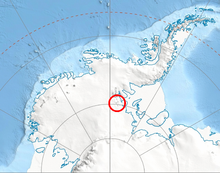
The Independence Hills (80°25′S 81°33′W) are a line of rugged hills and peaks, 10 miles (16 km) long, with mainly bare rock eastern slopes. They lie 3 miles (5 km) southeast of the Marble Hills and form the southern segment of the west wall of Horseshoe Valley, in the Heritage Range of Antarctica. The Independence Hills were mapped by the United States Geological Survey from ground surveys and U.S. Navy air photos, 1961–66. The name was applied by the Advisory Committee on Antarctic Names in association with the name "Heritage Range".[1]
Features
Geographical features include:
- Marble Hills
- Horseshoe Valley
- Morris Cliff
- Mount Geissel
- Mount Shattuck
- Mount Simmons
- Patriot Hills
- Redpath Peaks
References
- "Independence Hills". Geographic Names Information System. United States Geological Survey. Retrieved 6 July 2012.
![]() This article incorporates public domain material from the United States Geological Survey document: "Independence Hills". (content from the Geographic Names Information System)
This article incorporates public domain material from the United States Geological Survey document: "Independence Hills". (content from the Geographic Names Information System)
Antarctica | ||||||||
|---|---|---|---|---|---|---|---|---|
| Geography |
|  | ||||||
| History |
| |||||||
| Politics |
| |||||||
| Society |
| |||||||
| Famous explorers |
| |||||||
| ||||||||
This Ellsworth Land location article is a stub. You can help Wikipedia by expanding it. |
На других языках
[de] Independence Hills
Die Independence Hills (deutsch : Unabhängigkeitsberge) sind eine 16 Kilometer lange Bergkette, die zur Heritage-Range-Bergkette in den südlichen Ausläufern des westantarktischen Ellsworthgebirges gehört. Sie liegen etwa 4,8 Kilometer südöstlich der Marble Hills und bilden den südlichsten Teil der Westwand des Horseshoe Valley.[1]- [en] Independence Hills
Другой контент может иметь иную лицензию. Перед использованием материалов сайта WikiSort.org внимательно изучите правила лицензирования конкретных элементов наполнения сайта.
WikiSort.org - проект по пересортировке и дополнению контента Википедии