geo.wikisort.org - Mountains
The Hudson Mountains are a mountain range in western Ellsworth Land just east of Cranton Bay and Pine Island Bay at the eastern extremity of Amundsen Sea. They are of volcanic origin, consisting of low scattered mountains and nunataks that protrude through the West Antarctic Ice Sheet. The Hudson Mountains are bounded on the north by Cosgrove Ice Shelf and on the south by Pine Island Glacier.[3]
| Hudson Mountains | |
|---|---|
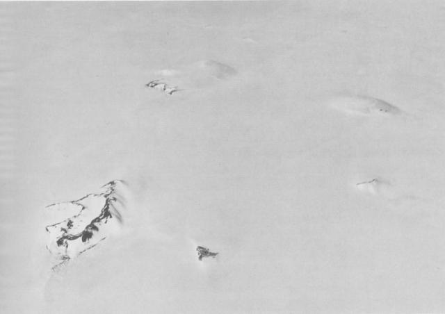 Aerial view of the southern Hudson Mountains. | |
| Highest point | |
| Peak | Mount Moses[1] |
| Elevation | 750 m (2,460 ft)[1] |
| Coordinates | 74°33′S 99°11′W |
| Geography | |
 Hudson Mountains Ellsworth Land, Antarctica | |
| Geology | |
| Mountain type | Stratovolcanoes |
| Last eruption | 210 BCE[2] |
Geology
The Hudson Mountains contain slightly eroded parasitic cones that overlie three extensively eroded Miocene stratovolcanoes: Mount Manthe, Teeters Nunatak and Mount Moses. Potential steam was reported in 1974 and an unconfirmed report of an eruption detected by satellite was made in 1985, indicating that the Hudson Mountains may be volcanically active.[2]
Volcanic activity of the Hudson Mountains has produced predominantly subaerial basaltic lava flows, although subglacial or subaqueous tuffs and lava flows have also been noted. A tephra layer deposited from a subglacial eruption has been dated at about 200 BCE based on ice thickness.[2]
History
The mountains were discovered by members of the USAS in flights from the USS Bear in February 1940, and further delineated from air photos taken by USN Operation Highjump in December 1946. The full extent of the group was mapped by USGS from US Navy air photos of 1966. Named by US-SCAN after Captain William L. Hudson, commander of USS Peacock during USEE, 1838–1842. Peacock, accompanied by USS Flying Fish under Lieutenant Walker, cruised along the edge of the pack to the north of this area for several days during the latter part of March 1839.[3]
On January, 2008, the British Antarctic Survey scientists led by Hugh Corr and David Vaughan, reported (in the journal Nature Geoscience) that 2,200 years ago, a volcano had a subglacial eruption under the Antarctic ice sheet, based on airborne survey with radar images. Described as the biggest eruption in Antarctica in the last 10,000 years, the volcanic ash was found deposited on the ice surface under the Hudson Mountains, close to Pine Island Glacier.[4]
See also
Further reading
- Corr, H., & Vaughan, D.(2008). A recent volcanic eruption beneath the West Antarctic ice sheet. Nature Geoscience, Vol. 1(no. 2), p. 122-125. doi:10.1038/ngeo106
- Corr H F J, Vaughan D G, 2008. A recent volcanic eruption beneath the West Antarctica ice sheet. Nature Geosci, 1: 122-125.
- Craddock C, Bastien T W, Rutford R H, 1964. Geology of the Jones Mountains area. In: Adie R J (ed) Antarctic Geol, Proc 1st Internatl Symp Antarctic Geol, Amsterdam: Elsevier, p 172-187.
- Dort W, 1972. Late Cenozoic volcanism in Antarctica. In: Adie R J (ed) Antarctic Geol and Geophys, IUGS Ser-B(1): 645-652.
- LeMasurier W E, 1972. Volcanic record of Cenozoic glacial history Marie Byrd Land. In: Adie R J (ed) Antarctic Geol and Geophys, IUGS Ser-B(1): 251-260.
- LeMasurier W E, Thomson J W (eds), 1990. Volcanoes of the Antarctic Plate and Southern Oceans. Washington, D C: Amer Geophys Union, 487
References
- "Mount Moses". Geographic Names Information System. United States Geological Survey, United States Department of the Interior. Retrieved 31 August 2020.
- "Hudson Mountains". Global Volcanism Program. Smithsonian Institution.
- "Hudson Mountains". Geographic Names Information System. United States Geological Survey, United States Department of the Interior.
- Black, Richard (20 January 2008). "Ancient Antarctic eruption noted". BBC News.
External links
- Hudson Mountains on USGS website
- Hudson Mountains on SCAR website
- Hudson Mountains on VOGRIPA
- Hudson Mountains on Smithsonian Institution website
- Hudson Mountains on volcanodiscovery
- Hudson Mountains updated sunrise/sunset / moonrise/moonset times
- Hudson Mountains long term updated weather forecast on mountain-forecast website
Bibliography
- LeMasurier, W. E.; Thomson, J. W., eds. (1990). Volcanoes of the Antarctic Plate and Southern Oceans. American Geophysical Union. ISBN 0-87590-172-7.
Antarctica | ||||||||
|---|---|---|---|---|---|---|---|---|
| Geography |
|  | ||||||
| History |
| |||||||
| Politics |
| |||||||
| Society |
| |||||||
| Famous explorers |
| |||||||
| ||||||||
На других языках
[de] Hudson-Gebirge
Das Hudson-Gebirge (englisch Hudson Mountains) ist eine Gruppe zahlreicher niedriger Berge und Nunataks im westlichen Ellsworthland in Westantarktika. Es erstreckt sich über ein Gebiet von ungefähr 125 km in Nord-Süd-Richtung und 55 km in Ost-West-Richtung.- [en] Hudson Mountains
[es] Montañas Hudson
Las montañas Hudson son un grupo de conos parásitos, que forman nunataks apenas por sobre la superficie de la capa de hielo antártica al oeste de la tierra de Ellsworth.[1] Se encuentran al este de la bahía de Cranton y la bahía de la isla Pine en el extremo este del mar de Amundsen, y están definidas en el norte por la barrera de hielo Cosgrove y por el sur por el glaciar de la isla Pine.[2][fr] Chaîne Hudson
La chaîne Hudson est une chaîne de montagnes volcanique de type stratovolcan actif, située dans la partie occidentale de la Terre d'Ellsworth en Antarctique occidental.Другой контент может иметь иную лицензию. Перед использованием материалов сайта WikiSort.org внимательно изучите правила лицензирования конкретных элементов наполнения сайта.
WikiSort.org - проект по пересортировке и дополнению контента Википедии