geo.wikisort.org - Mountains
The Hanthana Mountain Range lies in central Sri Lanka, south-west of the city of Kandy. It was declared as an environmental protection area in February 2010 under the National Environment Act.[1] The maximum height of the range is 3800 ft. The mountain range consists of seven peaks. The highest one being the Uura Kanda.[2] The range is a favourite destination among the mountain hikers in Sri Lanka. University of Peradeniya is situated adjacent to the Hanthana mountain range.[3]
| Hanthana conservation forest | |
|---|---|
 | |
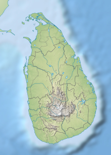 Location of the conservation forest | |
| Location | Central Province, Sri Lanka |
| Nearest city | Kandy |
| Coordinates | 7°15′31″N 80°37′43″E |
| Established | 2010 |
| Governing body | Department of Forest Conservation |
Gallery
 A view from Hanthana
 Uura kanda - the highest peak in the Hanthana range
 A view from Hanthana communication towers
 A scenic evening view from the Hanthana Mountain


References
- www.dailynews.lk http://www.dailynews.lk/2010/09/03/news50.asp. Retrieved 4 February 2011.
{{cite web}}: Missing or empty|title=(help) - tops.lk. "Heavenly High at Hanthana - Top Spots - Featured News - Tops Sri Lanka - Tops.lk".
- "Doing their bit to heal the earth".
External links
Текст в блоке "Читать" взят с сайта "Википедия" и доступен по лицензии Creative Commons Attribution-ShareAlike; в отдельных случаях могут действовать дополнительные условия.
Другой контент может иметь иную лицензию. Перед использованием материалов сайта WikiSort.org внимательно изучите правила лицензирования конкретных элементов наполнения сайта.
Другой контент может иметь иную лицензию. Перед использованием материалов сайта WikiSort.org внимательно изучите правила лицензирования конкретных элементов наполнения сайта.
2019-2026
WikiSort.org - проект по пересортировке и дополнению контента Википедии
WikiSort.org - проект по пересортировке и дополнению контента Википедии