geo.wikisort.org - Mountains
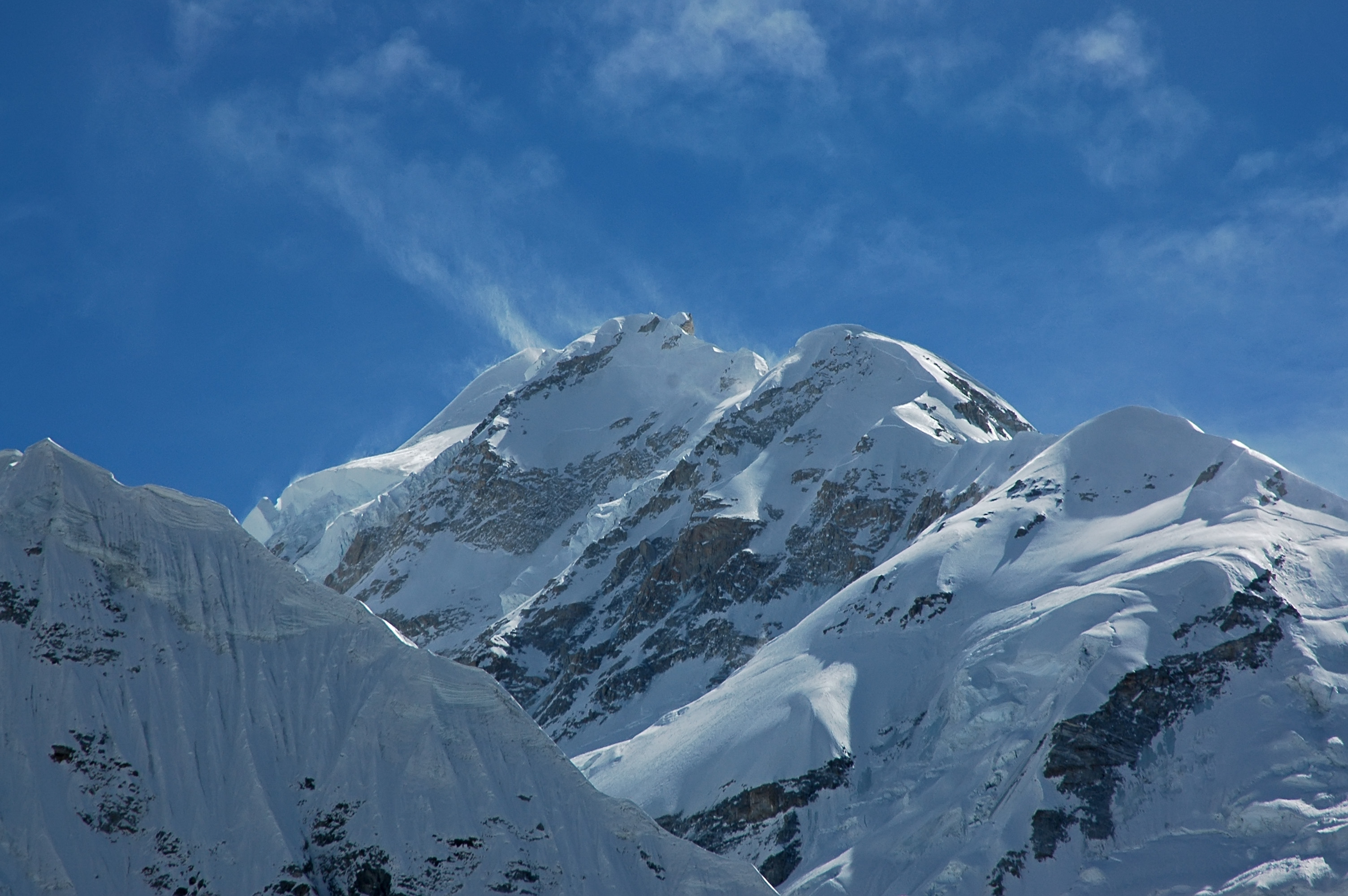
Gimmigela Chuli, or The Twins, are two-peak mountains in the Himalayas, located on the border between Taplejung, Mechi, Nepal and Sikkim, India.
| Gimmigela Chuli | |
|---|---|
| The Twins | |
 | |
| Highest point | |
| Elevation | 7,350 m (24,110 ft)[1] |
| Prominence | 432 m (1,417 ft)[1] |
| Parent peak | Kangchenjunga |
| Coordinates | 27°44′N 88°09′E[1] |
| Geography | |
 Gimmigela Chuli Location in Nepal, on the border with India | |
| Location | India–Nepal border |
| Parent range | Kangchenjunga Himal, Himalayas |
| Climbing | |
| First ascent | 1995 by Taroh Tanigawa, Koji Nagakubo and Yuichi Yoshida |
| Easiest route | glacier/snow/ice climb |

Location
It has an elevation of 7,350 m (24,110 ft) above sea level and prominence is at 432 m (1,417 ft). It is situated approximately 4.2 km (2.6 mi) NNE from Kangchenjunga.
The mountain has a subpeak, Gimmigela Chuli II 7,005 m (22,982 ft) metres; prominence is at 185 m (607 ft).[2] This subpeak, sometimes referred to as "Gimmigela's Sister", lies entirely within India. Together the two peaks, Gimmigela I and Gimmigela II, are known as "The Twins".
Climbing history
A Japanese expedition attempted to reach the west (main) summit in 1993 via the east ridge from Sikkim, ending on 18 October 1993 after the death of expedition leader Masanori Sato. The team had achieved the first ascent of Gimmigela II and were on the summit ridge connecting the two peaks in an attempt to summit Gimmigela I when Sato fell 35 meters into a hidden crevasse. Despite the efforts of the other team members, his body was not recovered and the expedition was terminated.[3]
One year later in October 1994, Taroh Tanigawa, Koji Nagakubo and Yuichi Yoshida, members of the failed attempt in 1993, achieved the first ascent of Gimmigela I.[4][5]
References
- "Gimmigela, India/Nepal". Peakbagger.com. Retrieved 7 May 2014.
- "Gimmigela II, India". Peakbagger.com. Retrieved 7 May 2014.
- "Gimmigela first ascent". American Alpine Journal. Retrieved 2014-05-11.
- "The First successful ascent to the Twins: Mt. Gimmigela", by the Tokyo University of Agriculture Alpine Club. The Japanese Alpine Club. Retrieved 2014-05-11.
- "Gimmigela Chuli East, Northeast Face", American Alpine Journal. Retrieved 2020-02-11.
External links
На других языках
[de] Gimmigela Chuli
Der Gimmigela Chuli (auch The Twins, englisch für „die Zwillinge“) ist ein Berg im Himalaya an der Grenze zwischen Nepal und Sikkim in Indien.- [en] Gimmigela Chuli
[fr] Gimmigela Chuli
Le Gimmigela Chuli est un sommet de l'Himalaya, sur la frontière indo-népalaise, entre le district de Taplejung et l'État indien du Sikkim, atteignant 7 350 mètres d'altitude[1]. Il est situé à environ 4 km au nord du Kangchenjunga (8 586 m), troisième plus haut sommet sur Terre.Другой контент может иметь иную лицензию. Перед использованием материалов сайта WikiSort.org внимательно изучите правила лицензирования конкретных элементов наполнения сайта.
WikiSort.org - проект по пересортировке и дополнению контента Википедии