geo.wikisort.org - Mountains
The Dôme du Goûter (4,304 m) is a mountain in the Mont Blanc massif. It is a shoulder of Mont Blanc, whose summit lies two kilometres to the south-east. The Dôme is traversed on ascents of Mont Blanc via the Bosses route.
| Dôme du Goûter | |
|---|---|
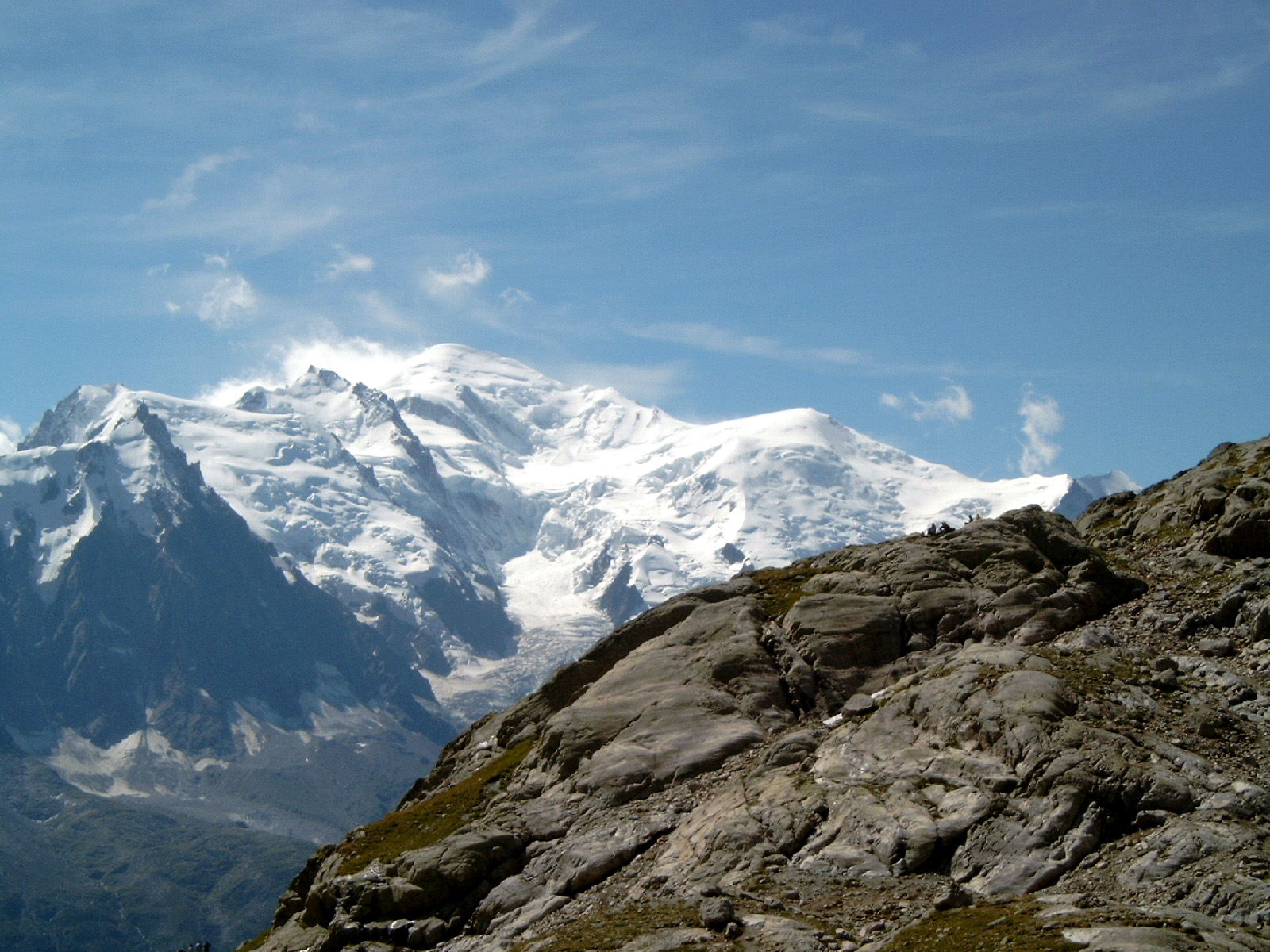 Mont Blanc (centre left) and the Dôme du Goûter (right) | |
| Highest point | |
| Elevation | 4,304 m (14,121 ft) |
| Prominence | 58 m ↓ Col du Dôme[1] |
| Isolation | 1.98 km → Mont Blanc |
| Coordinates | 45°50′34″N 6°50′36″E |
| Geography | |
 Dôme du Goûter Alps | |
| Location | Haute-Savoie, France / Aosta Valley, Italy |
| Parent range | Graian Alps |
| Geology | |
| Mountain type | Granite/Porphyry |
| Climbing | |
| First ascent | 17 September 1784 by Jean-Marie Couttet and François Cuidet |
| Easiest route | From Refuge du Goûter, 3,817 m, (F) |
The summit of the Dôme is marked as lying entirely within France on the French Institut Géographique National (IGN) map , although on Italian Istituto Geografico Militare (IGM) map the summit appears to lie on the frontier between France and Italy. In June 2015, Italian Prime Minister Matteo Renzi expressed repeated claims on the territory. [2] [3] [4] The Swiss National Map, which covers the massif at 1:50'000 scale, shows both disputed areas around Mont Blanc and Dôme du Goûter in a neutral way, after previously following the French interpretation of the border until 2018.[5]

Goûter Refuge
In 2013, the Goûter Refuge opened, a mountain hut noted for its modern style.[6] From the hut the summit of the Dome du Gouter is about two hours away by foot.[7] The hut is located above the Aiguille du Gouter cliff and is constructed of wood and steel in a roughly egg shape.[8] The older shelter was a more basic metal shed that sat on the ice, whereas the new building has supports drilled into the rock.[6]
See also
- List of 4000 metre peaks of the Alps
References
- Mountains above 4000 metres in the Alps
- Mont Blanc controversy: French suffer a fit of pique as Italy's Prime Minister 'reclaims' Europe's highest mountain - Neighbours bicker about where the border should run around famous mountain
- Querelle confine Monte Bianco, il Governo si dice pronto ad intervenire “di fronte a nuovi episodi”
- 'Stop stealing Mont Blanc': Italy tells France
- "Swiss National Map: Courmayeur (1:50'000)". map.geo.admin.ch. Retrieved 17 May 2020.
- Todd, Andrew (2015-10-21). "Eco-friendly architecture in the Alps hits new heights". The Guardian. ISSN 0261-3077. Retrieved 2017-05-30.
- "Refuge du Goûter : Hut & Campground Information : SummitPost".
- Todd, Andrew (2015-10-21). "Eco-friendly architecture in the Alps hits new heights". The Guardian. ISSN 0261-3077. Retrieved 2017-05-30.
External links
| Settlements |
|    |
|---|---|---|
| Mountains |
| |
| Cols |
| |
| Glaciers |
| |
| Refuges |
| |
| Mountaineers (first or major ascents) |
| |
| Other |
| |
На других языках
[de] Dôme du Goûter
Der Dôme du Goûter ist ein 4.304 Meter hoher Berg im Mont-Blanc-Massiv. Er liegt auf französischem Boden im Département Haute-Savoie. 200 Meter südlich unterhalb seines Gipfels verläuft die Grenze zwischen Frankreich und Italien.- [en] Dôme du Goûter
[fr] Dôme du Goûter
Le dôme du Goûter, culminant à 4 304 ou 4 306 m, est le troisième plus haut sommet des Alpes françaises, dans le massif du Mont-Blanc, entre la Haute-Savoie et la Vallée d'Aoste.[it] Dôme du Goûter
Il Dôme du Goûter (4.306[1] m s.l.m.) è una delle cime più alte del gruppo Bionnassay-Goûter, nel Massiccio del Monte Bianco lungo la linea di confine tra Italia e Francia.[ru] Дом-дю-Гуте
Дом-дю-Гуте (фр. Dôme du Goûter) — вершина в массиве Монблан на границе Франции, регион Рона, и Италии, провинция Валле-д’Аоста высотой 4304 метра над уровнем моря. Вершина лежит на гребне массива Монблан в двух километрах к северо-западу от основной вершины. Первое зарегистрированное восхождение на Дом-дю-Гуте совершили Жан-Мари Куттет и Франсуа Куидет 17 сентября 1784 года.Другой контент может иметь иную лицензию. Перед использованием материалов сайта WikiSort.org внимательно изучите правила лицензирования конкретных элементов наполнения сайта.
WikiSort.org - проект по пересортировке и дополнению контента Википедии