geo.wikisort.org - Mountains
Chimboya or Chimbolla (possibly from Aymara Chimpuya, Chimpulla), Inchurusi (Jinchurusi), Iruna or Vilcanota (Willkanuta) is a mountain in the La Raya mountain range in the Andes of Peru, about 5,489 metres (18,009 ft) high. It is situated in the Cusco Region, Canas Province, Layo District and in the Puno Region, Melgar Province, Santa Rosa District.[3] Chimboya lies northeast of the La Raya Pass and the mountain Kunka and southeast of the mountain Yana Khuchilla.
| Chimboya | |
|---|---|
| Jinchurusi, Iruna, Willkanuta | |
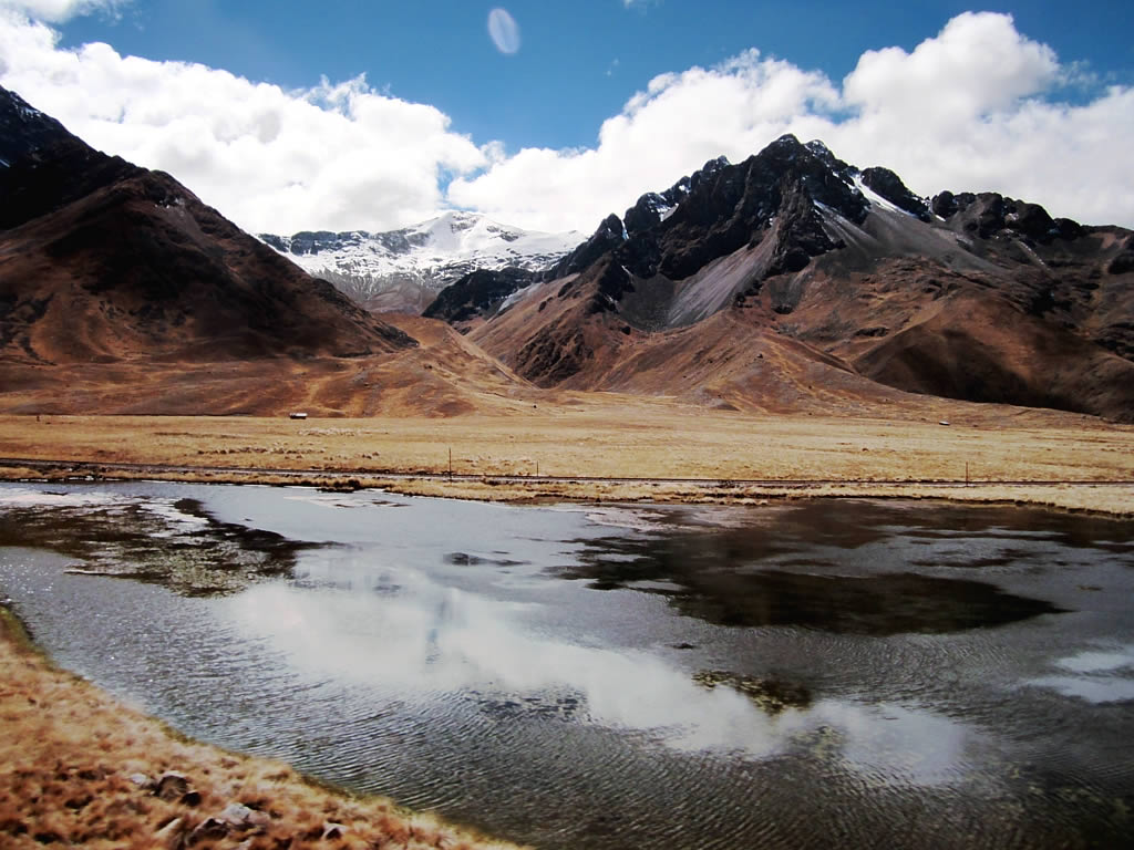 Chimboya, the snow-covered mountain in the background, as seen from a small lake near the La Raya pass | |
| Highest point | |
| Elevation | 5,489 m (18,009 ft)[1] |
| Coordinates | 14°26′37″S 70°57′44″W[2] |
| Geography | |
 Chimboya Peru | |
| Location | Peru, Puno Region - Cusco Region |
| Parent range | Andes, La Raya |
Images
![The train Belmond Andean Explorer[4] at La Raya Station with market stalls and the mountain Chimboya in the background](//upload.wikimedia.org/wikipedia/commons/thumb/8/82/La_Raya_%285688184350%29.jpg/120px-La_Raya_%285688184350%29.jpg) The train Belmond Andean Explorer[4] at La Raya Station with market stalls and the mountain Chimboya in the background
The train Belmond Andean Explorer[4] at La Raya Station with market stalls and the mountain Chimboya in the background
![The train Belmond Andean Explorer[4] at La Raya Station with market stalls and the mountain Chimboya in the background](http://upload.wikimedia.org/wikipedia/commons/8/82/La_Raya_%285688184350%29.jpg)
References
- Jill Neate, Mountaineering in the Andes: "Chimboya (Vilcanota, Iruna, Inchurusi) 5489m"
- ign.gob.pe Archived 2013-08-12 at archive.today IGN, Peru, Nevados: Chimbolla 14°26'37" S 70°57'44" W
- escale.minedu.gob.pe - UGEL map of the Melgar Province (Puno Region)
- Belmont
This Cusco Region geography article is a stub. You can help Wikipedia by expanding it. |
This Puno Region geography article is a stub. You can help Wikipedia by expanding it. |
На других языках
- [en] Chimboya
[es] Chimboya
Chimboya es una montaña del Perú. Tiene una altitud de 5.489 msnm. Forma parte de la cordillera La Raya, en los Andes. Se encuentra en el límite entre los departamentos de Cusco y Puno, Perú.[1][2]Текст в блоке "Читать" взят с сайта "Википедия" и доступен по лицензии Creative Commons Attribution-ShareAlike; в отдельных случаях могут действовать дополнительные условия.
Другой контент может иметь иную лицензию. Перед использованием материалов сайта WikiSort.org внимательно изучите правила лицензирования конкретных элементов наполнения сайта.
Другой контент может иметь иную лицензию. Перед использованием материалов сайта WikiSort.org внимательно изучите правила лицензирования конкретных элементов наполнения сайта.
2019-2026
WikiSort.org - проект по пересортировке и дополнению контента Википедии
WikiSort.org - проект по пересортировке и дополнению контента Википедии