geo.wikisort.org - Mountains
The La Raya mountain range (Spanish for the line, the limits, the border) is situated in the Andes of Peru. It extends in a northeasterly direction approximately between 14º 20’ and 14º 33’S and 70º 57’ and 71º 02’W for about 10 km.[1] It is located in the Cusco Region as well as in the Puno Region, northwest of the Peruvian Altiplano and Lake Titicaca, near the La Raya pass.
| La Raya mountain range | |
|---|---|
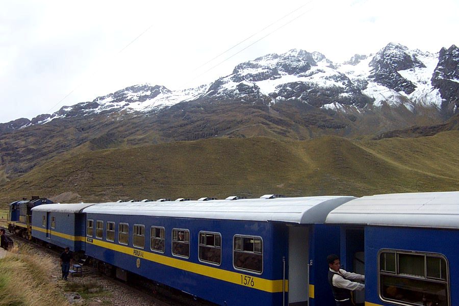 The train from Puno to Cusco at the La Raya Pass at 4,313 m (14,150 ft) | |
| Highest point | |
| Elevation | 5,489 m (18,009 ft) |
| Dimensions | |
| Length | 10 km (6.2 mi) NE-SW |
| Geography | |
| Country | |
| Region | Cusco Region, Puno Region |
| Parent range | Andes |
Mountains
One of the highest peaks of the range is Chimpulla (5,489 metres (18,009 ft)). Other mountains are listed below:[2][3][4]
- Yana Khuchilla, 5,472 m (17,953 ft)
- Chinchina, 5,463 m (17,923 ft)
- Muskaya, 5,414 m (17,762 ft)
- Kuntur Quta, 5,425 m (17,799 ft)
- Qillqa, 5,360 m (17,590 ft)
- Awkar Utaña, 5,310 m (17,420 ft)
- Huch'uy K'uchu, 5,300 m (17,400 ft)
- Hatun Awkara, 5,230 m (17,160 ft)
- Kunka, 5,200 m (17,100 ft)
- Wila Quta, 5,200 m (17,100 ft)
- Yanaqucha, 5,105 m (16,749 ft)
- Mamaniri, 5,077 m (16,657 ft)
- Qullqini, 5,025 m (16,486 ft)
- Chawpi Tiyana, 5,000 m (16,000 ft)
- Hatun Ichhuna Kunka, 5,000 m (16,000 ft)
- Huch'uy Awkara, 5,000 m (16,000 ft)
- Puka Urqu, 5,000 m (16,000 ft)
- Taruja Marka, 5,000 m (16,000 ft)
- Yana Ranra, 5,000 m (16,000 ft)
- Hatun Wasi, 4,800 m (15,700 ft)
- Inka Kancha, 4,800 m (15,700 ft)
- Ñiq'i Quta, 4,800 m (15,700 ft)
- Silluta, 4,800 m (15,700 ft)
- Yaritani, 4,800 m (15,700 ft)
See also
- PeruRail
References
- Inventario de Glaciares del Perú, Ministerio de Agricultura y Riego, Autoridad Nacionaldel Agua, Huaraz 2014
- Peru 1:100,000, Palca 2742, Map prepared and published by the Defense Mapping Agency, Hydrographic/Topographic Center, Bethesda, MD
- escale.minedu.gob.pe - UGEL map of the Melgar Province (Puno Region)
- Peru 1:100,000, Sicuani 2642 J632 Edition I-DMA, Map prepared and published by the Defense Mapping Agency
Wikimedia Commons has media related to La Raya mountain range.
This Puno Region geography article is a stub. You can help Wikipedia by expanding it. |
This Cusco Region geography article is a stub. You can help Wikipedia by expanding it. |
На других языках
- [en] La Raya mountain range
[fr] Cordillère la Raya
La cordillère la Raya est située au Sud-Est du Pérou. Elle est notamment traversée par la route 3S, qui relie Cuzco à Puno, au col de La Raya, qui offre une vue sur le mont Chimboya (ou Chumpulla) culminant à 5 489 mètres.Текст в блоке "Читать" взят с сайта "Википедия" и доступен по лицензии Creative Commons Attribution-ShareAlike; в отдельных случаях могут действовать дополнительные условия.
Другой контент может иметь иную лицензию. Перед использованием материалов сайта WikiSort.org внимательно изучите правила лицензирования конкретных элементов наполнения сайта.
Другой контент может иметь иную лицензию. Перед использованием материалов сайта WikiSort.org внимательно изучите правила лицензирования конкретных элементов наполнения сайта.
2019-2026
WikiSort.org - проект по пересортировке и дополнению контента Википедии
WikiSort.org - проект по пересортировке и дополнению контента Википедии