geo.wikisort.org - Mountains
Cerro Catedral ("Cathedral Hill"), also known as Cerro Cordillera, is a peak and the highest point of Uruguay, with an altitude of 513.66 m (1,685.2 ft). It is located north of Maldonado Department, in the municipality of Aiguá, in a hill range named Sierra Carapé, which constitutes part of a larger range named Cuchilla Grande. Its name derived from the curious forms of the rocky elevations of its summit, which are very common in the southern part of this country.
- For the mountain in Argentina, see Cerro Catedral.
| Cerro Catedral | |
|---|---|
 The summit of Cerro Catedral, near a dirt road (Ruta 109). | |
| Highest point | |
| Elevation | 513.66 m (1,685.2 ft) |
| Prominence | 63 m (207 ft) |
| Listing | Country high point |
| Coordinates | 34°22′55.9″S 54°40′27.7″W |
| Naming | |
| English translation | Cathedral Hill |
| Language of name | Spanish |
| Pronunciation | Spanish: [ˈsero kateˈðɾal] |
| Geography | |
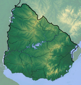 Cerro Catedral Uruguay | |
| Location | Aiguá, Maldonado Department, Uruguay |
| Parent range | Sierra Carapé (part of Cuchilla Grande) |
| Geology | |
| Age of rock | Precambrian |
| Mountain type | Hill (granite, gneiss) |
| Climbing | |
| First ascent | Unknown |
| Easiest route | Hike |
History
Until 1973, Cerro de las Ánimas (formerly known as Mirador Nacional), with an elevation of 501 m (1,644 ft), was considered the highest point of Uruguay. However, in that year, a group of scientists of the Servicio Geográfico Militar (Military Geographic Service) changed the measure of Cerro Catedral.
Geography
Location and geology

Sierra Carapé, formed in Precambrian time, crosses the Maldonado Department from west to east and enters the Rocha Department. It constitutes the border between the departments of Lavalleja and Maldonado. Cerro Catedral, or Cerro Cordillera, is situated in the region of Las Cañas, in the 8th Judicial Section and the 9th Police Section of the Maldonado Department. Near Cerro Catedral there are the source of José Ignacio Stream (Arroyo José Ignacio), which runs from north to south, and the source of Coronilla Stream (Arroyo Coronilla), running to the northwest, which drains into Aiguá.
The hill is situated in an area of the range which its formation is mainly granitic and gneissic.
Vegetation
In the highest areas of Cerro Catedral, the vegetation practically does not exist, with the sparse appearance of a shrub called Myrtus ugni between the rocks. Above the altitude of 400 m (1,300 ft), tough grasses, xerophile vegetation, Baccharis articulata and marcela predominate.
Climate
The climate in this locality is oceanic (described by the Köppen climate classification as Cfb), with mild to warm summers and chilly to cool winters (with frequent frosts). Strong winds are a common occurrence. The precipitation is evenly distributed throughout the year and snowfalls are uncommon.
| Climate data for Cerro Catedral (514 metres - modelled data) | |||||||||||||
|---|---|---|---|---|---|---|---|---|---|---|---|---|---|
| Month | Jan | Feb | Mar | Apr | May | Jun | Jul | Aug | Sep | Oct | Nov | Dec | Year |
| Average high °C (°F) | 26 (79) |
25 (77) |
23 (73) |
19 (66) |
16 (61) |
14 (57) |
13 (55) |
15 (59) |
16 (61) |
19 (66) |
21 (70) |
24 (75) |
19 (67) |
| Average low °C (°F) | 14 (57) |
14 (57) |
13 (55) |
10 (50) |
7 (45) |
5 (41) |
4 (39) |
5 (41) |
6 (43) |
8 (46) |
10 (50) |
12 (54) |
9 (48) |
| Average precipitation mm (inches) | 69 (2.7) |
101 (4.0) |
98 (3.9) |
93 (3.7) |
83 (3.3) |
74 (2.9) |
82 (3.2) |
70 (2.8) |
74 (2.9) |
102 (4.0) |
103 (4.1) |
77 (3.0) |
1,026 (40.5) |
| Source: MeteoBlue [1] | |||||||||||||
See also
- Cerro Pan de Azúcar
- Geography of Uruguay
Sources
- (in Spanish) Cerro Catedral, Site of the Municipality of Maldonado, Uruguay.
References
- "Clima Cerro Catedral". Retrieved 14 April 2020.
External links
- (in English) "Cerro Catedral, Uruguay". Peakbagger.com.
Authority control | |
|---|---|
| General | |
| National libraries | |
This article about a place in Maldonado Department is a stub. You can help Wikipedia by expanding it. |
На других языках
[de] Cerro Catedral (Uruguay)
Cerro Catedral (deutsch: Kathedralenhügel – Aussprache: [.mw-parser-output .IPA a{text-decoration:none}'sero kate'ðɾal], auch bekannt als Cerro Cordillera) ist der höchste Punkt von Uruguay. Der Gipfel liegt auf einer Höhe von 513,7 Meter.[1] Er befindet sich im Norden des Maldonado Departamentos und gehört zur Hügelkette der Sierra Carapé.- [en] Cerro Catedral (Uruguay)
[es] Cerro Catedral (Uruguay)
El Cerro Catedral o Cerro Cordillera, como también se lo denomina, es el punto más alto del territorio de Uruguay, con 513,66 msnm. Se encuentra ubicado al norte del departamento de Maldonado, en el municipio de Aiguá, y pertenece a la llamada Sierra Carapé, que constituye uno de los ramales de la Cuchilla Grande.[fr] Cerro Catedral (Uruguay)
Le Cerro Catedral (littéralement « colline cathédrale ») est une colline, point culminant de l'Uruguay. Son altitude est de 514 m. En comparaison d'autres points culminants d'autres pays d'Amérique latine, l'altitude du Cerro Catedral est modeste.[ru] Серро-Катедраль
Се́рро-Катедра́ль[уточнить] (исп. Cerro Catedral, также известный как Серро-Кордильера исп. Cerro Cordillera) — пик в южной оконечности Уругвая, высшая точка страны.Другой контент может иметь иную лицензию. Перед использованием материалов сайта WikiSort.org внимательно изучите правила лицензирования конкретных элементов наполнения сайта.
WikiSort.org - проект по пересортировке и дополнению контента Википедии