geo.wikisort.org - Mountains
Beinn a' Bhùird is a Munro in the Cairngorm mountain range of Scotland.
| Beinn a' Bhùird | |
|---|---|
 | |
| Highest point | |
| Elevation | 1,197 m (3,927 ft)[1] |
| Prominence | c. 456 m |
| Parent peak | Cairn Gorm |
| Listing | Munro, Marilyn |
| Naming | |
| English translation | Mountain of the table |
| Language of name | Gaelic |
| Pronunciation | Scottish Gaelic: [ˈpeiɲ ə ˈvuːrˠtʲ] |
| Geography | |
 Beinn a' Bhùird Moray / Aberdeenshire | |
| Parent range | Cairngorms |
| OS grid | NJ092006 |
| Topo map | OS Landranger 36 |
In Watson (1975) the author suggests the mountain should be named Beinn Bòrd - table hill, saying that local Scottish Gaelic speakers pronounced the mountain Paing Bòrd, with some of the older local folk still using Painna Bòrd.
The closest 'village' to Beinn a' Bhùird is Braemar, Aberdeenshire and the most common approach by car is through this village. To reach Beinn a' Bhùird by car, the most common approach is by the Linn of Dee road along the south side of the River Dee to the Linn of Dee, looping back along the north-bank to the car park at Allanaquoich where camping is permitted. The distance between Braemar and Allanaquoich by this route is about 10 miles (16 kilometres).
In 2006, a glider pilot from Deeside Gliding Club crashed on the hillside, spending 24 hours trapped in his plane until he was located by the RAF.[citation needed]
Ascents
The usual ascent of Beinn a' Bhùird is from the car park at Allanaquoich walking up Glen Quoich and following the new path along the line of the old land rover road up An Diollaid.
An alternate ascent follows the Quoich Water through the Am Beitheachan to the bealach named The Sneck (Watson, 1975) (and the 1:25000 series Ordnance Survey maps) - between Beinn a' Bhùird and Ben Avon.
Skiing
In the early 1960s there was an attempt to develop a large ski area on Beinn a' Bhùird. The development was financed by the Panchaud brothers (Gerald and Jhon) [2] of Switzerland who had purchased the estate when skiing in Scotland was booming.[3] The area was to be called Mar Lodge and opened in 1963[4] after a series of record snowfalls. At the time of opening there were two T-bars on site, one 620 ft (190 m) long and one 2,050 ft (620 m) long. These offered a total uphill capacity of 1,400 people per hour. Unfortunately, the seasons of 1963–64 and 1964–65 offered very little snow to the area, meaning that the ski lifts were rarely used, with the resort becoming abandoned in 1965.[5] When the resort closed both T-bars were moved to Glenshee[6] to become the Cairnwell T-Bar and Trainer Tow (removed for the 2003 season).[7]
Gallery
![]() Media related to Beinn a' Bhùird at Wikimedia Commons
Media related to Beinn a' Bhùird at Wikimedia Commons
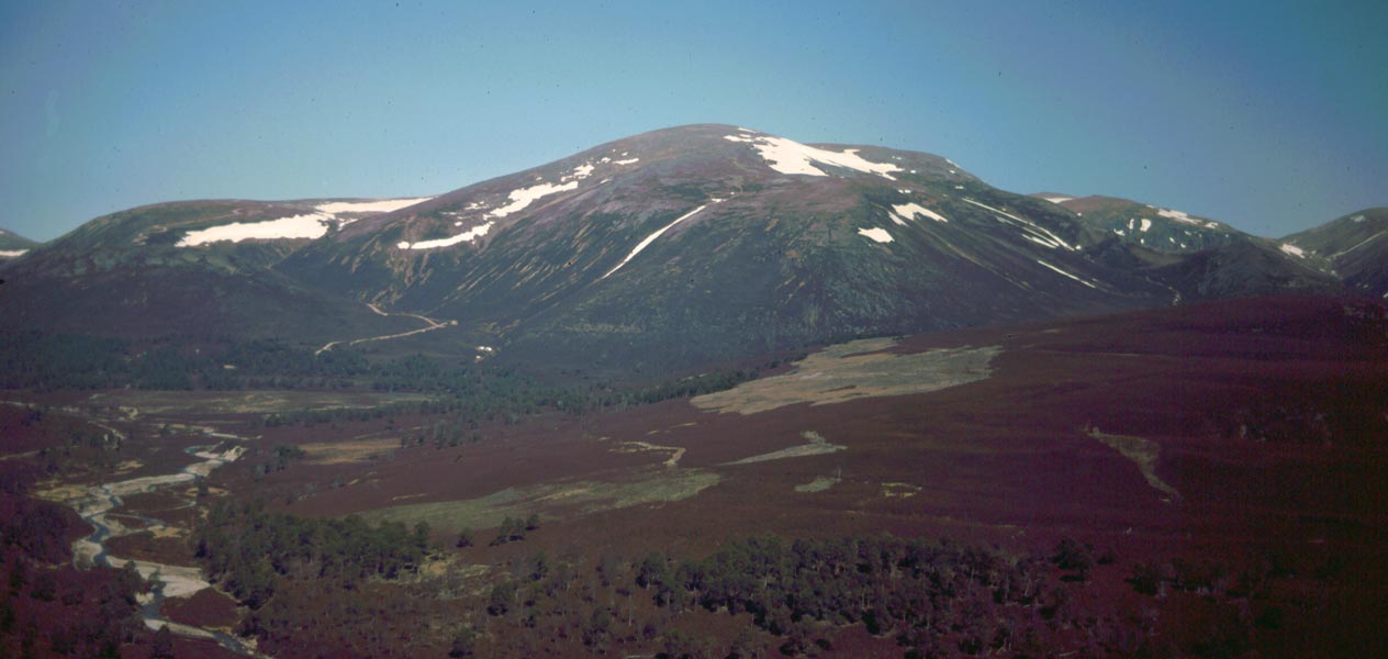
 Beinn a' Bhùird from Linn of Dee road
 Garbh Choire on Beinn a' Bhùird
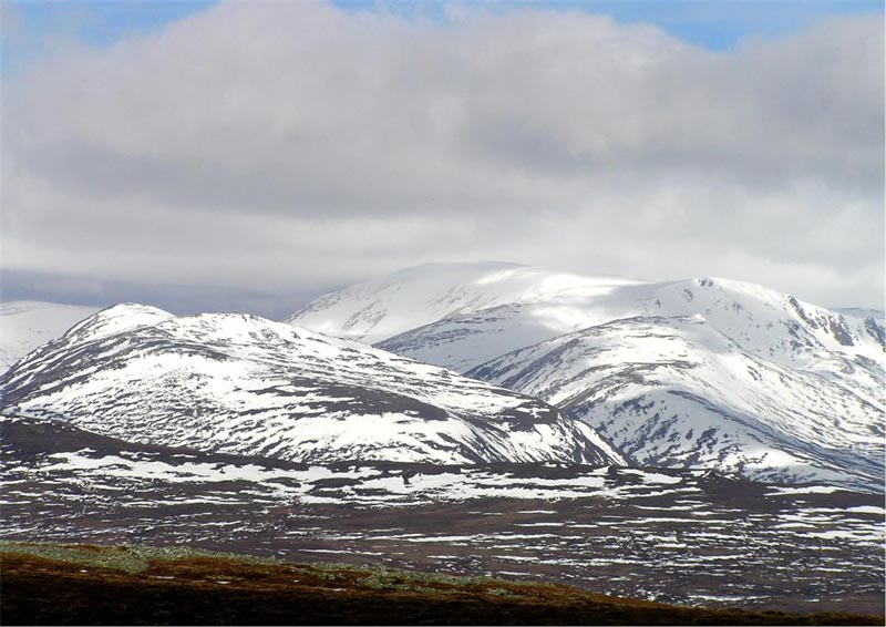
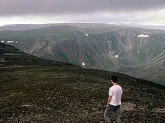 Beinn a' Bhùird from Ben Avon
 Parking at Allanaquoich


See also
Sources
- Watson, Adam (1975). The Cairngorms. Edinburgh: The Scottish Mountaineering Trust.
- "walkhighlands Beinn a'Bhuird". walkhighlands.co.uk. 2013. Retrieved 30 November 2013.
- Rattray (2011). Scottish Skiing: The Golden Years 1950-1990. Troubador Publishing Ltd. p. 166. ISBN 9781780880372.
- "Highland-instinct.co.uk :: Scottish ski resorts :: History - mar lodge".
- "The history of Mar Lodge ski centre - the upland of Mar history project". Archived from the original on 4 March 2016. Retrieved 7 November 2015.
- "Highland-instinct.co.uk :: Photo galleries :: Mar Lodge Ski Centre - 26 Dec 09". Archived from the original on 4 March 2016. Retrieved 7 November 2015.
- "Highland-instinct.co.uk :: Scottish ski resorts :: History - mar lodge".
- "Highland-instinct.co.uk :: Scottish ski resorts :: History - mar lodge".
Munros of Scotland: the Cairngorms | |||
|---|---|---|---|
 |  | ||
| |||
| Authority control |
|
|---|
На других языках
[de] Beinn a’ Bhùird
Der Beinn a’ Bhùird ist ein als Munro und Marilyn eingestuftes, 1.197 m (3.927 ft) hohes Bergmassiv in Schottland. Der gälische Name kann in etwa mit Berg des Tisches oder Berg der Tafel übersetzt werden.[1] Der Hauptgipfel des Beinn a’ Bhùird liegt auf der Grenze zwischen den Council Areas Aberdeenshire und Moray im Osten der zentralen Cairngorms etwa 15 Kilometer nordwestlich von Braemar und gut 25 Kilometer südöstlich von Aviemore. Er ist der elfthöchste Berg Schottlands und des Vereinigten Königreichs.- [en] Beinn a' Bhùird
[ru] Бенн-а-Бюирд
Бенн-а-Бюирд (англ. Beinn a' Bhùird) — мунро в горном хребте Кернгормс в Абердиншире Северной Шотландии (Великобритания). Высота вершины составляет 1197 м над уровнем моря[1]. Ближайший населённый пункт — Бремар.Другой контент может иметь иную лицензию. Перед использованием материалов сайта WikiSort.org внимательно изучите правила лицензирования конкретных элементов наполнения сайта.
WikiSort.org - проект по пересортировке и дополнению контента Википедии