geo.wikisort.org - Mountains
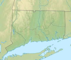
The Barn Door Hills of north-central Connecticut are a pair of prominent rocky trap rock knobs separated by a steep sided gap. They are located in Granby, Connecticut. The hills are an outlying section of the narrow, linear Metacomet Ridge that extends from Long Island Sound near New Haven, north through the Connecticut River Valley of Massachusetts to the Vermont border. The crest of the Metacomet Ridge is located 3.75 miles (6.04 km) east at Hatchet Hill.
| Barn Door Hills | |
|---|---|
 Western Barndoor Hill from Barndoor Hills Road, looking slightly south of west | |
| Highest point | |
| Elevation | c. 560 feet (171 m) and c.. 580 feet (177 m) |
| Coordinates | 41°55′46″N 72°49′31″W and 41°55′57″N 72°49′04″W |
| Geography | |
 Barn Door Hills Granby, Connecticut | |
| Parent range | Metacomet Ridge |
| Geology | |
| Age of rock | 200 million yrs. |
| Mountain type | Fault-block; igneous |
Recreation and conservation
East Barndoor Hill is located in the 4,000-acre (16 km2) McLean Game Refuge founded by former United States Senator George P. McLean and now a National Natural Landmark.[1] A hiking trail climbs the summit of the hill. West Barndoor Hill is maintained by the Granby Land Trust.[2]

References
- "McLean Game Refuge Natural Areas". National Natural Landmarks Program. National Park Service. 1973. Retrieved December 27, 2018.
- "Western Barndoor Hill Preserve Trail Map" (PDF). Granby Land Trust. Retrieved January 11, 2009.
- Farnsworth, Elizabeth J. Metacomet-Mattabesett Trail Natural Resource Assessment July 17, 2004. Cited November 1, 2007.
- Connecticut Walk Book: A Trail Guide to the Connecticut Outdoors. 17th Edition. The Connecticut Forest and Park Association. Rockfall, Connecticut. Undated.
- Raymo, Chet and Raymo, Maureen E. Written in Stone: A Geologic History of the Northeastern United States. Globe Pequot, Chester, Connecticut, 1989.
External links
Текст в блоке "Читать" взят с сайта "Википедия" и доступен по лицензии Creative Commons Attribution-ShareAlike; в отдельных случаях могут действовать дополнительные условия.
Другой контент может иметь иную лицензию. Перед использованием материалов сайта WikiSort.org внимательно изучите правила лицензирования конкретных элементов наполнения сайта.
Другой контент может иметь иную лицензию. Перед использованием материалов сайта WikiSort.org внимательно изучите правила лицензирования конкретных элементов наполнения сайта.
2019-2026
WikiSort.org - проект по пересортировке и дополнению контента Википедии
WikiSort.org - проект по пересортировке и дополнению контента Википедии