geo.wikisort.org - Mountains
The Banks Peninsula Volcano is an extinct volcanic complex to the east of Christchurch on New Zealand's South Island.[1] While the volcano is highly eroded it still forms the majority of Banks Peninsula with a highest point of 919 metres (3,015 ft).[2] It is a composite of two main eruptive centers one originating at Lyttelton Harbour, the other at Akaroa Harbour. The eruptions were predominantly basaltic, with associated andesite and trachytes, with minor rhyolite. The volcanic activity occurred in the Late Miocene and possibly extended into the Early Pliocene. There are four volcanic groups, all of which are within the Māui Supergroup.[3] The Christchurch earthquakes led to rumors of a possible eruption, however, there is no known magma chamber beneath the volcano and there has not been any sign of volcanic activity in the last 5 million years.[4]
| Banks Peninsula Volcano | |
|---|---|
| Stratigraphic range: Late Miocene, ~ | |
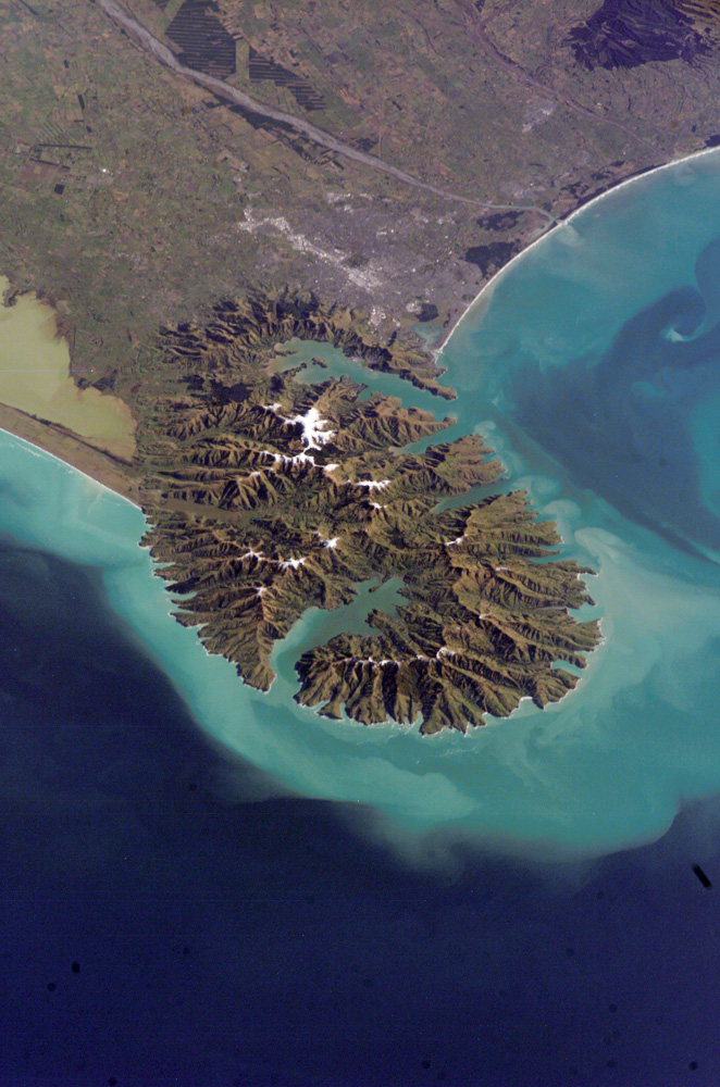 Banks Peninsula with Akaroa Harbour (West, Lower) and Lyttelton Harbour (East, Upper) | |
| Type | Volcanic Complex |
| Sub-units | Diamond Harbour Volcanic Group, Mount Herbert Volcanic Group, Akaroa Volcanic Group, Lyttelton Volcanic Group |
| Overlies | Torlesse Composite Terrane and Mount Somers Volcanics |
| Thickness | Originally c.1500m |
| Lithology | |
| Primary | Basalt |
| Other | Andesite, trachytes and rhyolite |
| Location | |
| Coordinates | 43°44′S 172°51′E |
Origin and relationship to other volcanoes
New Zealand's South Island has many extinct volcanic centers with no obvious tectonic mechanism of formation.[5][6] Because of this the cause of these intraplate volcanoes is debated. They extend in age from the Cretaceous to the Pliocene and outcrop throughout Otago, Canterbury and on the Chatham Islands.[6] The largest of these is the Banks Peninsula Volcano followed by the Dunedin Volcano which is half its size. Also the Cretaceous Mount Somers Volcanics occur throughout Canterbury including Banks Peninsula.[6]
These volcanic centers can be dormant for tens of millions of years between eruptions. This implies that the mechanism of formation is connected to the lithosphere unlike some other intraplate volcanoes such as the Hawaii island chain, which are rooted in the asthenosphere. One mechanism for the creation of these volcanoes is the flaking off of the base of Zealandia's lower lithosphere into the asthenosphere. Zealandia has a thin lithosphere as it has been extended while rafting away from Australia. If large sections of this already thin lithosphere sank into the asthenosphere, it would be replaced with hotter rock leading to decompression melting. This theoretically could cause volcanic activity that is locked to the moving lithosphere over many millions of years.[6]
Geomorphology and structure
The shape of the volcano was controlled by a north-west south-east fault system that controlled magma flow.[7] Local extension formed the Lyttelton Volcanic Complex. Erosion has formed streams radially around the volcanic cones and more significant valleys have formed where these radial patterns meet.[8] The erosion and destruction of one wall of these cones has led to an increase in catchment size and associated erosion. Therefore, forming the significant natural harbours of Banks Peninsula. By this mechanism Lyttelton Harbour had started to form by 8.1 Ma.[8] The large mass of resistant volcanic rock that now makes up Banks Peninsula has significantly controlled the shape of the Canterbury Plains.[9]
Volcanic subunits
Volcanic activity started at Lyttelton Harbour (c.11 Ma)[10] then extended through the Mount Herbert Volcanic Group to Akaroa Harbour (c.9 Ma).[10] During the latter phase of the volcano it was simultaneous active from both its major magma chambers, at Akaroa and Lyttelton. The complex geochemically evolved over time and has cyclic eruptive phases. Each packed[clarification needed] has an increase feldspar with time, which created more blocky lava flows due to increased viscosity.[8]
Lyttelton Volcanic Group
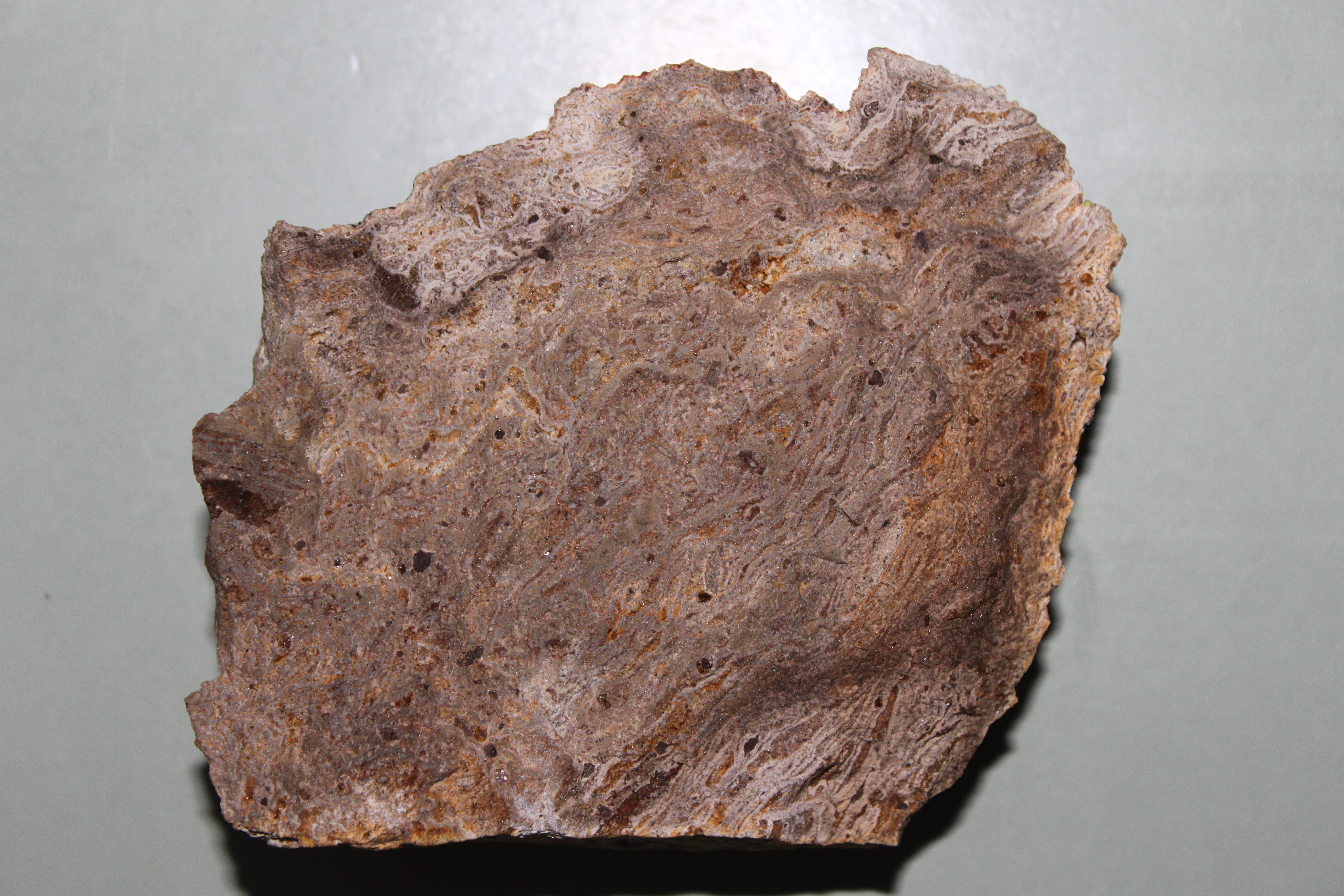
The oldest eruptions of the Banks Peninsula occurred between 11–9.7 Ma around the modern town of Lyttelton. These volcanic rocks rest unconformably on Mount Somers Volcanic Group and Rakaia Terrane. The Lyttelton Volcanic Group is primarily basalt and it has been constructed by the formation of five overlapping volcanic cones.[10][1]
The Allandale Rhyolite is composed of rhyolite and dacite banded flows with rare tuffs and obsidian (10.8 Ma). it is conformably overlain by Governors Bay Andesites in the Lyttelton Harbour area.[10]
Mount Herbert Volcanic Group
The Mount Herbert Volcanic Group (9.7–8 Ma) represents the movement of volcanic activity towards the east.[10][1][8]
Akaroa Volcanic Group
The Akaroa Volcanic Group (9–8Ma) are basaltic to trachytic lava flows centred on Akaroa Harbour.[10][1]
Diamond Harbour Volcanic Group

The Diamond Harbour Volcanic Group represents a return of volcanic activity to the western side of the peninsula (7–5.8Ma). The group is mostly made up of basalt, with rare interbedded carbonaceous mud.[10][1]
See also
- List of rock formations of New Zealand
- List of volcanoes in New Zealand
- Stratigraphy of New Zealand
- Volcanology of New Zealand
- Tombolo (coastline landform)
References
- Sewell 1986
- "Banks Peninsula tramping tracks". Department of Conservation. Retrieved 19 June 2017.
- Mortimer et al. 2014
- "Lyttelton eruption 'not possible'". Stuff. Retrieved 2019-02-21.
- Timm 2009
- Hoernle 2006 et al.
- Ring 2012
- Hampton 2010
- Ballance 2009 p.252
- Forsyth 2008 p.29
Bibliography
- Ballance, Peter (2009), New Zealand geology: an illustrated guide (PDF), pp. 1–397, retrieved 2019-02-20
- Forsyth, P.J.; et al. (2008), Geology of the Christchurch area: scale 1:250,000, GNS Science, pp. 1–67, retrieved 2019-02-22
- Hampton, S.J.; Cole, J.W. (2009). "Lyttelton Volcano, Banks Peninsula, New Zealand: Primary volcanic landforms and eruptive centre identification". Geomorphology. Elsevier BV. 104 (3–4): 284–298. doi:10.1016/j.geomorph.2008.09.005. ISSN 0169-555X.
- Hampton, Samuel (2010), Growth, Structure and Evolution the Lyttelton Volcanic Complex, Banks Peninsula, New Zealand, University of Canterbury, pp. 1–311, retrieved 2019-02-22
- Hampton, Sam; Ring, Uwe (2012-11-01). "Faulting in Banks Peninsula: tectonic setting and structural controls for late Miocene intraplate volcanism, New Zealand". Journal of the Geological Society. 169 (6): 773–785. doi:10.1144/jgs2011-167. ISSN 0016-7649.
- Hoernle, K. (2006). "Cenozoic intraplate volcanism on New Zealand: Upwelling induced by lithospheric removal". Earth and Planetary Science Letters. 248 (1–2): 350–367. doi:10.1016/j.epsl.2006.06.001.
- Mortimer, N; Rattenbury, MS; King, PR; Bland, KJ; Barrell, DJA; Bache, F; Begg, JG; Campbell, HJ; Cox, SC; Crampton, JS; Edbrooke, SW; Forsyth, PJ; Johnston, MR; Jongens, R; Lee, JM; Leonard, GS; Raine, JI; Skinner, DNB; Timm, C; Townsend, DB; Tulloch, AJ; Turnbull, IM; Turnbull, RE (2014). "High-level stratigraphic scheme for New Zealand rocks". New Zealand Journal of Geology and Geophysics. 57 (4): 402–419. doi:10.1080/00288306.2014.946062. ISSN 0028-8306.
- Sewell, R. J. (1988). "Late Miocene volcanic stratigraphy of central Banks Peninsula, Canterbury, New Zealand". New Zealand Journal of Geology and Geophysics. 31 (1): 41–64. doi:10.1080/00288306.1988.10417809. ISSN 0028-8306.
- Timm, Christian; Hoernle, Kaj; Van Den Bogaard, Paul; Bindeman, Ilya; Weaver, Steve (2009). "Geochemical Evolution of Intraplate Volcanism at Banks Peninsula, New Zealand: Interaction Between Asthenospheric and Lithospheric Melts". Journal of Petrology. 50 (6): 989–1023. doi:10.1093/petrology/egp029. ISSN 1460-2415.
Другой контент может иметь иную лицензию. Перед использованием материалов сайта WikiSort.org внимательно изучите правила лицензирования конкретных элементов наполнения сайта.
WikiSort.org - проект по пересортировке и дополнению контента Википедии