geo.wikisort.org - Mountains
An Riabhachan is a Scottish mountain in the Skye and Lochalsh district of the Highland council area. It is situated 35 kilometres east of Kyle of Lochalsh standing in an isolated position at the western end of Loch Mullardoch, ten kilometres from any public road.
| An Riabhachan | |
|---|---|
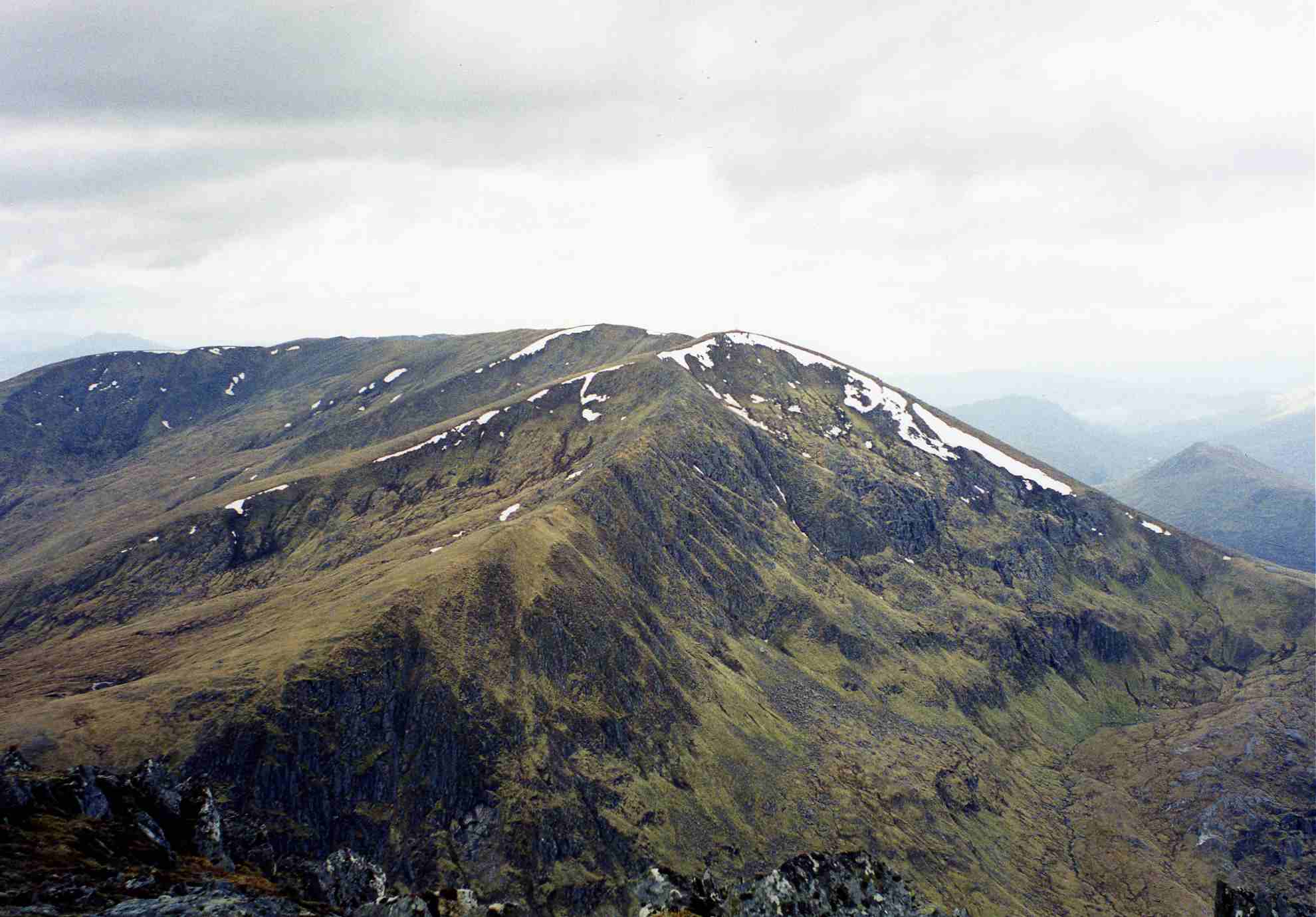 An Riabhachan seen from Sgurr na Lapaich, three kilometres to the east. | |
| Highest point | |
| Elevation | 1,129 m (3,704 ft)[1] |
| Prominence | 302 m (991 ft) |
| Listing | Munro, Marilyn |
| Naming | |
| English translation | The Brindled One |
| Language of name | Gaelic |
| Pronunciation | Scottish Gaelic: [əˈrˠiəvəxan] English approximation: ən-REER-və-khan |
| Geography | |
 An Riabhachan Highland, Scotland | |
| Parent range | Northwest Highlands |
| OS grid | NH133344 |
| Topo map | OS Landranger 25, OS Explorer 414 |
| Listed summits of An Riabhachan | ||||
| Name | Grid ref | Height | Status | |
|---|---|---|---|---|
| South West Top | NH122336 | 1086 m (3563 ft) | Munro Top | |
| West Top | NH117337 | 1040 m (3412 ft) | Munro Top | |
Overview
An Riabhachan reaches a height of 1129 metres (3704 feet) and is one of the highest Munros north of the Great Glen. The mountain's name originates from the Gaelic language and translates as “The Brindled One” which is believed to refer to the flecked effect given by the stone studded turf on the hill.[2]
Geography
An Riabhachan is a mainly grassy mountain. The only rocky area is at the north-east end of the summit ridge, above the fine craggy coire of Coire Gnada containing the lochans of Loch Mòr and Loch Beag. The east ridge links to the adjacent Munro of Sgurr na Lapaich and follows the steep edge above Coire Gnada. The mountain has a 2.5 km long summit ridge which does not drop below 1000 metres throughout its length and contains three other high points. At the north east end of the summit ridge is the NE Top with a height of 1125 metres. In the 1921 revision of Munro's Tables it was named as the principal summit of the mountain, but reverted to the current summit in the 1933 and subsequent editions. It was deleted from the list of Munro Tops in 1997.[3]
With the demise of the NE Top, An Riabhachan has been left with just two subsidiary Tops. The West Top with a height of 1040 metres stands at the western end of the summit ridge, before descending to the Bealach Bholla and reascending to the adjoining Munro of An Socach. The South West Top lies 700m SE of the West Top and has a height of 1086 metres.[4] The summit ridge falls away on both sides over grassy slopes to Loch Mullardoch to the south and to the upper part of Glen Strathfarrar to the north.
Ascents
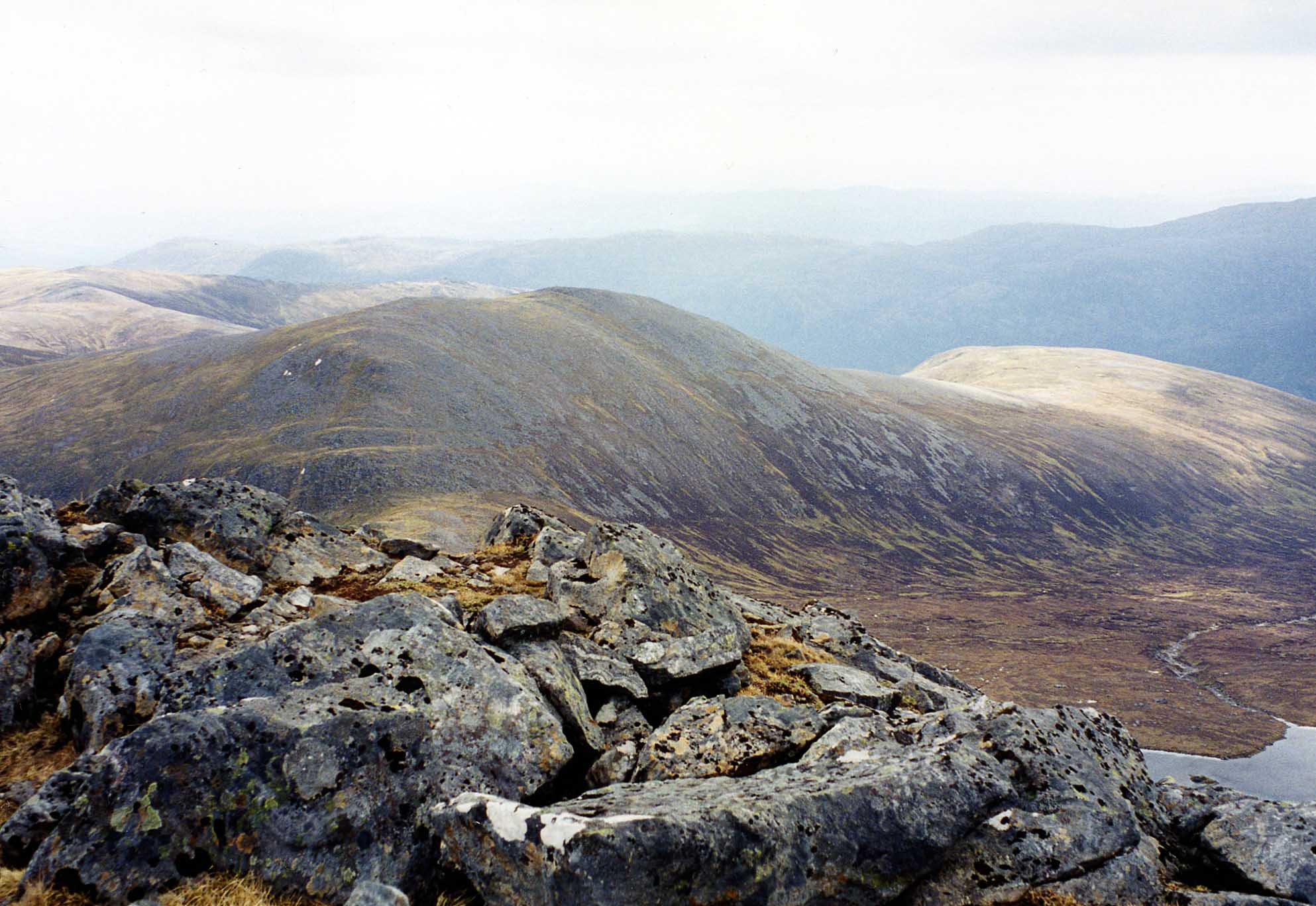
The mountain is usually climbed together with two or three of the other Munros on the north side of Loch Mullardoch. The most convenient ascent of all four Munros starts at the Mullardoch dam in Glen Cannich (grid reference NH219316) and proceeds 9 km along the loch's northern shore before climbing An Socach, continuing to An Riabhachan and returning via Sgurr na Lapaich and Càrn nan Gobhar. The long walk along the shore can be bypassed by hiring a boat, currently available between 1 April and 1 August.[5] The walk can be shortened by omitting An Socach, but it is better to include it if you can as there is no easier access to this remote Munro.
The alternative route starts in Glen Strathfarrar to the north at the hydroelectric power station in Gleann Innis (grid reference NH182381), reached by a 17-mile drive from Struy along a private road; the locked gate at the entrance to this road is opened at specified times to give access to vehicles.[6] From the power station a stalkers' path leads to the Bealach Toll an Lochain between An Riabhachan and Sgurr na Lapaich, from where there is a further climb west of over 300 metres to reach the summit. A return to the power station can be made over Sgurr na Lapaich and Càrn nan Gobhar.
See also
References
- "walkhighlands An Riabhachan". walkhighlands.co.uk. 2014. Retrieved 9 January 2014.
- "The Magic of the Munros" Page 148 Gives details of translated name.
- The Munros and Tops 1891-1997. Spreadsheet giving details of changes in successive editions of Munro's Tables.
- Database of British and Irish Hills. Retrieved 19 February 2012.
- http://www.scottishsport.co.uk/walking/mullardoch.htm Archived 2008-11-21 at the Wayback Machine Contact details for boatman.
- Strathfarrar Access Arrangements
External links
- The Munros, Scottish Mountaineering Trust, 1991, Donald Bennett (Editor) ISBN 0-907521-13-4
- The High Mountains of Britain and Ireland, Diadem, 1993, Irvine Butterfield, ISBN 0-906371-30-9
- The Magic Of The Munros, Irvine Butterfield, ISBN 0-7153-2168-4
- Hamish’s Mountain Walk, Baton Wicks, 1996, Hamish Brown, ISBN 1-898573-08-5
Munros of Scotland: Kyle of Lochalsh to Inverness | |||
|---|---|---|---|
 |  | ||
List of Munros | |||
На других языках
[de] An Riabhachan
Der An Riabhachan ist ein 1.129 m (3.704 ft) hoher Berg in den schottischen Highlands. Der gälische Name des als Munro eingestuften Gipfels bedeutet etwa Der Graugestreifte, der Graugescheckte.[1]- [en] An Riabhachan
Другой контент может иметь иную лицензию. Перед использованием материалов сайта WikiSort.org внимательно изучите правила лицензирования конкретных элементов наполнения сайта.
WikiSort.org - проект по пересортировке и дополнению контента Википедии