geo.wikisort.org - Mountains
Allamuchy Mountain is a mountain in Sussex and Warren Counties, New Jersey. The major peak rises to 1,222 feet (372 m), and is located in Byram Township. The mountain also covers portions of Allamuchy Township in Warren County and Green Township in Sussex County. It overlooks the Musconetcong River to the southeast, and forms part of the divide between that river and the Pequest to the northwest. It is part of the New York–New Jersey Highlands of the Reading Prong.
| Allamuchy Mountain | |
|---|---|
 View from Rutherfurd Hall estate | |
| Highest point | |
| Elevation | 1,222 ft (372 m) NGVD 29[1] |
| Coordinates | 40°56′08″N 74°46′23″W[2] |
| Geography | |
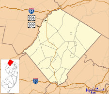 Allamuchy Mountain Sussex County, New Jersey, U.S. 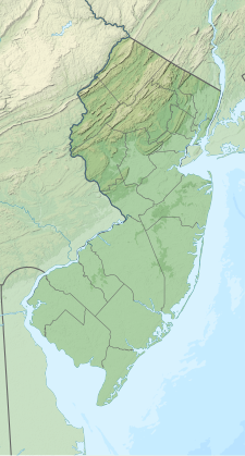 Allamuchy Mountain Allamuchy Mountain (New Jersey) 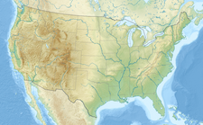 Allamuchy Mountain Allamuchy Mountain (the United States) | |
| Topo map | USGS Tranquility |
| Climbing | |
| Easiest route | Hiking |
Allamuchy Mountain State Park covers portions of the mountain.
History
An 1834 description read,
Alamuche Mountain is one of the chain of hills which bounds the valley of the Musconetcong creek in Warren county.[3]
References
- Verified elevation from USGS topographic map Tranquility
- "Allamuchy Mountain". Geographic Names Information System. United States Geological Survey. Retrieved 2014-04-06.
- Gordon, Thomas Francis (1834). A Gazetteer of the State of New Jersey - Thomas F. Gordon - Google Books. Retrieved April 6, 2014.
This Sussex County, New Jersey state location article is a stub. You can help Wikipedia by expanding it. |
This Warren County, New Jersey state location article is a stub. You can help Wikipedia by expanding it. |
Другой контент может иметь иную лицензию. Перед использованием материалов сайта WikiSort.org внимательно изучите правила лицензирования конкретных элементов наполнения сайта.
WikiSort.org - проект по пересортировке и дополнению контента Википедии