geo.wikisort.org - Bergen
Der Muhabura (auch Muhavura oder Muhawura) ist ein Vulkan auf der Grenze von Ruanda und Uganda und gehört zur Virunga-Kette. Mit 4127 m ist der Muhabura der dritthöchste der acht Virunga-Vulkane. Der Berg liegt innerhalb des Volcanoes Nationalpark in Ruanda und zu einem kleinen Teil im Mgahinga-Gorilla-Nationalpark in Uganda. Für Touristen ist der Berg von ugandischer Seite aus erschlossen. Auf der Spitze liegt ein kleiner Kratersee.

| Muhabura | ||
|---|---|---|

Muhabura (rechts) und Gahinga | ||
| Höhe | 4127 m | |
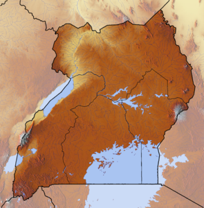
| Lage | Grenze Uganda / Ruanda | |
| Gebirge | Virunga-Vulkane | |
| Koordinaten | 1° 23′ 0″ S, 29° 40′ 40″ O | |
| ||
| Typ | Schichtvulkan | |
Literatur
- Stichwort: Muhawura. Online in: Deutsches Kolonial-Lexikon, Band II, Leipzig 1920, S. 598.
- Stichwort: Virunga. Online in: Deutsches Kolonial-Lexikon, Band III, Leipzig 1920, S. 627 f.
Weblinks
- Muhabura im Global Volcanism Program der Smithsonian Institution (englisch)
- Muhabura auf Peakbagger.com (englisch)
На других языках
- [de] Muhabura
[en] Mount Muhabura
Mount Muhabura, also known as Mount Muhavura, is an inactive volcano in the Virunga Mountains on the border between Rwanda and Uganda. At 4,127 metres (13,540 ft) Muhabura is the third highest of the eight major mountains of the mountain range, which is a part of the Albertine Rift, the western branch of the East African Rift. Its summit contains a small crater lake. The limited evidence for this volcano suggests that it last erupted some time in the Holocene, but the exact date is not known. Muhabura is partly in the Volcanoes National Park, Rwanda and partly in the Mgahinga Gorilla National Park, Uganda.[fr] Muhavura
Le Muhavura, également appelé Muhabura ou Muhavuru[1], est un volcan situé sur la frontière entre le Rwanda et l'Ouganda[2],[3].[it] Muhabura
Il Monte Muhabura, conosciuto anche come Monte Muhavura, è un vulcano spento nella catena dei Monti Virunga posto al confine tra Ruanda e Uganda. Con i suoi 4.127 metri sul livello del mare il Muhabura è il terzo per altezza delle otto principali vette della catena montuosa, che è parte della Rift Valley. Muhabura si trova in parte nel Volcanoes National Park in Ruanda e in parte nel Mgahinga Gorilla National Park in Uganda.[ru] Мухавура
Мухавура[2] (руанда Ikirunga cya Muhabura)— стратовулкан, расположенный на границе Руанды и Уганды.Текст в блоке "Читать" взят с сайта "Википедия" и доступен по лицензии Creative Commons Attribution-ShareAlike; в отдельных случаях могут действовать дополнительные условия.
Другой контент может иметь иную лицензию. Перед использованием материалов сайта WikiSort.org внимательно изучите правила лицензирования конкретных элементов наполнения сайта.
Другой контент может иметь иную лицензию. Перед использованием материалов сайта WikiSort.org внимательно изучите правила лицензирования конкретных элементов наполнения сайта.
2019-2026
WikiSort.org - проект по пересортировке и дополнению контента Википедии
WikiSort.org - проект по пересортировке и дополнению контента Википедии