geo.wikisort.org - Bergen
Mount Galloway ist der höchste Berg der neuseeländischen Antipoden-Inseln im Südpazifik, rund 770 km südöstlich der Südinsel Neuseelands gelegen. Er liegt im Zentrum von Antipodes Island, der Hauptinsel des Archipels und erreicht eine Höhe von 366 m,[1] nach anderen Quellen auch 402 m[2] über dem Meer. Mount Galloway stellt die höchste Erhebung eines Vulkans von Typ Pyroklastischer Kegel aus dem Holozän dar.[2]
| Mount Galloway | ||
|---|---|---|
| Höhe | 366 m | |
| Lage | Antipoden-Inseln, Neuseeland | |
| Koordinaten | 49° 41′ 4″ S, 178° 46′ 52″ O | |
| ||
| Besonderheiten | Höchster Berg der Antipoden-Inseln | |
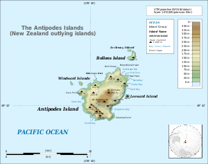
Topographische Karte der Antipoden-Inseln | ||

Weblinks
- Mount Galloway auf Peakbagger.com (englisch)
Einzelnachweise
- Detaillierte topographische Karte von Land Information New Zealand (JPG)
- Mount Galloway im Global Volcanism Program der Smithsonian Institution (englisch)
На других языках
- [de] Mount Galloway
[en] Mount Galloway
Mount Galloway is the highest point on Antipodes Island, one of New Zealand's outlying islands. It rises to a height on 366 metres (1,201 ft).[1] It is part of the most recently active volcano in the group, but there is no exact eruption date known.[1] Mount Galloway together with Mount Waterhouse are probably formed during the most recent eruption. They are at least as old as the Holocene era.Текст в блоке "Читать" взят с сайта "Википедия" и доступен по лицензии Creative Commons Attribution-ShareAlike; в отдельных случаях могут действовать дополнительные условия.
Другой контент может иметь иную лицензию. Перед использованием материалов сайта WikiSort.org внимательно изучите правила лицензирования конкретных элементов наполнения сайта.
Другой контент может иметь иную лицензию. Перед использованием материалов сайта WikiSort.org внимательно изучите правила лицензирования конкретных элементов наполнения сайта.
2019-2026
WikiSort.org - проект по пересортировке и дополнению контента Википедии
WikiSort.org - проект по пересортировке и дополнению контента Википедии