geo.wikisort.org - Bergen
Die Cook Mountains sind eine Gruppe von Berggipfeln in der antarktischen Ross Dependency. Sie ragen zwischen dem Mulock- und dem Darwin-Gletscher auf.
| Cook Mountains | ||
|---|---|---|
| Lage | Ross Dependency, Antarktika | |
| Teil des | Transantarktischen Gebirges | |
|
| ||
| Koordinaten | 79° 25′ S, 158° 0′ O | |
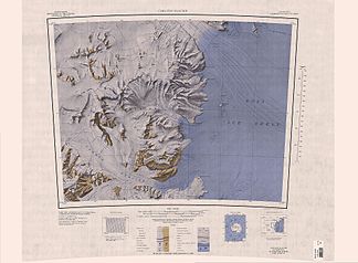
 Karte von 1963 mit den Cook Mountains und Darwin Mountains | ||
Erstmals gesichtet wurden sie durch Teilnehmer der Discovery-Expedition (1901–1904) vom Ross-Schelfeis. Kartografisch erfasst wurden die Cook Mountains jedoch erst durch die neuseeländische Mannschaft der Commonwealth Trans-Antarctic Expedition (1955–1958) und schließlich vom United States Geological Survey mithilfe von Luftaufnahmen zwischen 1959 und 1963. Benannt wurden sie durch das New Zealand Antarctic Place-Names Committee nach dem Seefahrer und Entdecker James Cook (1728–1779).
Weblinks
- Cook Mountains im Geographic Names Information System des United States Geological Survey (englisch)
- Cook Mountains auf geographic.org (englisch)
На других языках
- [de] Cook Mountains
[en] Cook Mountains
The Cook Mountains is a group of mountains bounded by the Mulock and Darwin glaciers in Antarctica. Parts of the group were first viewed from the Ross Ice Shelf by the British National Antarctic Expedition (1901–04). Additional portions of these mountains were mapped by a New Zealand party of the CTAE (1956–58), and they were completely mapped by the USGS from Tellurometer surveys and US Navy air photos, 1959–63.[fr] Chaîne Cook
La chaîne Cook est une chaîne de montagnes située dans la chaîne Transantarctique, dans la Terre Victoria en Antarctique. Elle culmine au mont Longhurst à 2 846 mètres d'altitude.[it] Montagne di Cook
Le montagne di Cook sono una gruppo montuoso dell'Antartide. Situato in particolare nella Terra di Oates, e in particolare in corrispondenza della costa di Hillary, davanti alla barriera di Ross, il gruppo, che fa parte della più vasta catena dei monti Transantartici, si estende in direzione nord-sud per circa 85 km e in direzione est-ovest per circa 60. Il gruppo, la cui vetta più elevata risulta essere quella del monte Longhurst, che arriva a 2846 m s.l.m., è delimitato a nord dal flusso del ghiacciaio Mulock, che lo separa dalla dorsale Worcester, a ovest dall'Altopiano Antartico, a sud dal flusso del ghiacciaio Darwin, che lo separa dalle montagne di Churchill, e a est dalla barriera di Ross. All'interno del gruppo montuoso sono presenti diverse dorsali e sottocatene, tra cui spicca la dorsale Conway, tra le quali scorrono grandi ghiacciai, tra cui i più grandi sono il Carlyon e il Bertoglio.[1]Текст в блоке "Читать" взят с сайта "Википедия" и доступен по лицензии Creative Commons Attribution-ShareAlike; в отдельных случаях могут действовать дополнительные условия.
Другой контент может иметь иную лицензию. Перед использованием материалов сайта WikiSort.org внимательно изучите правила лицензирования конкретных элементов наполнения сайта.
Другой контент может иметь иную лицензию. Перед использованием материалов сайта WikiSort.org внимательно изучите правила лицензирования конкретных элементов наполнения сайта.
2019-2025
WikiSort.org - проект по пересортировке и дополнению контента Википедии
WikiSort.org - проект по пересортировке и дополнению контента Википедии
