geo.wikisort.org - Isla
La isla Berezán (en ucraniano y ruso: Березань) es una isla del mar Negro localizada a la entrada del limán del Bug y Dniéper (en Ucrania).
| Isla Berezán | ||
|---|---|---|
| Березань | ||
 | ||
| Ubicación geográfica | ||
| Mar | Mar Negro | |
| Coordenadas | 46°35′55″N 31°24′37″E | |
| Ubicación administrativa | ||
| País |
| |
| División | Raión de Ochakiv | |
| Óblast | Óblast de Nicolaiev | |
| Características generales | ||
| Superficie | 0,236 | |
| Longitud | 900 m | |
| Anchura máxima | 320 m | |
| Punto más alto | (21 metros) | |
| Población | ||
| Población | 0 hab. (2019) | |
| Mapa de localización | ||
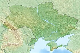 Isla Berezán Geolocalización en Ucrania | ||
 Isla Berezán Geolocalización en el óblast de Mykolaiv | ||
Historia
La isla fue sede de la colonia griega de Borístenes, llamada así a partir del nombre griego del río Dniéper. Fue fundada por colonos de Mileto hacia el año 647 a. C.[1] El historiador griego Heródoto la visitó en el siglo V a. C.
En la Edad Media fue una estación militar de Kiev, y fue allí donde los rusos entraron en contacto con los bizantinos. Los rusos la llamaban Beloberezhye (Orillas Blancas). Un tratado entre Bizancio y Kiev estableció que los rusos podían usar la isla en verano. Sviatosvlav I se retiró el invierno del 971 al 972 tras su paso por Dorostolon.
Entre los siglos XVI y XVII fue una fortaleza de los cosacos zaporogos contra los tártaros de Crimea. Pasó a Rusia después de la conquista de Ochákov, cerca de la antigua Olbia (Escitia).
La colonia ha sido excavada desde el siglo XIX y se han descubierto numerosas tumbas y restos.
Véase también
- Geografía de Ucrania
- Geografía de Europa
 Wikimedia Commons alberga una categoría multimedia sobre Isla Berezán.
Referencias
- Adolfo J. Domínguez Monedero, La polis y la expansión colonial griega. Siglos VIII-VI, p.18, Madrid: Síntesis (1993), ISBN 84-7738-108-9.
| Control de autoridades |
|
|---|
 Datos: Q9454297
- Multimedia: Berezan Island
На других языках
[de] Beresan (Insel)
Beresan (ukrainisch und russisch Березань, altgriechisch Βορυσθένης .mw-parser-output .Latn{font-family:"Akzidenz Grotesk","Arial","Avant Garde Gothic","Calibri","Futura","Geneva","Gill Sans","Helvetica","Lucida Grande","Lucida Sans Unicode","Lucida Grande","Stone Sans","Tahoma","Trebuchet","Univers","Verdana"}Borysthenēs, Ἅγιος Αἰθέριος Hagios Aitherios, Heiliger Aitherios, altrussisch Белобережье Belobereschje) ist eine Insel im Schwarzen Meer in der Nähe des Dnepr-Bug-Limans.[en] Berezan Island
Berezan (Cyrillic: Береза́нь; Ancient Greek: Borysthenes; former Turkish: Pirezin) is an island in the Black Sea at the entrance of the Dnieper-Bug Estuary, Ochakiv Raion, Mykolaiv Oblast, Ukraine. Located 8 kilometers from the city of Ochakov and 4 kilometers from the resort village of Rybakovka. It is often being confused with the artificial island of Pervomaisky that is located within Dnieper-Bug Estuary. The Berezan island measures approximately 900 metres in length by 320 metres in width, the height of the northern part is 3-6 metres, the southern part is 21 metres. It is separated from the mainland (to which it may have been connected long ago) by about a mile and a half of shallow water. Berezan is an integral part of the historical and archaeological reserve of the National Academy of Sciences of Ukraine "Olvia". The island is uninhabited. In the summer, archaeological expeditions of the IA NASU and the State Hermitage Museum work here. The archaeological site is regularly destroyed as a result of unauthorized excavations.[1]- [es] Isla Berezán
[fr] Île de Berezan
Berezan est une île de la mer Noire, à l'embouchure de l'estuaire du Dniepr et du Boug méridional, à 8 km d'Otchakiv, en Ukraine.[ru] Березань (остров)
Береза́нь (укр. Березань) — остров в Чёрном море, в 8 километрах от города Очаков и в 4 километрах от курортного посёлка Рыбаковка. Наряду с островом Змеиный является одним из немногих островов Чёрного моря, сложенных коренными породами, а не образованных аккумулятивной деятельностью вод. Административно входит в Очаковский район Николаевской области. В длину около километра, в ширину около полукилометра, высота северной части 3—6 м, южной — 21 м. Березань является составной частью историко-археологического заповедника Национальной Академии наук Украины «Ольвия». Остров необитаем. В летний период здесь работают археологические экспедиции ИА НАНУ и Государственного Эрмитажа. Археологический памятник регулярно разрушается в результате несанкционированных раскопок.Другой контент может иметь иную лицензию. Перед использованием материалов сайта WikiSort.org внимательно изучите правила лицензирования конкретных элементов наполнения сайта.
WikiSort.org - проект по пересортировке и дополнению контента Википедии