geo.wikisort.org - Island
The Écréhous (or in Jèrriais: Êcrého) are a group of islands and rocks situated six miles (9.6 km) north-east of Jersey, and eight miles (12.8 km) from France. They form part of the Bailiwick of Jersey and are administratively part of the Parish of St. Martin.
Native name: Les Écréhous, Êcrého | |
|---|---|
 Aerial view of the Ecrehos. | |
| Geography | |
| Location | English Channel |
| Coordinates | 49.283°N 1.933°W |
| Major islands | Maîtr'Île La Marmotchiéthe Lé Bliantch'Île |
| Administration | |
Jersey | |
| Parish | Saint Martin, Jersey |
| Demographics | |
| Population | 0 |
Ramsar Wetland | |
| Official name | Les Écréhous & Les Dirouilles, Jersey |
| Designated | 2 February 2005 |
| Reference no. | 1455[1] |
Etymology
The name 'Ecrehous' is Norse in origin. "Esker" as in Skerry meaning a stony bank and 'Hou', the toponym found also in Jethou, Lihou, Brecqhou, Burhou and other islets, derives from holm, meaning island. The first part of the name appears to be traced back to the Norse word sker, meaning reef. The Ecrehos are actually, geologically, part of the same island group as Les Dirouilles (west) and Les Pierres de Lecq ('the Paternosters') (further west).
Islets
The most significant islets in the group are:
- Maîtr'Île
- La Marmotchiéthe ('La Marmotière' in gallicized form)
- Lé Bliantch'Île (La Blanche Île in gallicized form);
others include:
- Les D'mies
- La Grand' Naithe
- L'Etchièrviéthe
- Lé Fou
- La Froutchie
All but the three largest are submerged at high tide. There are no permanent residents on the islands and there is no fresh water there. Due to erosion, they are now much smaller than they may have been within historic times. Maîtr'Île, the largest of the islets, is about 300 metres (0.19 mi) long.[2] There is a small number of fishermen's huts, some used as holiday residences, on the largest islets, and one official building, a customs house, on La Marmotchiéthe.
History

During the last ice age, sea levels were lower and the islands were high ground above a plain that connected the European Continent with southern England.
Sovereignty
The islets, along with the other Channel Islands and the Cotentin Peninsula, were annexed to the Duchy of Normandy in 933. After William, Duke of Normandy conquered England in 1066 the islands remained united to the Duchy until the conquest of mainland Normandy in 1204 by Philip Augustus. In 1259 Henry III did homage to the French king for the Channel Islands. While Edward III in the 1360 Treaty of Brétigny waived his claims to the crown of France and to Normandy, he reserved various territories to England.
Chapel and Priory
In 1203, shortly before the division of Normandy in 1204, John, Duke of Normandy granted the Ecrehos to the Abbey of Val-Richer that they might build a church there. The chapel measured 10 feet 3 inches (3.12 m) in width and 16 feet 6 inches (5.03 m) in length; the priory accommodation for the monks formed an extension to the chapel.[3] In 1309 it was reported that a prior was living in the Ecrehos with one monk and a servant; a navigation light was lit every night.[3]
In 1413 alien priories were suppressed, and the monks returned to Val-Richer. Their church and priory on La Maîtr'Île fell into ruins.[4]
Uses
In the 17th century the Ecrehos were used by smugglers. It was recorded that the main smuggled goods in the 1690s through the Ecrehos was lead and gunpowder destined for St Malô.[5]
In order to help control voting in Jersey, it was not unknown for citizens to find themselves taken and stranded on the Islands until after voting had taken place.[5]: 72
Long-term residents
Though they are only inhabited sporadically by holidaymakers and fishermen, in the past there have been more permanent residents on the Ecrehos due to more abundant vegetation. Two eccentrics who lived on the Ecrehos for a long time proclaimed themselves to be Le Roi des Écréhous[citation needed] (The King of the Ecrehous) and claimed that sovereignty over the islands belonged to them. Philippe Pinel lived on Bliantch'Île from 1848 to 1898 and exchanged gifts with Queen Victoria. In the 1960s and 1970s Alphonse Le Gastelois found refuge in the islands from unfounded public suspicion of being the Beast of Jersey (a notorious sexual attacker of children who was later arrested, thus clearing Le Gastelois of suspicion).
Resolution of disputed status
In the 19th and early 20th centuries there were several occasions on which nominal control was displayed – e.g. flags and buoys, and there were several occasions on which the British government indicated to the French government that it wished to settle the matter.
In 1950 France took the United Kingdom to the International Court of Justice (ICJ) for discussions to decide to which country the Minquiers and Ecrehos belonged. The French fished in the waters, but Jersey exercised various administrative rights. In the Minquiers and Ecrehos case, the ICJ considered the historical evidence, and in its judgment of 17 November 1953 awarded the islands to Jersey.[6]
On currency
La Marmotchiéthe is depicted on the 2010 issue Jersey 50 pound note.
Protected status
In 2005, the States of Jersey designated it as an area under the Ramsar convention, signifying it was a wetland of international importance and giving it an enhanced status and recognition.[7] A management plan for the area has yet to be published. There was a public consultation in 2010 into Jersey's management of Ramsar areas but the results were not made public.
In 2022, four areas of Les Ecréhous islands were introduced under Jersey's wildlife law. This decision was made in order to protect the breeding activities and nesting of wild birds, some of them including European shags, great cormorants, common terns, the roseate terns, and oystercatchers. In practice, this means unauthorized people cannot enter during breeding periods, the speed of boats is limited, dogs may not enter, and the use of drones, lasers, and fireworks is prohibited.[8]
Pilotage and sailing
Entrance to the islands can be difficult. However, it is possible to visit at all states of tide with the main entrance from the southwest.[9]
Gallery
 19th century illustration
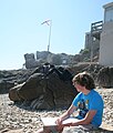 Maîtr'Île Flag Mast 2008
 Maîtr'Île Flag Mast 2008
 Maîtr'Île from the South
 Looking South from Maîtr'Île


Footnotes
- "Les Écrehous & Les Dirouilles, Jersey". Ramsar Sites Information Service. Retrieved 25 April 2018.
- Coysh, Victor (1985). Channel Islets: The Lesser Channel Islands. Guernsey Press Co Ltd. ISBN 0902550128.
- Balleine's History of Jersey. p. 26. ISBN 1860776507.Balleine's History of Jersey, 1998
- Balleine, George Reginald (1951). 'The Bailiwick of Jersey'. Hodder & Stoughton Ltd. ISBN 0340002670.
- Cooper, Glynis. Foul Deeds and Suspicious Deaths in Jersey. Casemate Publishers, 2008. ISBN 9781845630683.
- "Minquiers and Ecrehos (France/United Kingdom): Summary of the judgment of 17 November 1953". icj-cij.org. International Court of Justice.
- "Les Écrehous & Les Dirouilles, Jersey". rsis.ramsar.org. Ramsar Sites Information Service.
- "Islands get special protection status for birds". BBC News. Retrieved 13 April 2022.
- Carnegie, Peter (2015). Channel Islands, Cherbourg Peninsula & North Brittany. RCC Pilotage Foundation. pp. 131–135. ISBN 9781846234439.
References
- Files on the ICJ case can be found in the National Archives, mostly in the FO 371 sequence.
- Les Ecrehous, Jersey: History and Archaeology of a Channel Island Archipelago (ISBN 0-901897-21-3) by Warwick Rodwell.
- Histoire des Minquiers et des Écréhous. Robert Sinsoilliez. Éditions l'Ancre de Marine.
External links
- Les Écréhous: a Toponymy
- International Court of Justice: The Minquiers and Ecrehos Case
- (in French), Accord commercial sur la pêche entre la France et Jersey
- The Écréhous
- Video "Les Écréhou, petit bijou anglo-normand" by MancheLibre
- Sentence of the International Court of Justice
| Authority control |
|
|---|
На других языках
- [en] Écréhous
[fr] Écréhou
Les Écréhou sont un petit archipel anglo-normand formé d’îles et de rochers situés dans la mer de la Manche. Certaines des îles sont submergées par la marée haute, la plupart de ces îlots sont inhabitables.[ru] Экреу
Экреу́ (Экрихос или Лез-Экреу) (фр. Les Écréhous, норманд. Êcrého) — группа островов и скал, расположенная в шести километрах к северо-востоку от Джерси и входящая в его состав в приходе Сент-Мартин.Другой контент может иметь иную лицензию. Перед использованием материалов сайта WikiSort.org внимательно изучите правила лицензирования конкретных элементов наполнения сайта.
WikiSort.org - проект по пересортировке и дополнению контента Википедии