geo.wikisort.org - Island
Viti Levu (pronounced [ˈβitʃi ˈleβu]) is the largest island in the Republic of Fiji. It is the site of the nation's capital, Suva, and home to a large majority of Fiji's population.
This article needs additional citations for verification. (September 2016) |
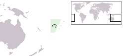
 Map of Fiji showing Viti Levu (one of its major islands) | |
 | |
| Geography | |
|---|---|
| Location | Pacific Ocean |
| Coordinates | 17°48′S 178°0′E |
| Archipelago | Viti Levu Group |
| Area | 10,388 km2 (4,011 sq mi) |
| Area rank | 75th |
| Length | 146 km (90.7 mi) |
| Width | 106 km (65.9 mi) |
| Highest elevation | 1,324 m (4344 ft) |
| Highest point | Tomanivi |
| Administration | |
Fiji | |
| Division | Western Division and Central Division |
| Largest settlement | Suva (pop. 93,970) |
| Demographics | |
| Population | 740,000 (2022) |
| Pop. density | 55.83/km2 (144.6/sq mi) |
| Ethnic groups | Native Fijians (54.3%), Indo-Fijians (38.1%); other (Asian, Europeans, other Pacific Islander) (7.6%) |
Geology
Fiji lies in a tectonically complex area between the Australian Plate and the Pacific Plate. The Fiji Platform lies in a zone bordered by active extension fault lines, around which most of the shallow earthquakes in the area have been centred. These fault lines are: the Fiji Fracture Zone (FFZ) to the north; the 176° Extension Zone (176°E EZ) to the west; and the Hunter Fracture Zone (HFZ) and Lau Ridge to the east.[1]
The oldest rocks on the island are those formed during the Eocene and Lower Miocene epochs that belong to the Wainimala group. The lower portion of the group is made up of volcanic flows and volcanoclastics, which grade from basalt to trachyte and rhyolite. Geographically, this group is found south of Nadi, including on the peaks of Koromba (at 3528 feet high) and Natambumgguto (at 1242 feet high), and down to Sigatoka. From Sigatoka, the group extends almost all the way to Lodoni, and includes the peaks of Tuvutau (at 3060 feet) and Tikituru (at 3071 feet). Along the southern coast it extends almost to Nausori. The group is intruded by the Tholo Plutonics, which consist of similar-age stocks of tonalite, granodiorite, gabbro and diorite. Mio-Pliocene sandstones, and marl, grading into epiclastics and andesitic Volcanic rocks of the Suva group are found mainly in the river valleys, such as those formed by the Nadi River and Navua River. The Plio-Pleistocene Mba group is found in the northern portion of the island. It consists of porphyritic basalt flows and volcanoclastics, grading into greywacke. Geographically, it includes the peaks of Koroyanitu (at 3921 feet), Malua (at 3294 feet), Monavatu (at 3708 feet), Mount Tomanivi (at 4341 feet), and Ndelamendamu (at 2540 feet). It extends along the eastern coast, almost to Nausori, and includes the Emperor Mine near Vatukoula.[2][3].........
Geography, economy and ecology


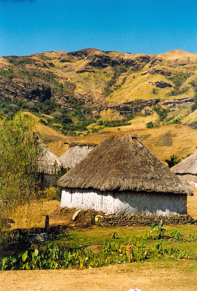
Viti Levu is the largest island in the Republic of Fiji — home to 70% of the population (about 600,000 people) - and is the hub of the entire Fijian archipelago. It measures 146 kilometres (91 mi) long and 106 kilometres (66 mi) wide, and has an area of 10,389 square kilometres (4,011 sq mi). Earthquakes and volcanic eruptions account for the somewhat rugged terrain of the island, which is divided into roughly equal halves by a mountain range that runs north to south. The centre of the island is forested and includes the nation's highest peak Mount Tomanivi (otherwise known as Mount Victoria), which rises to 1,324 metres (4,344 ft).
The eastern side of the island experiences heavy rainfall, particularly in the mountains, and is home to Fiji’s tropical moist forests. The western side (colloquially called the "burning west") is in the mountain range's rain shadow and is noticeably drier; it is home to Fiji’s tropical dry forests. Accordingly, sugar cane production thrives in the west, while a dairy industry is being developed in the east.[citation needed] Fiji's largest cattle ranch, with 7000 head of cattle on 70 square kilometres (17,000 acres), is in Yaqara, midway between Tavua and Rakiraki. The island of Viti Levu is the only known home of one of the world's largest insects, the Giant Fijian long-horned beetle.
The island is susceptible to the effects of climate change. It is estimated that the compound effects of sea level rise and storm surge may result in a temporary relocation of a relatively high numbers of the inhabitants of Viti Levu, predominantly the northern and western parts, with an exposure of up to 6.75% of the islands' population in the future.[4]
Localities

Viti Levu is home to the capital city of Suva, and to nearly three quarters of the population of the Republic of Fiji (about 580,000 people). Other important towns, which are spread out all along the coast, include Ba, Lautoka, Nadi, Nausori, Rakiraki, and Sigatoka. Two other well-known localities are Natadola Beach in Natadola, and Pacific Harbour (a resort centre about 50 kilometers from Suva). A single major road runs around the perimeter of Viti Levu.
Politics
Eight of Fiji's fourteen Provinces are in Viti Levu. The Provinces of Ba, Nadroga-Navosa, and Ra comprise the Western Division, while Naitasiri, Namosi, Rewa, Serua, and Tailevu form the Central Division. The political dynamics of western Viti Levu are somewhat different from those of eastern Viti Levu, in part because western Vitu Levu has a high concentration of Indo-Fijians (many of whose ancestors came to the island from India as indentured workers between 1879 and 1916), whereas eastern Viti Levu has a high concentration of indigenous Fijians (except in its urban areas, which are more racially diverse).
History
Prehistory
Viti Levu is believed to have been inhabited longer than the island of Vanua Levu, which lies to its north. According to oral tradition, the first Melanesian settlers landed at Vuda Point and established Viseisei as Fiji's first oldest settlement. There is archaeological evidence contradicting this account.
Transportation
Ferry service, provided by the Patterson Brothers Shipping Company LTD, connects Viti Levu to the rest of the islands.
Nausori International Airport is in the island. It has service on 3 domestic commercial passenger airlines.
Other
The Canadian entrepreneur Peter Munk named his house in Klosters after the island, because Viti Levu was where he and David Gilmour started the Southern Pacific Hotel chain in the 1960s.[5]
References
- Greenbaum, D.; Bowker, M. R; Dau, I; Drospy, H; Greally, K. B; McDonald A. J. W; Marsh, S. H; Northmore, K. J; O'Connor, E. A; Prasad, R. S & Tragheim, D. G. (1995). "Landslide hazards in Fiji" (PDF). Technical Report WC/95/28 Rapid methods of landslide hazard mapping : Fiji case study. British Geological Survey. Retrieved 23 March 2011.
- Provisional Geologic Map of Fiji. Suva: Fiji Geological Survey. 1965.
- Rodda, P. (1967). "Outline of the geology of Viti Levu". New Zealand Journal of Geology and Geophysics. 10 (5): 1260–1273. doi:10.1080/00288306.1967.10420217.
- Sabūnas, Audrius; Mori, Nobuhito; Shimura, Tomoya; Fukui, Nobuki; Miyashita, Takuya (8 April 2022). "Estimating Compounding Storm Surge and Sea Level Rise Effects and Bias Correction Impact when Projecting Future Impact on Volcanic Islands in Oceania. Case Study of Viti Levu, Fiji". Frontiers in Built Environment. doi:10.3389/fbuil.2022.796471.
- "Peter Munk: A mining magnate nears the end of his golden reign" ERIC REGULY. The Globe and Mail 15 March 2014
External links
Authority control | |
|---|---|
| General |
|
| National libraries | |
| Other | |
На других языках
[de] Viti Levu
Viti Levu [.mw-parser-output .IPA a{text-decoration:none}ˈβitʃi ˈleβu] ist die 10.531[1] Quadratkilometer große Hauptinsel der Fidschi-Gruppe im Südpazifik.- [en] Viti Levu
[es] Viti Levu
Viti Levu (Gran Fiyi), situada en las coordenadas 17°48′S 178°0′E, es la isla más grande de Fiyi y una de las más grandes de Oceanía. En ella se encuentra la capital del país, Suva, y gran parte de la población.[fr] Viti Levu
Viti Levu, toponyme tongien signifiant littéralement en français « grande Viti »[1], est la plus grande des îles des Fidji (dont le nom est la prononciation tongienne du mot viti). Elle concentre environ 75 % de la population sur une superficie de 10 388 km2, soit l'équivalent de la taille du Liban, et mesure 146 kilomètres d'est en ouest et 106 kilomètres du nord au sud. C'est par sa taille la troisième île de l'océan Pacifique après l'île d'Hawaï et Grande Terre (Nouvelle-Calédonie).[it] Viti Levu
Viti Levu è la più grande delle isole che compongono l'arcipelago delle Figi.[ru] Вити-Леву
Ви́ти-Ле́ву (англ. Viti Levu) — крупнейший остров Фиджи, расположенный в группе Вити-Леву в Тихом океане.Другой контент может иметь иную лицензию. Перед использованием материалов сайта WikiSort.org внимательно изучите правила лицензирования конкретных элементов наполнения сайта.
WikiSort.org - проект по пересортировке и дополнению контента Википедии