geo.wikisort.org - Island
Koro (village in Fijian) is a volcanic island of Fiji that forms part of the Lomaiviti Archipelago. The Koro Sea is named after this volcanic island, which has a chain of basaltic cinder cones extending from north to south along its crest. With a land area of 103.2 square kilometers (42.1 square Miles), it is the seventh largest island (approximately 5x10 miles) of Fiji. Its latitude is 17.18°; its longitude is 179.24°. Its population as of 2017 census was 2,937 spread across 14 villages on the island. A roll-on, roll-off ferry services Koro weekly from Suva, and also connects Koro to Vanua Levu to the North. Fiji Link provides one scheduled flight per week to Koro, usually on Friday from Nausori Airport.
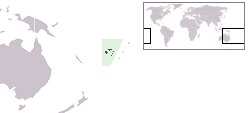
 Map of Fiji | |
 | |
| Geography | |
|---|---|
| Location | Fiji |
| Coordinates | 17°18′00″S 179°24′00″E |
| Archipelago | Lomaiviti |
| Adjacent to | Koro Sea |
| Total islands | 1 |
| Major islands | 1 |
| Area | 105.3 km2 (40.7 sq mi)[1] |
| Area rank | 7th |
| Length | 17 km (10.6 mi) |
| Administration | |
Fiji | |
| Division | Eastern |
| Province | Lomaiviti Province |
| Largest settlement | Nakodu (pop. 500) |
| Demographics | |
| Population | 4,500 (2007) |
| Pop. density | 42.735/km2 (110.683/sq mi) |
| Ethnic groups | Native Fijians, Indo-Fijians ; other (Asian, Europeans, other Pacific Islander) |
The island has been accurately and exotically described by no one better than Captain Bligh of His Majesty’s ship “Providence”. During his historical journey from Tahiti to Batavia in 1789, he wrote, “the island of Koro is of good height, it is easternmost of the islands I discovered and passed and recorded in my log book on May 6, 1789, on the Bounty’s Launch. Nothing can exceed its beauty".
The island has an airport, situated on its eastern coast. On its northwestern tip is situated the Dere Bay Resort[2] and the Koro Beach Resort.[3] A residential subdivision, Koro Seaview Estates[4] was established around Dere Bay Resort in 1989 and about 60 homes have been established in the development as of 2009[update], including a re-constructed 300-year-old home imported from Java, Indonesia. Planting kava and selling copra are the major economic activities for villagers on Koro. Among Fijians, Koro is known as the most fertile island in Fiji, boasting large plantations and thriving tropical forests. Koro has an exception bird life and has been featured in numerous books.. The village of Nacamaki on the northern side of the island does a traditional turtle calling ceremony during which villagers chant songs and turtles rise to the surface.[5] The island has several small medical stations and schools up to High school. A Police Post, Western Union and a Post Office are also on the island.
The US 2d Marines (regiment) of the 2d Marine Division and part of the 1st Marine Division undertook landing rehearsals (Operation DOVETAIL) on Koro in July 1942 before deploying to Guadalcanal. The short-lived 2002 U.S. reality show Under One Roof was filmed on Koro Island. Koro Island was featured on Home and Garden TV's International House Hunters in 2009. The episode was filmed in May 2009.
Transport
Ferry service by Patterson Brothers Shipping Company LTD connects Koro to Viti Levu.
See also
References
- Gillespie, Rosemary G.; D. A. Clague (2009). Encyclopedia of Islands. University of California Press. p. 299. ISBN 978-0520256491.
- "Dere Bay Resort | A beautiful resort on Koro Island in Fiji". Archived from the original on 2019-05-31. Retrieved 2020-02-19.
- "Koro Beach Resort Fiji". Archived from the original on 2018-08-07. Retrieved 2020-02-19.
- "Koro Sea beach front property view - Fiji real estate". Archived from the original on 2002-09-03. Retrieved 2020-02-19.
- "- YouTube". YouTube.
External links
- "Koro". Global Volcanism Program. Smithsonian Institution. Retrieved 2021-06-28.
- - Information about Koro Island and Owners community of Koro Seaview Estates
- - Information on Travel to and Living on Koro and the Koro Beach Resort
- - Information on Real Estate on Koro Island
This article about a geographical location in Fiji is a stub. You can help Wikipedia by expanding it. |
На других языках
[de] Koro (Insel)
Koro ist eine Vulkaninsel im Zentrum des Inselstaates Fidschi. Administrativ gehört die Insel zur Provinz Lomaiviti in der Eastern Division. Sie ist eine der Fidschi-Inseln, die von William Bligh im Mai 1789 nach der Meuterei auf der Bounty während der Fahrt in der Barkasse entdeckt wurde.[1][2]- [en] Koro Island
[es] Koro
Koro es una isla volcánica de Fiyi que conforma el archipiélago de Lomaiviti. El mar de Koro lleva el nombre de la localidad, que es una de cadena de conos de ceniza de basalto, la cual se extiende de norte a sur. Con un área de 108,9 km² es la sexta mayor isla de Fiyi. Su latitud es 17° 10' 48" y su longitud 179° 14' 24". En 2007 su población era de cerca de 4500 habitantes, en catorce poblados. Un servicio de ferry lo conecta dos veces a la semana con la capital Suva, así como con Vanua Levu al norte.[fr] Koro (île)
L'île de Koro est une île volcanique de l'océan Pacifique située dans le centre des îles Fidji. Elle fait partie de la province de Lomaiviti.[it] Koro (Figi)
L'isola di Koro (nome che significa villaggio in figiano) è un'isola vulcanica della provincia di Lomaiviti nelle Figi che ha dato il suo nome al mar di Koro.[ru] Коро (остров)
Коро (фидж. Koro) — остров в Фиджи. Административно входит в состав провинции Ломаивичи.Другой контент может иметь иную лицензию. Перед использованием материалов сайта WikiSort.org внимательно изучите правила лицензирования конкретных элементов наполнения сайта.
WikiSort.org - проект по пересортировке и дополнению контента Википедии