geo.wikisort.org - Island
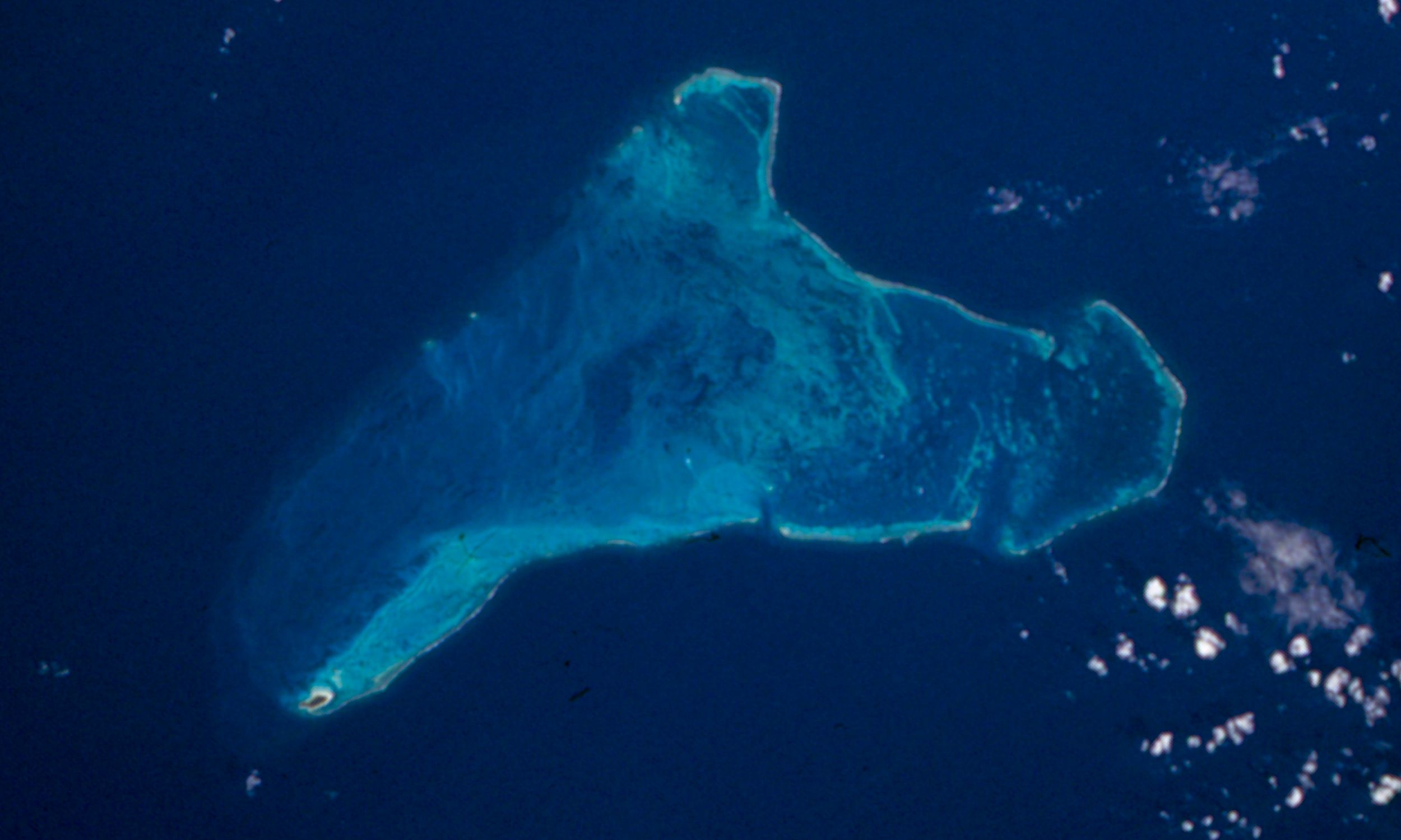
Serrana Bank is a Colombian-administered atoll in the western Caribbean Sea. It is a mostly underwater reef about 50 km long and 13 km wide and has six cays, or islets, the largest of which is Southwest Cay.
 Serrana Bank | |
 Serrana Bank  Serrana Bank | |
| Geography | |
|---|---|
| Location | Caribbean Sea |
| Coordinates | 14°20′N 80°20′W |
| Administration | |
Geography
The cays from south to north are:
- Southwest Cay (500 by 200 meters)[1][2]
- South Cay (150 by 25 meters)[1]
- Little Cay (less than 100 meters in diameter)[1]
- East Cay (80 by 40 meters)[3]
- Narrow Cay
- North Cay
History
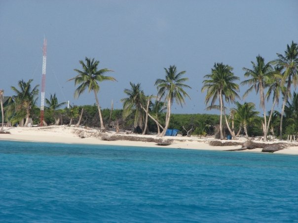
Serrana Bank is believed to be named after the Spanish castaway Pedro Serrano. It was first shown on a Dutch map in 1545 with this name. They were mapped more extensively by the English in 1660. A former base for the US military, it is now mostly visited by lobster fishermen. It is now Colombian territory, though it was formerly claimed by the United States. On September 8, 1972, the two countries signed a treaty recognizing Colombia's sovereignty over Roncador Cay, and Serrana Bank and abandoning American sovereignty over Quita Sueño Bank. A fishing concession was retained by the United States over the three banks. This treaty became effective on September 17, 1981. On November 19, 2012, in regard to Nicaraguan claims to the islands, the International Court of Justice (ICJ) reaffirmed Colombia's sovereignty.[4]
On September 3, 2007 the eye of Category 5 Hurricane Felix passed over Serrana Bank.[5]
See also
References
- Milliman, John D. (15 August 1969), Atoll Research Bulletin No. 129 Four Southwestern Caribbean Atolls: Courtown Cays, Albuquerque Cays, Roncador Bank and Serrana Bank (PDF), The Smithsonian Institution, Washington, DC, USA, retrieved 2013-08-16
- Cortes, Jorge (2003). Latin American Coral Reefs. Gulf Professional Publishing. p. 283. ISBN 978-0444540256.
- "Territorial and Maritime Dispute (Nicaragua v. Colombia). Counter-Memorial of the Republic of Colombia" (PDF). 1. International Court of Justice. 11 November 2008: 30. para. 2.23. Archived from the original (PDF) on 2015-09-15. Retrieved 2013-08-16.
{{cite journal}}: Cite journal requires|journal=(help) - International Court of Justice (2012). "Territorial and maritime dispute (Nicaragua vs Colombia)" (PDF). Retrieved 2012-11-27.
- ElTiempo.com [dead link]
External links
- Light House Details
- Serrana Bank
- Photos at the Wayback Machine (archived December 23, 2010)
| |
| |
| |
| |
| |
| |
| |
| |
|
| Authority control: National libraries |
|---|
На других языках
[de] Serrana Bank
Serrana Bank (spanisch Banco Serrana) ist ein isoliert gelegenes Atoll im südwestlichen Karibischen Meer. Es liegt etwa auf halber Strecke zwischen Jamaika und Costa Rica, 360 km östlich der Küste von Nicaragua. Die größtenteils unter Wasser liegende Korallenbank ist etwa 37 km lang, bis zu 13 km breit und bedeckt ein Meeresgebiet von rund 500 km² Fläche. Sie besteht aus sechs kleinen Cays, von denen Southwest Cay das größte und bekannteste ist. Auf Southwest Cay sowie Narrow Cay befindet sich je ein Leuchtturm, auf North Cay ein kleines, permanent bewohntes Fischerdorf.- [en] Serrana Bank
[es] Banco Serrana
El banco Serrana es un atolón del mar Caribe perteneciente al archipiélago de San Andrés, Providencia y Santa Catalina, el cual es administrado por Colombia.[1][fr] Banc de Serrana
Le banc de Serrana (en espagnol : banco Serrana) est un atoll de la mer des Caraïbes faisant partie de l'archipel de San Andrés, Providencia et Santa Catalina, administré par la Colombie.Другой контент может иметь иную лицензию. Перед использованием материалов сайта WikiSort.org внимательно изучите правила лицензирования конкретных элементов наполнения сайта.
WikiSort.org - проект по пересортировке и дополнению контента Википедии