geo.wikisort.org - Island
Sabana-Camagüey (Spanish: Archipiélago de Sabana-Camagüey) is an archipelago that lies on Cuba's north-central Atlantic coast. It is located off the northern coast of the provinces of Matanzas, Villa Clara, Sancti Spíritus, Ciego de Ávila and Camagüey, and is bounded to the north by the Atlantic Ocean, specifically by the Nicholas Channel (Sabana segment) and Old Bahama Channel (Camagüey segment).
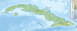
The archipelago is positioned on a general north-west to south-east axis, and stretches for 475 km (295 mi) from the Hicacos Peninsula and Varadero to the Bay of Nuevitas.[1] The entire system covers more than 75,000 km2 (29,000 sq mi)[2] and is composed of approximately 2,517 cays and isles.[1] The eastern islands are grouped in the Jardines del Rey archipelago, and contains Cayo Coco, Cayo Guillermo and Cayo Romano among others.
Conservation
The coastal and marine ecosystem represented by the archipelago is undergoing conservation projects supported by the Global Environment Facility and Environment Canada.[2] Mangroves and coastal forests effectively create a buffer zone between the agricultural coast and the sensitive marine environment.[3] The Sabana-Camagüey ecosystem encompasses the Bay of Buena Vista Biosphere Reserve, the Caguanes National Park, as well as wetlands of northern Ciego de Ávila Province. A total of 35 protected sites are located here.[3]
List of cays
Sabana section
|
Camagüey section
|
See also
- Geography of Cuba
References
- Mapping Interactivo (March 2005). "Mangroves variability in the Sabana-Camaguay Archipellago". Archived from the original on 2007-08-08. Retrieved 2007-10-16.
- Environment Cuba. "Sabana-Camaguey Project" (in Spanish). Archived from the original on 2007-07-07. Retrieved 2007-10-13.
- Radio Habana. "El ecosistema Sabana Camaguey" (in Spanish). Archived from the original on 2007-10-05. Retrieved 2007-10-13.
| |||||||||||||||||||||||||||
| |||||||||||||||||||||||||||
| |||||||||||||||||||||||||||
| |||||||||||||||||||||||||||
| |||||||||||||||||||||||||||
| |||||||||||||||||||||||||||
This Cuban location article is a stub. You can help Wikipedia by expanding it. |
На других языках
[de] Sabana-Camagüey-Archipel
Der Sabana-Camagüey-Archipel (spanisch Archipiélago de Sabana-Camagüey) ist eine Inselkette vor der Nordküste Kubas, die aus einer Vielzahl von Cays besteht. Er befindet sich an den Küsten der Provinzen Matanzas, Villa Clara, Sancti Spíritus, Ciego de Ávila und Camagüey. Der Archipel erstreckt sich von Nordwest nach Südost über eine Länge von 475 km und kann geographisch in einen nordwestlichen Abschnitt (Archipiélago de Sabana) und einen südöstlichen Abschnitt (Archipiélago de Camagüey) unterteilt werden.- [en] Sabana-Camagüey Archipelago
[fr] Archipel Sabana-Camagüey
L'archipel de Sabana-Camagüey (en espagnol : Archipiélago de Sabana-Camagüey) est un archipel qui longe la côte nord de l'île de Cuba, parallèlement au littoral des provinces de Matanzas, Villa Clara, Sancti Spíritus, Ciego de Ávila et Camagüey. Il est délimité au nord par l'océan Atlantique, en particulier par le canal de Nicolas (en) et le vieux canal de Bahama.Другой контент может иметь иную лицензию. Перед использованием материалов сайта WikiSort.org внимательно изучите правила лицензирования конкретных элементов наполнения сайта.
WikiSort.org - проект по пересортировке и дополнению контента Википедии