geo.wikisort.org - Island
Mejlø is a small uninhabited Danish island located in the Kattegat. Mejlø covers an area of 0.4 km2,[1] and the highest point on the island is c. 9 m.[2]
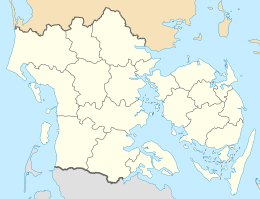  Mejlø | |
| Geography | |
|---|---|
| Coordinates | 55°35′24″N 10°36′50″E |
| Archipelago | South Funen Archipelago |
| Area | 0.4 km2 (0.15 sq mi) |
| Administration | |
Denmark | |
| Region | Region of Southern Denmark |
| Municipality | Kerteminde Municipality |
References
- "Mejlø. Ø-flora nr. 63" (PDF) (in Danish).
- "Mejlø Vildtreservat" (PDF). mst.dk (in Danish).
{{cite web}}: CS1 maint: url-status (link)
Islands of Denmark | ||
|---|---|---|
| Baltic Sea | ||
| Sydhavsøerne | ||
| Kattegat | ||
| South Funen Archipelago |
| |
| Limfjorden |
| |
| Øresund | ||
| Great Belt | ||
| Little Belt | ||
| Wadden Sea | ||
| Other islands | ||

 | This article about an island of Denmark is a stub. You can help Wikipedia by expanding it. |
Текст в блоке "Читать" взят с сайта "Википедия" и доступен по лицензии Creative Commons Attribution-ShareAlike; в отдельных случаях могут действовать дополнительные условия.
Другой контент может иметь иную лицензию. Перед использованием материалов сайта WikiSort.org внимательно изучите правила лицензирования конкретных элементов наполнения сайта.
Другой контент может иметь иную лицензию. Перед использованием материалов сайта WikiSort.org внимательно изучите правила лицензирования конкретных элементов наполнения сайта.
2019-2026
WikiSort.org - проект по пересортировке и дополнению контента Википедии
WikiSort.org - проект по пересортировке и дополнению контента Википедии