geo.wikisort.org - Island
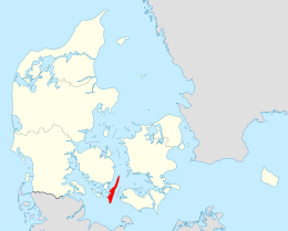
Langeland (Danish: [ˈlɑŋəˌlænˀ] (![]() listen), lit. 'Long land') is a Danish island located between the Great Belt and Bay of Kiel. The island measures 285 km2 (c. 110 square miles) and, as of 1 January 2018, has a population of 12,446.[1] The island produces grain and is known as a recreational and wellness tourism area. A bridge connects it to Tåsinge via Siø – a small island with a population of approx. 20 – and the main island of Funen (to the northwest). There are connections by car ferry to the islands of Lolland, Ærø, and Strynø.
listen), lit. 'Long land') is a Danish island located between the Great Belt and Bay of Kiel. The island measures 285 km2 (c. 110 square miles) and, as of 1 January 2018, has a population of 12,446.[1] The island produces grain and is known as a recreational and wellness tourism area. A bridge connects it to Tåsinge via Siø – a small island with a population of approx. 20 – and the main island of Funen (to the northwest). There are connections by car ferry to the islands of Lolland, Ærø, and Strynø.
 Rudkøbing, Langeland | |
 | |
| Geography | |
|---|---|
| Location | Great Belt |
| Coordinates | 54°55′N 10°45′E |
| Area | 284 km2 (110 sq mi) |
| Administration | |
Denmark | |
| Region | South Denmark Region |
| Municipality | Langeland Municipality |
| Largest settlement | Rudkøbing (pop. 4.658) |
| Demographics | |
| Population | 12,446 (2018) |
| Pop. density | 43.8/km2 (113.4/sq mi) |
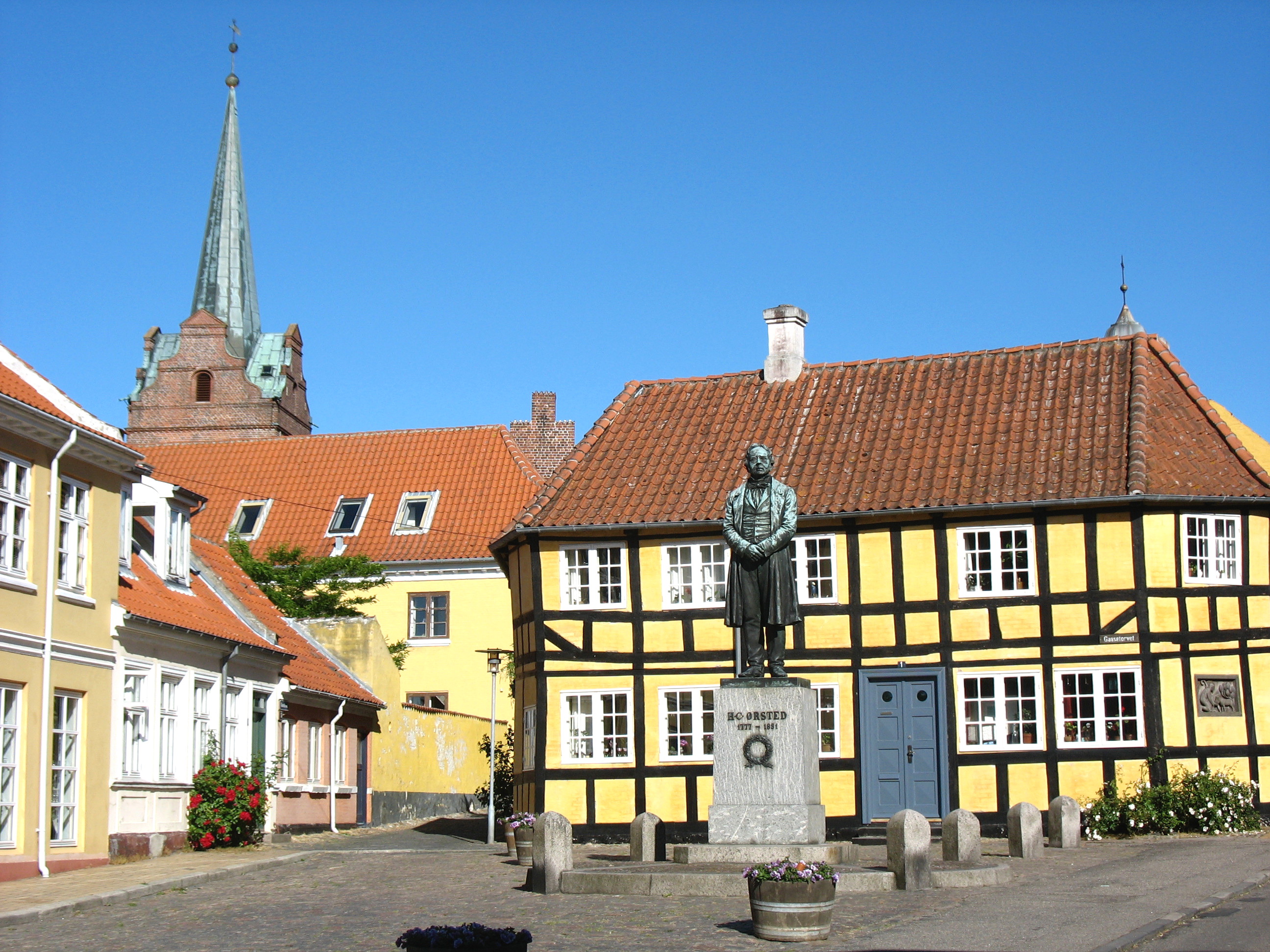
Rudkøbing, the island's largest town, is the birthplace of famous physicist and chemist Hans Christian Ørsted, his brother, Anders Sandøe Ørsted, a former Danish prime minister, and their nephew, botanist Anders Sandøe Ørsted.
Administratively, Langeland and several smaller islands around it form the Municipality of Langeland, the most populous of them being Strynø.
Role in the Larne gun-running
On 30 March 1914, the vessel SS Fanny docked at Langeland and proceeded to be loaded with a "mysterious" cargo.[2] This cargo turned out to be a weapons cache including 11,000 Männlicher rifles brought from the Steyr works in Austria; 9,000 ex-German army Mausers; 4,600 Italian Vetterli-Vitali rifles; and 5 million rounds of ammunition in clips of five.[2] The cache had been purchased by Major Frederick Hugh Crawford for the Ulster Unionist Council to equip the Ulster Volunteer Force in Ireland.[2][3]
Danish customs officials suspected that the cargo might have contained weapons to arm militant Icelandic home rulers who sought independence from Denmark. However the SS Fanny cut loose, escaped in a gale and sailed out of Danish territorial waters.[2]
The weapons cache would later land in Larne on the north-east coast of Ireland in what became known as the Larne gun-running.[2][3]
Gallery
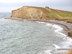 Dovns Klint
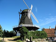 Rudkøbing windmill
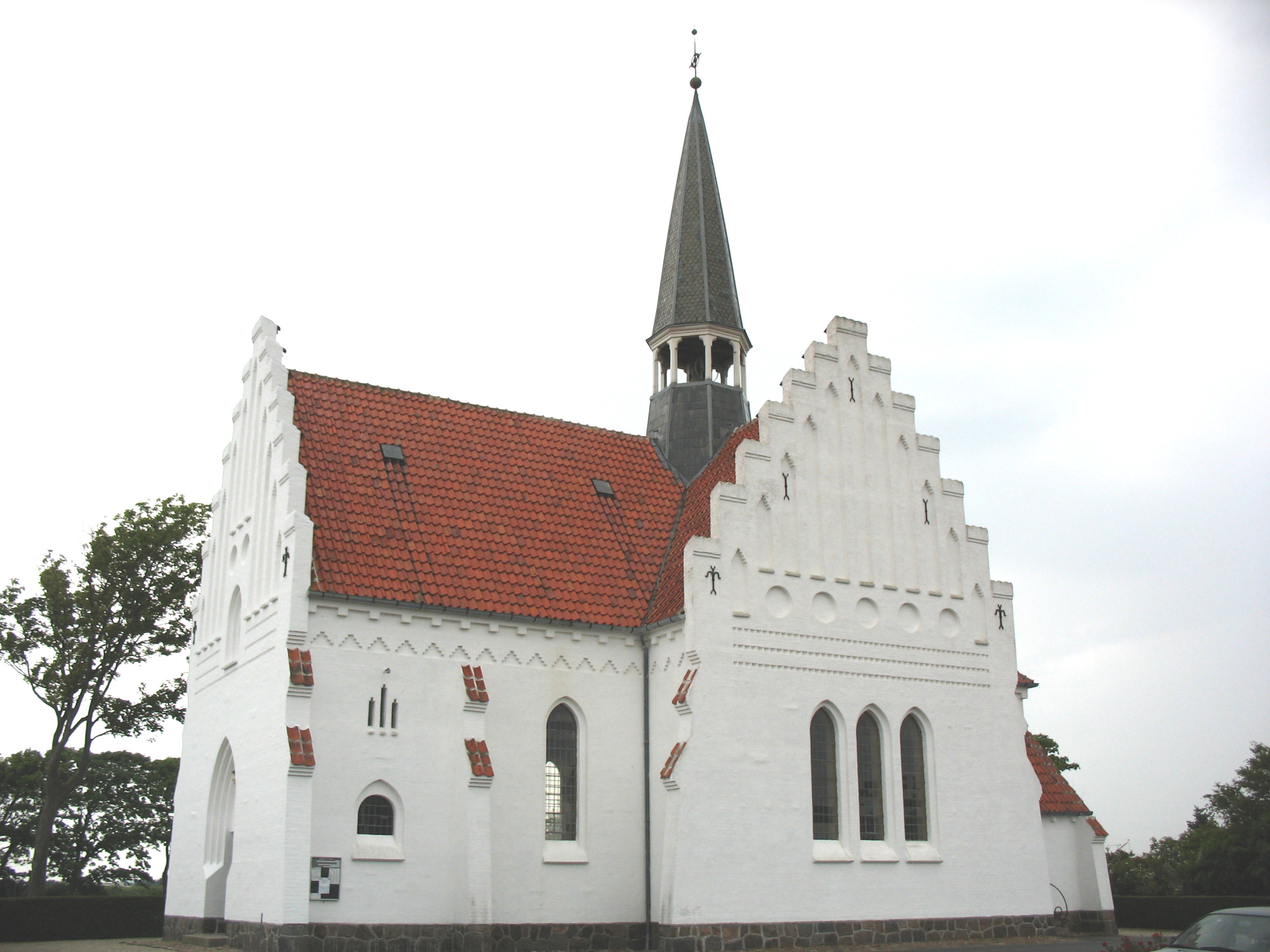
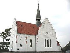 Bagenkop Church
 Rudkøbing market place


See also
| Wikimedia Commons has media related to Langeland. |
- List of Danish islands
- Langeland Municipality
References
- "Danmarks Statistik." Retrieved 14 June 2018.
- Jonathan Bardon, A History of Ulster, published by The Black Staff Press, ISBN 0-85640-764-X
- S. J. Connolly, Oxford Companion to Irish History, published by Oxford University Press, ISBN 978-0-19-923483-7
External links
Islands of Denmark | ||
|---|---|---|
| Baltic Sea | ||
| Sydhavsøerne | ||
| Kattegat | ||
| South Funen Archipelago |
| |
| Limfjorden |
| |
| Øresund | ||
| Great Belt | ||
| Little Belt | ||
| Wadden Sea | ||
| Other islands | ||
Langeland Municipality | ||
|---|---|---|
| Populated places |
|  |
| Landmarks |
| |
| Events |
| |
| Transport |
| |
| Geographical features |
| |
| Archeology |
| |
| Lists |
| |
Authority control | |
|---|---|
| General |
|
| National libraries | |
| Other |
|
На других языках
[de] Langeland
Langeland [.mw-parser-output .IPA a{text-decoration:none}ˈlɑŋəlanʔ] ist eine 52 km lange und bis zu 11 km breite Ostseeinsel in der Region Syddanmark in Dänemark. Sie ist über ein Brückensystem erreichbar, das die Inseln Siø und Tåsinge einschließt und das an das nordwestlich gelegene Fyn (dt.: Fünen) angebunden ist. Die Insel Langeland bildet mit 12.137 Einwohnern (1. Januar 2021)[1] auf 283,84 km²[2] zugleich auch eine Kommune (seit der Kommunalreform 2007). Östlich von Langeland erstreckt sich der Langelandsbelt. Er ist eine südliche Verlängerung des Großen Belts, der einen der dänischen Ostseezugänge bildet. Langeland ist Teil der Inselwelt der sogenannten Dänischen Südsee (im Dänischen: Sydfynske øhav). Am 12. Februar 2003 gab es nur in der Sydlangeland Kommune eine Volksabstimmung für oder gegen einer Zusammenlegung inselweit mit den übrigen zwei Kommunen. Die Abstimmung sprach sich dafür aus. 1992 und 2000 gab es inselweit Volksabstimmungen, und Sydlangeland war in beiden gegen Zusammenlegung.- [en] Langeland
[fr] Langeland (Danemark)
Langeland est une commune du Danemark de la région du Danemark-du-Sud[Note 1], qui tient son nom de l’île de la mer Baltique dont elle épouse le territoire. Elle comptait 12 358 habitants en 2019, pour une superficie de 284 km2[1].[ru] Лангеланн
Лангеланн (дат. Langeland) — остров в Балтийском море, расположенный к западу от пролива Большой Бельт, между островами Фюн и Лолланн. Принадлежит Дании. Площадь — 283,84 км², длина 52 км, ширина 11 км. Население — 13 340 (1 января 2009).Другой контент может иметь иную лицензию. Перед использованием материалов сайта WikiSort.org внимательно изучите правила лицензирования конкретных элементов наполнения сайта.
WikiSort.org - проект по пересортировке и дополнению контента Википедии