geo.wikisort.org - Island
This is a list of islands of Trinidad and Tobago. Trinidad and Tobago is an archipelagic republic in the southern Caribbean.
Major islands
Bocas Islands

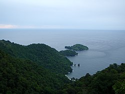
The Bocas Islands lie between Trinidad and Venezuela, in the Bocas del Dragón (Dragons' Mouth). Locally they are referred to as "Down de Islands" or "DDI".
- Chacachacare
- Monos
- Huevos
- Gaspar Grande (Gasparee)
- Gasparillo Island (Little Gasparee or Centipede Island)
Five Islands


The Five Islands are actually a group of six small islands lying west of Port of Spain in the Gulf of Paria. Also known as Las Cotorras.
- Caledonia Island
- Craig Island (Craig and Caledonia are joined by a man made causeway)
- Lenagan Island
- Nelson Island
- Pelican Island
- Rock Island
San Diego Islands

Sometimes referred to simply as the Diego Islands, these two islets lie between the Bocas Islands and the Five Islands.
Others in the Gulf of Paria
- Faralon Rock, off San Fernando
- Soldado Rock
North Coast of Trinidad

Off Tobago
- Little Tobago (Bird of Paradise Island)
- St. Giles Island
- Goat Island
- Sisters' Rock
List of minor islands with co-ordinates
Taken from the Archipelagic Baselines of Trinidad and Tobago Order, Notice No. 206 of 31 October 1988, as corrected by Legal Notice No. 77 on 5 April 1989.[1]
- East Rock 10°08′12″N 60°59′02″W
- Casa Cruz Rock 10°04′22″N 61°09′45″W
- Alcatras Rock 10°04′19″N 61°13′28″W
- Icacos Point 10°02′28″N 61°54′30″W
- Black Rock 10°03′27″N 62°01′33″W
- Cabresse Point 10°41′47″N 61°45′36″W
- Cabresse Island 10°41′58″N 61°45′25″W
- Sisters Island 11°19′57″N 60°38′42″W
- Marble Island 11°21′39″N 60°31′37″W
- St. Giles Island 11°21′28″N 60°30′52″W
- Little Tobago 11°17′39″N 60°29′40″W
References
- Trinidad and Tobago, Department of Navy, 2005
See also
- List of islands in the Caribbean
- Geography of Trinidad and Tobago
На других языках
[de] Bocas Islands
Die Bocas Islands sind eine Inselgruppe in der Meeresenge Bocas del Dragón zwischen Trinidad und Venezuela. Sie bilden die nördliche Begrenzung des Golf von Paria zum Karibischen Meer hin. Zwischen den Inseln gibt es kleinere Meerengen. Zur Inselgruppe gehören von Westen nach Osten folgende Inseln:- [en] List of islands of Trinidad and Tobago
[es] Islas de Trinidad y Tobago
Trinidad y Tobago es un país localizado al sur del mar Caribe. Está conformada por un archipiélago de varios islas, las cuales se listan a continuación.[fr] Liste des îles de Trinité-et-Tobago
La république de Trinité-et-Tobago comporte les îles suivantes :[ru] Острова Тринидада и Тобаго
Тринидад и Тобаго располагается на многочисленных островах.Текст в блоке "Читать" взят с сайта "Википедия" и доступен по лицензии Creative Commons Attribution-ShareAlike; в отдельных случаях могут действовать дополнительные условия.
Другой контент может иметь иную лицензию. Перед использованием материалов сайта WikiSort.org внимательно изучите правила лицензирования конкретных элементов наполнения сайта.
Другой контент может иметь иную лицензию. Перед использованием материалов сайта WikiSort.org внимательно изучите правила лицензирования конкретных элементов наполнения сайта.
2019-2025
WikiSort.org - проект по пересортировке и дополнению контента Википедии
WikiSort.org - проект по пересортировке и дополнению контента Википедии
